Pine River (Chippewa River)
| Pine River | |
|---|---|
 The Pine River in Alma | |
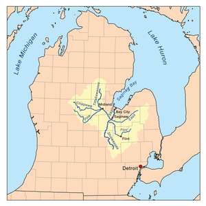 Map of the Saginaw River watershed showing the Pine River as one of its major tributaries | |
| Country | United States |
| Basin | |
| Main source | Wheatland Township, Mecosta County, Michigan |
| River mouth |
Chippewa River 600 ft (180 m)[1] |
| River system | Saginaw River |
| Physical characteristics | |
| Length | 103 mi (166 km) |
The Pine River is a 103-mile-long (166 km)[2] river in the Lower Peninsula of the U.S. state of Michigan. The Pine River is a tributary of the Chippewa River and is thus part of the Saginaw River drainage basin.
The river rises in Wheatland Township in southeast Mecosta County at 43°35′09″N 85°08′34″W / 43.58583°N 85.14278°W.[1] It flows southeast into southwest Isabella County. It turns south through northeast Montcalm County and Gratiot County, where it turns to the northeast, continuing through the cities of Alma and St. Louis. It enters Midland County and joins the Chippewa River at 43°36′06″N 84°17′33″W / 43.60167°N 84.29250°W[1] approximately two miles before the Chippewa joins the Tittabawassee River on the west side of the city of Midland.
Tributaries and features
- (left) Sucker Creek[3]
- (left) Bush Creek[4]
- (left) Horse Creek[7]
- (right) Sugar Creek[8]
- (right) Honeyoey Creek[9]
- (left) Newark and Arcadia Drain[13]
- (left) Carpenter Creek[14]
- (left) Twin Lake[15]
- (left) Robbins Lake[16]
- (left) Deaner Lake[17]
- (right) Mud Creek[18]
- (left) Bass Lake Drain[19]
- (right) North Branch Pine River[20]
- (left) Wolf Creek[23]
- (left) Skunk Creek[27]
- (left) South Branch Pine River[28]
- (right) Pony Creek[32]
- (left) Miller Creek[36]
- Meeker Lake[37]
- Pine Lake[38]
Drainage basin
References
- 1 2 3 "Pine River". Geographic Names Information System. United States Geological Survey.
- ↑ U.S. Geological Survey. National Hydrography Dataset high-resolution flowline data. The National Map, accessed November 7, 2011
- ↑ "Sucker Creek". Geographic Names Information System. United States Geological Survey.
- ↑ "Bush Creek". Geographic Names Information System. United States Geological Survey.
- ↑ "Taylor Drain". Geographic Names Information System. United States Geological Survey.
- ↑ "Rook Drain". Geographic Names Information System. United States Geological Survey.
- ↑ "Horse Creek". Geographic Names Information System. United States Geological Survey.
- ↑ "Sugar Creek". Geographic Names Information System. United States Geological Survey.
- ↑ "Honeyoey Creek". Geographic Names Information System. United States Geological Survey.
- ↑ "Coles Creek". Geographic Names Information System. United States Geological Survey.
- ↑ "Peterman Lake". Geographic Names Information System. United States Geological Survey.
- ↑ "Madison Lake". Geographic Names Information System. United States Geological Survey.
- ↑ "Newark and Arcadia Drain". Geographic Names Information System. United States Geological Survey.
- ↑ "Carpenter Creek". Geographic Names Information System. United States Geological Survey.
- ↑ "Twin Lake". Geographic Names Information System. United States Geological Survey.
- ↑ "Robbins Lake". Geographic Names Information System. United States Geological Survey.
- ↑ "Deaner Lake". Geographic Names Information System. United States Geological Survey.
- ↑ "Mud Creek". Geographic Names Information System. United States Geological Survey.
- ↑ "Bass Lake Drain". Geographic Names Information System. United States Geological Survey.
- ↑ "North Branch Pine river". Geographic Names Information System. United States Geological Survey.
- ↑ "Cedar Drain". Geographic Names Information System. United States Geological Survey.
- ↑ "Thatcher Creek". Geographic Names Information System. United States Geological Survey.
- ↑ "Wolf Creek". Geographic Names Information System. United States Geological Survey.
- ↑ "Offnear Lake". Geographic Names Information System. United States Geological Survey.
- ↑ "Cedar Lake". Geographic Names Information System. United States Geological Survey.
- ↑ "Marl Lake". Geographic Names Information System. United States Geological Survey.
- ↑ "Skunk Creek". Geographic Names Information System. United States Geological Survey.
- ↑ "South Branch Pine River". Geographic Names Information System. United States Geological Survey.
- ↑ "Blanchard Millpond". Geographic Names Information System. United States Geological Survey.
- ↑ "Decker Creek". Geographic Names Information System. United States Geological Survey.
- ↑ "Jewel Creek". Geographic Names Information System. United States Geological Survey.
- ↑ "Pony Creek". Geographic Names Information System. United States Geological Survey.
- ↑ "Halls Lake". Geographic Names Information System. United States Geological Survey.
- ↑ "Big Eldred Lake". Geographic Names Information System. United States Geological Survey.
- ↑ "Little Eldred Lake". Geographic Names Information System. United States Geological Survey.
- ↑ "Miller Creek". Geographic Names Information System. United States Geological Survey.
- ↑ "Meeker LAke". Geographic Names Information System. United States Geological Survey.
- ↑ "Pine Lake". Geographic Names Information System. United States Geological Survey.