Fort Prudhomme
Fort Prudhomme, or Prud'homme, was a simple stockade fortification, constructed on one of the Chickasaw Bluffs of the Mississippi River in West Tennessee by Cavelier de La Salle's French canoe expedition of the Mississippi River Basin in 1682. The fortification was intended to provide shelter during the search for a member of the expedition who got lost at a stop while hunting, it was used by the expedition for only ten days. Fort Prudhomme was the first structure built by the French in Tennessee; its exact location is not known.
La Salle's expedition
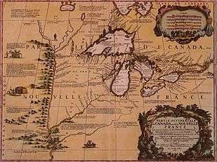
René-Robert Cavelier, Sieur de La Salle (1643–1687) was a French explorer. In February 1682, he started his 5th expedition. La Salle led a party of 41 on a canoe expedition from what is modern Peoria County, Illinois, located on the banks of the Illinois River, to the mouth of the Mississippi River in order to explore the Mississippi River basin. On their trip downriver, the expedition landed their canoes to hunt, when one of their members went missing. The armorer by the name of Pierre Prudhomme was assumed captured by Chickasaw Indians. La Salle decided to stay and search for the missing participant of the expedition.[1]
On top of the Mississippi River bluffs in Tennessee, La Salle's party constructed a stockade fortification. The fort was the first structure built by the French in Tennessee. La Salle named the fortification "Fort Prudhomme", after their lost man. Ten days after his disappearance, the missing member of the expedition found his way back to the camp, unharmed but starving.[1] Prudhomme had lost his way while hunting.[2] The expedition resumed their trip downstream and La Salle reached the mouth of the Mississippi River on April 6, 1682. He claimed the entire Mississippi River valley for France, it remained French until 1762.[1]
Location
The position of Fort Prudhomme is unknown and a documented controversy about the exact location of the fortification exists. Researchers agree that it was located on the Chickasaw Bluffs but it is disputed on which of the four bluffs the fortification was located. Some historians claim that Fort Prudhomme was built on the first Chickasaw Bluff, in modern-day Lauderdale County, placing it at the location of Fort Pillow, a later Civil War fortification, or "somewhere near this place".[3][4] The Tennessee Encyclopedia of History and Culture suggests that Fort Prudhomme was built on the second Chickasaw Bluff, south of the Hatchie River, near modern-day Randolph in Tipton County.[1][5] Other research mentions the third Chickasaw Bluff as the location of Fort Prudhomme, which would place the fortification at the border of what is modern day Tipton and Shelby Counties, encompassed in part by modern Meeman-Shelby Forest State Park.[2][6] Again other sources assume that "La Salle built Fort Prudhomme, possibly on the site of present-day Memphis", on the fourth Chickasaw Bluff below the mouth of the Wolf River, in what would later become Shelby County.[7][8] The location on the fourth Chickasaw Bluff would put Fort Prudhomme at or near the site of the later French Fort Assumption which was used as a base against the Chickasaw in the abortive Campaign of 1739.[9] The table below provides approximate coordinates for all four Chickasaw Bluffs, the possible locations of Fort Prudhomme, starting with the northernmost first Chickasaw Bluff above Fulton.
| Bluff | Location (north to south) | County | Coordinates (approx.)[10] |
|---|---|---|---|
| First | Above Fulton | Lauderdale | 35°37′26″N 89°52′12″W / 35.624°N 89.870°W |
| Second | At Randolph | Tipton | 35°30′58″N 89°53′17″W / 35.516°N 89.888°W |
| Third | Meeman-Shelby Forest State Park | Tipton and Shelby | 35°22′16″N 90°03′54″W / 35.371°N 90.065°W |
| Fourth | Below the mouth of the Wolf River at Memphis | Shelby | 35°08′28″N 90°03′18″W / 35.141°N 90.055°W |
See also
References
- 1 2 3 4 Magness, Perre (1998). "TN Encyclopedia: Fort Prudhomme and La Salle". The Tennessee Encyclopedia of History and Culture. Retrieved December 29, 2013.
- 1 2 Parkman, Francis; Levin, David (1983). France and England in North America. Library of America. p. 921. ISBN 0-940450-10-0.
- ↑ Federal Writers' Project; Tennessee Writers' Project (1978). Tennessee: A Guide to the State. US History Publishers. p. 422. ISBN 1-60354-041-5.
- ↑ Conard, Howard Louis (1901). Encyclopedia of the History of Missouri: A Compendium of History and Biography for Ready Reference. The Southern history company, Haldeman, Conard & co., proprietors. p. 492.
- ↑ "Mississippi River Corridor – Historical and Cultural Amenities". Mississippi River Corridor, Tennessee. 2008. Retrieved January 12, 2009.
- ↑ Kellogg, Louise Phelps (1917). Early Narratives of the Northwest, 1634–1699. C. Scribner's Sons. p. 297.
- ↑ "Encyclopedia.com – Tennessee Information – The Columbia Encyclopedia, Sixth Edition". Columbia University Press. 2008. Retrieved January 12, 2009.
- ↑ Phelan, James (1888). History of Tennessee: The Making of a State. Houghton, Mifflin and Company. pp. 307–308, 313.
- ↑ Pierson, Uriah (1873). James' River Guide. U. P. James, Cincinnati. pp. 33–36. OCLC 05153739.
- ↑ "Google Maps". Google. Retrieved 2009-02-19.