Picture Rocks, Arizona
| Picture Rocks, Arizona | |
|---|---|
| CDP | |
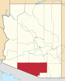
 Location in Pima County and the state of Arizona | |
 Picture Rocks, Arizona Location in the United States | |
| Coordinates: 32°19′51″N 111°13′47″W / 32.33083°N 111.22972°WCoordinates: 32°19′51″N 111°13′47″W / 32.33083°N 111.22972°W | |
| Country | United States |
| State | Arizona |
| County | Pima |
| Area | |
| • Total | 55.6 sq mi (144.1 km2) |
| • Land | 55.6 sq mi (143.9 km2) |
| • Water | 0.1 sq mi (0.1 km2) |
| Elevation | 2,080 ft (634 m) |
| Population (2010) | |
| • Total | 9,563 |
| • Density | 146.4/sq mi (56.5/km2) |
| Time zone | MST (no DST) (UTC-7) |
| FIPS code | 04-55300 |
| GNIS feature ID | 1866990 |
Picture Rocks is a census-designated place (CDP) in Pima County, Arizona, United States. The population was 8,139 at the 2000 census.
Geography
Picture Rocks is located at 32°19′51″N 111°13′47″W / 32.33083°N 111.22972°W (32.330735, -111.229652).[1]
According to the United States Census Bureau, the CDP has a total area of 55.6 square miles (144.1 km²), of which, 55.6 square miles (144.0 km²) of it is land and 0.1 square miles (0.1 km²) of it (0.09%) is water.
Demographics
As of the census[2] of 2000, there were 8,139 people and 2,883 households residing in the CDP. The population density was 146.4 people per square mile (56.5/km²). There were 3,088 housing units at an average density of 55.6/sq mi (21.5/km²). The racial makeup of the CDP was 89.63% White, 0.58% Black or African American, 1.40% Native American, 0.38% Asian, 0.07% Pacific Islander, 5.38% from other races, and 2.56% from two or more races. 13.76% of the population were Hispanic or Latino of any race.
There were 2,883 households out of which 38.6% had children under the age of 18 living with them, 59.2% were married couples living together, 10.6% had a female householder with no husband present, and 24.3% were non-families. 18.4% of all households were made up of individuals and 4.2% had someone living alone who was 65 years of age or older. The average household size was 2.82 and the average family size was 3.20.
In the CDP the population was spread out with 30.0% under the age of 18, 6.3% from 18 to 24, 31.3% from 25 to 44, 24.5% from 45 to 64, and 7.9% who were 65 years of age or older. The median age was 36 years. For every 100 females there were 102.6 males. For every 100 females age 18 and over, there were 99.8 males.
The median income for a household in the CDP was $39,534, and the median income for a family was $43,026. Males had a median income of $30,752 versus $21,513 for females. The per capita income for the CDP was $17,132. About 4.3% of families and 7.5% of the population were below the poverty line, including 10.9% of those under age 18 and 1.8% of those age 65 or over.
References
- ↑ "US Gazetteer files: 2010, 2000, and 1990". United States Census Bureau. 2011-02-12. Retrieved 2011-04-23.
- ↑ "American FactFinder". United States Census Bureau. Retrieved 2008-01-31.
External links
32°19′51″N 111°13′47″W / 32.330735°N 111.229652°W