Pic de l'Infern
| Pic de l'Infern | |
|---|---|
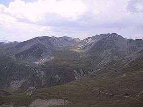 Freser, l'Infern and la Vaca peaks from the Coll de la Marrana pass | |
| Highest point | |
| Elevation | 2,859 m (9,380 ft) |
| Coordinates | 42°25′26″N 2°12′50″E / 42.42389°N 2.21389°ECoordinates: 42°25′26″N 2°12′50″E / 42.42389°N 2.21389°E |
| Geography | |
| Parent range | Pyrenees |
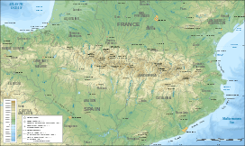
Pic de l'Infern is a mountain of Catalonia, Spain. Located in the Pyrenees, it has an elevation of 2,859 metres above sea level.[1]
See also
References
- ↑ "Mapa Topogràfic de Catalunya". Institut Cartogràfic de Catalunya. Retrieved May 22, 2010..
This article is issued from Wikipedia - version of the 8/8/2016. The text is available under the Creative Commons Attribution/Share Alike but additional terms may apply for the media files.