Pic de Montcalm
| Pic de Montcalm | |
|---|---|
 Pic de Montcalm view from la pica d'Estats | |
| Highest point | |
| Elevation | 3,077 m (10,095 ft) [1] |
| Listing | List of Pyrenean three-thousanders |
| Coordinates | 42°40′20″N 01°24′23″E / 42.67222°N 1.40639°ECoordinates: 42°40′20″N 01°24′23″E / 42.67222°N 1.40639°E [2] |
| Geography | |
 Pic de Montcalm | |
| Parent range | Pyrénées |
| Geology | |
| Mountain type | Granite |
| Climbing | |
| First ascent | 18 July 1807 by Candolle and Simon Faure |
| Easiest route |
Par le refuge du Pinet (France) ou le Vall Ferrera (Espagne) |
Pic de Montcalm is a French pyrenean summit, culminating at 3,077 m (10,095 ft), located in the Ariège department, Midi-Pyrénées region of France.
Topography
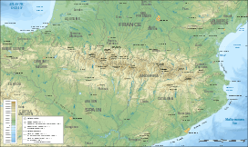
Located in the Ariège south of Auzat in the Vicdessos, it lies slightly north of the Franco-Spanish borderline crest.[3]
La pique du Montcalm (Ariège appellation), la pique d'Estats and the pic du port de Sullo are the three main summits of the massif du Montcalm, the last two bordering Spain and la Pica d'Estats the highest summit in Catalonia.
The summit is located in the perimeter of the parc naturel régional des Pyrénées ariégeoises.[4]
History
The first ascent was made on July 18, 1807 by Augustin Pyramus de Candolle along with guide Simon Faure[5][6]
Access

On the French side, three main itineraries are possible :
- by le refuge du Pinet located next to the lac du Pinet : the path (tagged red and white) is the easiest (namely downhill) and most borrowed itinerary.
- by la vallée de Soulcem and le couloir de Riufret : some passages are difficult downhill. it is poorly indicated.
- by the vallon de Pujol and le Pla Subra : which used to be the conventional track, borrowed by the first pyrenean pioneers. The route begins au chalet du Montcalm (also called "Refuge du Montcalm") located au bord de la route de l'Artigue, 1 km after le hameau de Marc. The route gradually lost its conventional status due to certain difficult passages, below and above the "Tables du Montcalm".
On the Spanish side : by the Val Ferrera, from la pica d'Estats from which one can reach the Montcalm by le col de l'Estats, French side.
References
- ↑ "Liste des 3000 pyrénéens par massif". Retrieved 2014-06-13.
- ↑ Source : Géoportail avec carte IGN à l'échelle 1:25000
- ↑ Géoportail
- ↑ Parc naturel régional des Pyrénées ariégeoises
- ↑ A. P. De Candolle, Le voyage de Tarbes, éd. Loubatières, Portet S/Garonne, 1999, pages 191, note 112 ; ouvrage retranscrit, annoté et commenté par Alain Bourneton
- ↑ A. Bourneton, « Deux siècles d'ascensions dans le massif Montcalm-Estats », Pyrénées, n° 200, 1999, pages 343-358 ; n° 201, pages 5-16 ; n° 202, pages 127-136 ; n° 203, pages 229-238