Phu Thap Boek
| Phu Thap Boek | |
|---|---|
| ภูทับเบิก | |
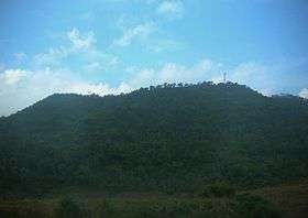 East side of the summit seen from Route 203 | |
| Highest point | |
| Elevation | 1,794 m (5,886 ft) |
| Listing | List of mountains in Thailand |
| Coordinates | 16°54′23″N 101°5′14″E / 16.90639°N 101.08722°ECoordinates: 16°54′23″N 101°5′14″E / 16.90639°N 101.08722°E |
| Geography | |
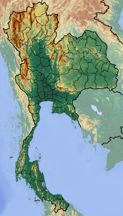 Phu Thap Boek Thailand | |
| Location | Phetchabun Province, Thailand |
| Parent range | Phetchabun Mountains |
| Geology | |
| Mountain type | sandstone |
| Climbing | |
| First ascent | Unknown |
| Easiest route | Hike |
Phu Thap Boek (Thai: ภูทับเบิก), also known as Phu Man Khao, is a 1,794 m high mountain in Phetchabun Province, Thailand near the border with Loei Province. It is in the Lom Kao District.[1]
Description
This mountain is the highest point of the Phetchabun Mountains and is in the western range of the massif. The peak rises 12 km west of Highway 203, between Loei town and Phetchabun town.[2]
The Phu Hin Rong Kla National Park is in the area around the mountain.[3] The park overlaps the borders of further two provinces, Phitsanulok and Phetchabun.[4] Most of the mountain is covered in mixed evergreen forest and there are also some farms on its slopes where the climate conditions favor cabbage farming.[5] The area around the mountain is part of the Luang Prabang montane rain forests ecoregion.[6]
The mountain, originally home of Hmong people's settlements, has been overrun by allegedly illegal resorts and restaurants.[7]
See also
References
- ↑ "Ban Thp Boek". Tourism Authority of Thailand (TAT). Retrieved 2 November 2015.
- ↑ Google Earth
- ↑ Phu Hin Rong Kla National Park
- ↑ Phu Thap Boek & Phuhinrongkla National Park
- ↑ Phu Thap Boek - Cabbage farms
- ↑ Luang Prabang montane rain forests
- ↑ Na Thalang, Jeerawat (2015-11-01). "Reclaiming some lost ground". Bangkok Post. Retrieved 2 November 2015.
External links
- "Luang Prabang montane rain forests". Terrestrial Ecoregions. World Wildlife Fund.
- Phu Thap Boek - Paragliding