Phnom Sruoch District
| Phnom Sruoch ស្រុកភ្នំស្រួច | |
|---|---|
| District (srok) | |
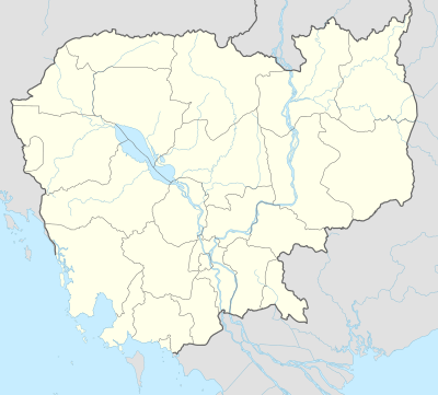 Phnom Sruoch Location in Cambodia | |
| Coordinates: 11°24′N 104°24′E / 11.400°N 104.400°E | |
| Country |
|
| Province | Kampong Speu |
| Communes | 12 |
| Villages | 126 |
| Population (1998)[1] | |
| • Total | 74,651 |
| Time zone | +7 |
| Geocode | 0506 |
Phnom Sruoch District (Khmer: ស្រុកភ្នំស្រួច) is a district located in Kampong Speu Province in central Cambodia.
Ecology
The largest surface of Kirirom National Park is part of Phnom Sruoch District, Kampong Speu, while another section is in neighboring Koh Kong Province.[2]
The Kirirom National Park is located in the eastern part of the Cardamom Mountains, about 112 km from Phnom Penh. The road from Phnom Penh to Kampong Som runs along the southern boundary of the park.
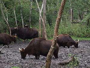
Among the animals in the park, the following deserve mention: Asian elephant, deer, gaur, banteng, leopard, spotted linsang, pileated gibbon and tiger.
Administration
Phnom Sruoch District is subdivided into 12 communes (khum)[3]
| Geocode | Name | |
|---|---|---|
| 050601 | Chambak Commune | |
| 050602 | Choam Sangkae Commune | |
| 050603 | Dambouk Rung Commune | |
| 050604 | Kiri Voan Commune | |
| 050605 | Krang Dei Vay Commune | |
| 050606 | Moha Sang Commune | |
| 050607 | Ou Commune | |
| 050608 | Prey Rumduol Commune | |
| 050609 | Prey Kmeng Commune | |
| 050610 | Tang Samraong Commune | |
| 050611 | Tang Sya Commune | |
| 050613 | Traeng Trayueng Commune | |
References
- ↑ General Population Census of Cambodia, 1998: Village Gazetteer. National Institute of Statistics. February 2000. pp. 106–109.
- ↑ Kirirom National Park, Cambodia
- ↑ National Institute of Statistics
| Capital city | 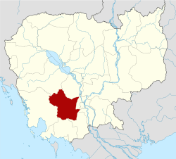 | |
|---|---|---|
| Districts | ||
Coordinates: 11°24′N 104°24′E / 11.400°N 104.400°E