Akşehir
| Akşehir | |
|---|---|
| District | |
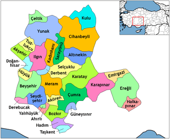 Location of Akşehir within Turkey. | |
 Akşehir Location of Akşehir within Turkey. | |
| Coordinates: 38°21′N 31°25′E / 38.350°N 31.417°E | |
| Country |
|
| Province | Konya |
| Government | |
| • Mayor | Abdulkadir Oğul (AKP) |
| Area[1] | |
| • District | 815.77 km2 (314.97 sq mi) |
| Elevation | 1,025 m (3,363 ft) |
| Population (2012)[2] | |
| • Urban | 62,054 |
| • District | 94,575 |
| • District density | 120/km2 (300/sq mi) |
| Time zone | EET (UTC+2) |
| • Summer (DST) | EEST (UTC+3) |
| Postal code | 42xxx |
| Area code(s) | 0332 |
| Licence plate | 42 |
| Climate | Csb |
| Website | www.aksehir.gov.tr |
Akşehir (Ottoman Turkish: اقشهر) is a town and district of Konya Province in the Central Anatolia region of Turkey. According to 2000 census, population of the district is 114,918 of which 63,000 live in the town of Akşehir.[3] The town was known in the Roman and Byzantine empires as Philomelium or Philomelion (Greek: Φιλομήλιον) respectively.
The town is situated at the edge of a fertile plain, on the north side of the Sultan Dagh.[4]
Climate
| Climate data for Aksehir | |||||||||||||
|---|---|---|---|---|---|---|---|---|---|---|---|---|---|
| Month | Jan | Feb | Mar | Apr | May | Jun | Jul | Aug | Sep | Oct | Nov | Dec | Year |
| Average high °C (°F) | 5 (41) |
7 (44) |
11 (51) |
16 (60) |
21 (69) |
25 (77) |
28 (82) |
28 (82) |
25 (77) |
18 (64) |
13 (55) |
7 (44) |
17 (62) |
| Average low °C (°F) | −2 (28) |
−1 (30) |
1 (33) |
5 (41) |
9 (48) |
12 (53) |
14 (57) |
14 (57) |
10 (50) |
6 (42) |
2 (35) |
0 (32) |
5 (41) |
| Average precipitation mm (inches) | 71 (2.8) |
66 (2.6) |
69 (2.7) |
69 (2.7) |
56 (2.2) |
46 (1.8) |
18 (0.7) |
13 (0.5) |
18 (0.7) |
48 (1.9) |
56 (2.2) |
80 (3) |
607 (23.9) |
| Source: Weatherbase [5] | |||||||||||||
History
Philomelion was probably a Pergamenian foundation on the great Graeco-Roman Highway from Ephesus to the east, and to its townsmen the Smyrniotes wrote the letter that describes the martyrdom of Polycarp. Cicero, on his way to Cilicia, dated some of his extant correspondence there; and the place played a considerable part in the frontier wars between the Byzantine emperors and the Sultanate of Rum. It became an important Seljuk town, and late in the 14th century passed into Ottoman hands. There Bayezit I of the Ottoman Empire is said by Ali of Yezd to have died after his defeat at the Battle of Ankara.[4]
Modern times
The town's landmarks include the alleged tomb of Nasreddin Hoca, the tomb of Seydi Mahmut, the house used as headquarters by the Turkish Army during the last phase of the Greco-Turkish War (1919–1922), other monuments and old Turkish houses.
Between 5 July and 10 July each year, commemorations with concerts and other social activities are held to the memory of Akşehir's famous resident, Nasreddin Hodja.
With its rich architectural heritage, Akşehir is a member of the Norwich-based European Association of Historic Towns and Regions.[6]
Name
The Turkish name Akşehir literally means "white city". It is a compound of two words, namely ak, "white", a Turkic word; and şehir, "town", which is from Persian شهر shahr, "town".
In English usage other spellings of the name include Ak-Shehr, Ak-Shahr, Akshehr, Akshahr, Akshehir, and Aqshahr.
See also
Notes
- ↑ "Area of regions (including lakes), km²". Regional Statistics Database. Turkish Statistical Institute. 2002. Retrieved 2013-03-05.
- ↑ "Population of province/district centers and towns/villages by districts - 2012". Address Based Population Registration System (ABPRS) Database. Turkish Statistical Institute. Retrieved 2013-02-27.
- ↑ Turkish Statistical Institute. "Census 2000, Key statistics for urban areas of Turkey" (in Turkish). Archived from the original (XLS) on 2007-07-22. Retrieved 2008-03-22.
- 1 2
 One or more of the preceding sentences incorporates text from a publication now in the public domain: Chisholm, Hugh, ed. (1911). "Ak-Shehr". Encyclopædia Britannica. 1 (11th ed.). Cambridge University Press. p. 458.
 - ↑ "Weatherbase: Historical Weather for Aksehir, Turkey". Weatherbase. 2011. Retrieved on November 24, 2011.
- ↑ The European Association of Historic Towns and Regions. "Historic Towns of Turkey" (DOC). Archived from the original on 2010-01-17. Retrieved 2008-03-22.
References
- Falling Rain Genomics, Inc. "Geographical information on Akşehir, Turkey". Retrieved 2008-03-22.
- http://tuikrapor.tuik.gov.tr/reports/rwservlet?adnks=&report=turkiye_ilce_koy_sehir.RDF&p_il1=42&p_ilce1=532&p_kod=2&desformat=html&ENVID=adnksEnv
- Attribution
- This article incorporates text from a publication now in the public domain: Herbermann, Charles, ed. (1913). "Philomelium". Catholic Encyclopedia. New York: Robert Appleton.
External links
| Wikivoyage has a travel guide for Akşehir. |
| Wikimedia Commons has media related to Akşehir. |
- District governor's official website (Turkish)
- District municipality's official website (Turkish)
Coordinates: 38°21′27″N 31°24′59″E / 38.35750°N 31.41639°E