Phaya Thai District
| Phaya Thai พญาไท | |
|---|---|
| Khet | |
|
| |
 Khet location in Bangkok | |
| Coordinates: 13°46′48″N 100°32′34″E / 13.78000°N 100.54278°E | |
| Country |
|
| Province | Bangkok |
| Seat | Sam Sen Nai |
| Khwaeng | 1 |
| Area | |
| • Total | 9.59 km2 (3.70 sq mi) |
| Population (2003) | |
| • Total | 72,495 |
| • Density | 8,156.7/km2 (21,126/sq mi) |
| Time zone | THA (UTC+7) |
| Postal code | 10400 |
| Geocode | 1014 |
Phaya Thai (Thai: พญาไท; IPA: [pʰā.jāː tʰāj]) is a district in central Bangkok, Thailand. It is also the name of a major road, as well as a BTS Skytrain station, both of which are in the nearby Ratchathewi district.
Neighboring districts are (from the north clockwise) Chatuchak, Din Daeng, Ratchathewi and Dusit.
History
The Phaya Thai district was set up in 1966 taking areas that were part of Dusit and Bang Kapi districts.[1] It was named after Phaya Thai Road, a major road in the area. Since then, many changes to the district has been made. In 1973, the Huai Khwang district was separated from Phaya Thai. Later in 1978, as an effort to balance the population among districts, the boundaries between Phaya Thai, Huai Khwang, and Bang Kapi districts were modified.[2] A new Ratchathewi district was created, carving out southern part of Phaya Thai in 1989.[3] And finally in 1993, some eastern part were moved out of the district to the newly formed Din Daeng,[4] leaving Phaya Thai with only one remaining sub-district, Sam Sen Nai as of today.
Note that, due to the split out of Ratchathewi, the Phaya Thai Road is no longer in Phaya Thai district. It only runs through Ratchathewi and Pathum Wan. The Bangkok Skytrain (BTS) station Phaya Thai is located on Phaya Thai Road in Ratchathewi.
Administration
The district is sub-divided into only one sub-district (Kwaeng).
| 1. | Sam Sen Nai | สามเสนใน |
Places

A large portion of the district in the east side is occupied by Royal Thai Army. This includes Army stadium, and military owned TV Channel 5. Several other government offices are also located here, such as Government Savings Bank (Thai: th:ธนาคารออมสิน), Ministry of Finance, and Ministry of Natural Resources and Environment.
The population is more concentrated in the area called Saphan Khwai (Thai: สะพานควาย) with lots of shops, apartments, and a BigC shopping center.
The Thai Philatelic Museum is recently renovated and moved to the building behind the Samsen Nai post office at Saphan Khwai in December 2004. Rather small, among of the exhibits are awards Thai philatelists received from various international competitions together with photocopies of the winning entries, posters depicting rare Thai stamps, winning postage stamp designs. It opens to public on Wednesday through Sunday except holidays.
Wat Phai Tan (Thai: วัดไผ่ตัน) is the only ฺBuddhist temple in the district.

Transportation
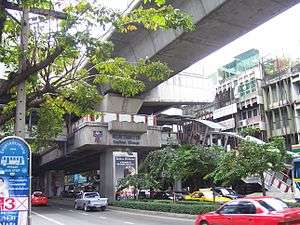
There are three Bangkok Skytrain (BTS) stations in Phaya Thai: Sanam Pao, Ari, and Saphan Khwai. The Bangkok Metro station Bang Sue is located on the extreme northwest corner of the district.
Trivia
Former Thai Prime Minister Thaksin Shinawatra (2001–2006) was an ex-police officer who began his career at Phaya Thai Police Station. Shinawatra and his political party, Thai Rak Thai were ousted in a bloodless coup in September 2006.
References
- ↑ พระราชกฤษฎีกาตั้งอำเภอพญาไท พ.ศ. ๒๕๐๙ (PDF). Royal Gazette (in Thai). 83 (39 ก special): 1–3. May 1, 1966.
- ↑ พระราชกฤษฎีกาเปลี่ยนแปลงพื้นที่เขตพญาไท เขตห้วยขวางและเขตบางกะปิ กรุงเทพมหานคร พ.ศ. ๒๕๒๑ (PDF). Royal Gazette (in Thai). 95 (48 ก): 180. 1978-05-02.
- ↑ ประกาศกระทรวงมหาดไทย เรื่อง เปลี่ยนแปลงพื้นที่เขตพญาไท และตั้งเขตราชเทวี (PDF). Royal Gazette (in Thai). 106 (208 ง ฉบับพิเศษ): 9. 1989-11-24.
- ↑ ประกาศกระทรวงมหาดไทย เรื่อง เปลี่ยนแปลงพื้นที่เขตพญาไท เขตราชเทวี เขตห้วยขวาง และตั้งเขตดินแดง กรุงเทพมหานคร (PDF). Royal Gazette (in Thai). 110 (184 ง ฉบับพิเศษ): 3–6. 1993-11-10.
.svg.png)