Pharr Mounds
|
Pharr Mounds | |
|
Two mounds at the Pharr Mounds site | |
 | |
| Nearest city | Tupelo, Mississippi |
|---|---|
| Coordinates | 34°27′59.3562″N 88°25′0.1734″W / 34.466487833°N 88.416714833°WCoordinates: 34°27′59.3562″N 88°25′0.1734″W / 34.466487833°N 88.416714833°W |
| NRHP Reference # | 78000346[1] |
| Added to NRHP | February 23, 1978[1] |

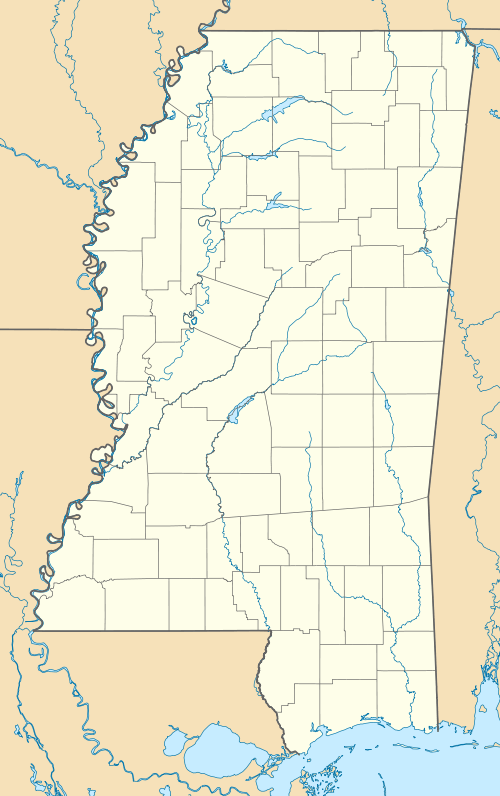
Pharr Mounds is a Middle Woodland period archaeological site located near Tupelo in parts of Itawamba and Prentiss County in northern Mississippi.
The complex of eight dome shaped Tumulus burial mounds was in use during the Miller 1 phase of the Miller culture[2] and was built between 1 and 200 CE. It is considered to be one of the largest and most important sites from this era.[3] It was listed on the National Register of Historic Places in 1978 as part of the Natchez Trace Parkway at milepost 286.7.[1]
Site description
The site is located at the headwaters of the Tombigbee River, a rugged, hilly area with many broad, swampy streams. It is named for "Pharr Flats", a wide gently rolling terrace overlooking the confluence of Little Brown and Mackeys Creeks. The site features eight dome-shaped mounds of differing sizes, several of which have been nearly flattened by European American farming. The mounds in the Pharr Mounds site are scattered over 90 acres of land.[4]

| Mound | Width and length | Height |
|---|---|---|
| Mound A | 55 feet (17 m) by 65 feet (20 m) | 7 feet (2.1 m) |
| Mound B | 105 feet (32 m) by 110 feet (34 m) | 18 feet (5.5 m) |
| Mound C | 115 feet (35 m) in diameter | 18 feet (5.5 m) |
| Mound D | 80 feet (24 m) by 95 feet (29 m) | 12 feet (3.7 m) |
| Mound E | 165 feet (50 m) by 175 feet (53 m) | 8 feet (2.4 m) |
| Mound F | 60 feet (18 m) in diameter | 8 feet (2.4 m) |
| Mound G | 200 feet (61 m) in diameter | 6 feet (1.8 m) |
| Mound H | 110 feet (34 m) by 130 feet (40 m) | 2 feet (0.61 m) |

Archaeology
In 1966 Robert Carr, an archaeologist for the National Park Service, led an excavation of four of the mounds. The excavators found fire pits and low clay platforms at the base of the mounds.[3] They also found human remains, some cremated, as well as various exotic ceremonial artifacts.
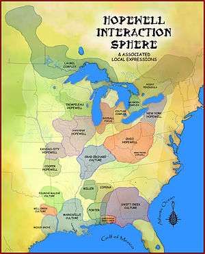
Many of the artifacts were made from nonlocal materials such as Great Lakes copper and greenstone, galena, and mica that were obtained through the Hopewell exchange system. These artifacts, which include copper ear-spools and a greenstone platform pipe, show the connection of the local peoples with the larger Middle Woodland period world of the time.[3]
See also
References
- 1 2 3 "National Register of Historic Places". National Register of Historic Places. National Park Service. 2010-11-16.
- ↑ "Pharr Mounds-Ceramic analysis". National Park Service. Retrieved 2010-11-16.
- 1 2 3 "Pharr Mounds-National Register of Historic Places Indian Mounds of Mississippi Travel Itinerary". National Park Service. Retrieved 2010-11-16.
- 1 2 "Pharr Mounds-The site and its setting". National Park Service. Retrieved 2010-11-16.
External links
| Topics | |
|---|---|
| Lists by states |
|
| Lists by insular areas | |
| Lists by associated states | |
| Other areas | |
| |