Phare du Portzic
 = The lighthouse from the sea in January 2006 | |
 Portzic Lighthouse Rear Range Phare du Portzic Finistère | |
| Location |
Goulet de Brest Finistère France |
|---|---|
| Coordinates | 48°21′30.0″N 4°32′03.0″W / 48.358333°N 4.534167°WCoordinates: 48°21′30.0″N 4°32′03.0″W / 48.358333°N 4.534167°W |
| Year first constructed | 1848 |
| Automated | 1984 |
| Construction | granite tower |
| Tower shape | octagonal prism tower with balcony and lantern |
| Markings / pattern | unpainted tower, red lantern |
| Height | 35 metres (115 ft) |
| Focal height | 56 metres (184 ft) |
| Light source | mains power |
| Range | 20 nmi (37 km) |
| Characteristic | Oc (2) WR 12s. |
| Admiralty number | D0790.1 |
| NGA number | 0160 |
| ARLHS number | FRA-034 |
| France number | FR-0655[1] |
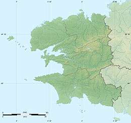
The phare du Portzic is situated on the north-eastern extremity of the Goulet de Brest (Finistère, France) and is the nearest lighthouse to the town of Brest. It was inscribed as a monument historique before 1987.[2] On the seaward side of the bottleneck entrance to the goulet, the lighthouse faces the Pointe des Espagnols.
It was built on military land in 1848, at the same time as the phare du Petit Minou (started slightly earlier to the north of the Goulet. It was electrified in 1953 and automated in 1984 (though a semaphore post set up at its base in 1987 to regulate traffic in and out of the goulet is still permanently manned).
Characteristics
- Signals : 1 main light for the sector with 2 flashes every 10 seconds (2 second flash then 6 second flash), accompanied by 2 twinkling directional lights in the direction of the Goulet, one continuous (one flash per second, known as the North signal, indicates to a navigator that he finds himself to the north of the channel), the other with 6 short flashes (one per second) and a long flash, known as the South signal, indicating to the nvaigator that he finds himself to the south of the channel.
See also
Notes
- ↑ Rowlett, Russ. "Lighthouses of Brittany: Southern Finistère". The Lighthouse Directory. University of North Carolina at Chapel Hill. Retrieved January 22, 2016.
- ↑ Culture Ministry of France
External links
- Phare du Portzic Ministère de la Culture
| Wikimedia Commons has media related to Portzic lighthouse. |
This article is issued from Wikipedia - version of the 1/23/2016. The text is available under the Creative Commons Attribution/Share Alike but additional terms may apply for the media files.