Phanom Phrai District
| Phanom Phrai พนมไพร | |
|---|---|
| Amphoe | |
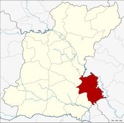 Amphoe location in Roi Et Province | |
| Coordinates: 15°40′42″N 104°6′36″E / 15.67833°N 104.11000°ECoordinates: 15°40′42″N 104°6′36″E / 15.67833°N 104.11000°E | |
| Country | Thailand |
| Province | Roi Et |
| Area | |
| • Total | 519.3 km2 (200.5 sq mi) |
| Population (2005) | |
| • Total | 75,140 |
| • Density | 144.7/km2 (375/sq mi) |
| Time zone | ICT (UTC+7) |
| Postal code | 45140 |
| Geocode | 4506 |
Phanom Phrai (Thai: พนมไพร) is a district (amphoe) in the southeastern part of Roi Et Province, northeastern Thailand.
Geography
Neighboring districts are (from the southwest clockwise) Nong Hi, Suwannaphum, At Samat, Selaphum of Roi Et Province, Mueang Yasothon, Kham Khuean Kaeo, Maha Chana Chai of Yasothon Province and Sila Lat of Sisaket Province.
Administration
The district is divided into 13 sub-districts (tambon), which are further subdivided into 160 villages (muban). Phanom Phrai is a township (thesaban tambon) which covers parts of tambon Phanom Phrai. There are a further 13 tambon administrative organizations (TAO).
| No. | Name | Thai name | Villages | Pop. | |
|---|---|---|---|---|---|
| 1. | Phanom Phrai | พนมไพร | 19 | 11,295 | |
| 2. | Saen Suk | แสนสุข | 18 | 8,714 | |
| 3. | Kut Nam Sai | กุดน้ำใส | 10 | 3,859 | |
| 4. | Nong Thap Thai | หนองทัพไทย | 14 | 7,284 | |
| 5. | Pho Yai | โพธิ์ใหญ่ | 14 | 7,046 | |
| 6. | Wari Sawat | วารีสวัสดิ์ | 11 | 4,516 | |
| 7. | Khok Sawang | โคกสว่าง | 16 | 5,030 | |
| 11. | Pho Chai | โพธิ์ชัย | 12 | 7,195 | |
| 12. | Na Nuan | นานวล | 13 | 4,759 | |
| 13. | Kham Hai | คำไฮ | 10 | 5,574 | |
| 14. | Sa Kaeo | สระแก้ว | 9 | 3,677 | |
| 15. | Kho Yai | ค้อใหญ่ | 7 | 2,288 | |
| 17. | Chanuwan | ชานุวรรณ | 7 | 3,903 |
Missing numbers are tambon which now form Nong Hi district.
References
This article is issued from Wikipedia - version of the 7/17/2016. The text is available under the Creative Commons Attribution/Share Alike but additional terms may apply for the media files.