Petanjci
| Petanjci | |
|---|---|
 Petanjci Location in Slovenia | |
| Coordinates: 46°39′2.23″N 16°4′40.3″E / 46.6506194°N 16.077861°ECoordinates: 46°39′2.23″N 16°4′40.3″E / 46.6506194°N 16.077861°E | |
| Country |
|
| Traditional region | Prekmurje |
| Statistical region | Mura |
| Municipality | Tišina |
| Area | |
| • Total | 7.64 km2 (2.95 sq mi) |
| Elevation | 196 m (643 ft) |
| Population (2002) | |
| • Total | 676 |
| [1] | |
Petanjci (pronounced [pɛˈtaːntsi]; Hungarian: Szécsénykút)[2] is a village on the left bank of the Mura River in the Municipality of Tišina in the Prekmurje region of northeastern Slovenia.[3]
There is a small chapel in the village. It is dedicated to Saint Florian and was built in the early 20th century in the Neo-Gothic style.[4]
References
- ↑ Statistical Office of the Republic of Slovenia
- ↑ Radkersburg und Luttenberg (map, 1:75,000). 1894. Vienna: K.u.k. Militärgeographisches Institut.
- ↑ Tišina municipal site
- ↑ Slovenian Ministry of Culture register of national heritage reference number 3449
External links
 Media related to Petanjci at Wikimedia Commons
- Petanjci on Geopedia
| Settlements | 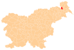 | |
|---|---|---|
| Landmarks |
| |
| Notable people |
| |
This article is issued from Wikipedia - version of the 11/29/2014. The text is available under the Creative Commons Attribution/Share Alike but additional terms may apply for the media files.