Miami County, Indiana
| Miami County, Indiana | |
|---|---|
 Miami County courthouse in Peru, Indiana | |
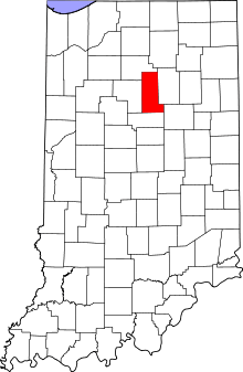 Location in the U.S. state of Indiana | |
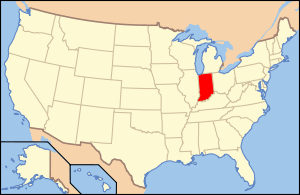 Indiana's location in the U.S. | |
| Founded | 1834 |
| Named for | Miami tribe |
| Seat | Peru |
| Largest city | Peru |
| Area | |
| • Total | 377.39 sq mi (977 km2) |
| • Land | 373.84 sq mi (968 km2) |
| • Water | 3.55 sq mi (9 km2), 0.94% |
| Population | |
| • (2010) | 36,903 |
| • Density | 98/sq mi (37.93/km²) |
| Congressional district | 2nd |
| Time zone | Eastern: UTC-5/-4 |
| Website |
www |
| Footnotes: Indiana county number 52 | |
Miami County is a county located in the U.S. state of Indiana. As of 2010, the population was 36,903.[1] The county seat is Peru.[2]
History
Indiana became a state on December 11, 1816, after being Indiana territory for sixteen years. Originally, Indiana was part of the Northwest Territory, which was made up of land gained by the British after the French and Indian War and organized into a territory after the American Revolution.[3] It was after the revolution that settlement in the area by Europeans really began. Knox territory was created in 1790 and included all of present-day Indiana and areas of Illinois. Ancestry’s Red Book notes that jurisdiction in Knox territory changed due to Indian uprisings in the area from 1790-1810.[4] In 1800, Indiana became the name of a territory. Parts Michigan and Illinois both broke away from the territory before it became a state in 1816.
Miami County was formed in 1832 from Cass County and unorganized land.[4] It was named for the Miami, a Native American people, many of whom still live in this area.[5] In 1834, Miami County widened its western border taking some area from Cass County. In 1838 a small portion of unorganized territory was added to the northeastern border, but in 1844 that area was lost to Fulton County. Miami County has been its present shape since 1844.
Geography
According to the 2010 census, the county has a total area of 377.39 square miles (977.4 km2), of which 373.84 square miles (968.2 km2) (or 99.06%) is land and 3.55 square miles (9.2 km2) (or 0.94%) is water.[6]
Adjacent counties
- Fulton County (north)
- Wabash County (east)
- Grant County (southeast)
- Howard County (south)
- Cass County (west)
Major highways
Cities and towns
Incorporated
Unincorporated
- Bennetts Switch
- Birmingham
- Chili
- Courter
- Deedsville
- Erie
- Flora
- Gilead
- Loree
- McGrawsville
- Miami
- New Santa Fe
- North Grove
- Peoria
- Perrysburg
- Pettysville
- Santa Fe
- South Peru
- Stockdale
- Wawpecong
- Wells
Extinct
- Doyle
- Leonda
- Paw Paw
- Wagoners Station
Townships
- Allen Township
- Butler Township
- Clay Township
- Deer Creek Township
- Erie Township
- Harrison Township
- Jackson Township
- Jefferson Township
- Perry Township
- Peru Township
- Pipe Creek Township
- Richland Township
- Union Township
- Washington Township
Climate and weather
| Peru, Indiana | ||||||||||||||||||||||||||||||||||||||||||||||||||||||||||||
|---|---|---|---|---|---|---|---|---|---|---|---|---|---|---|---|---|---|---|---|---|---|---|---|---|---|---|---|---|---|---|---|---|---|---|---|---|---|---|---|---|---|---|---|---|---|---|---|---|---|---|---|---|---|---|---|---|---|---|---|---|
| Climate chart (explanation) | ||||||||||||||||||||||||||||||||||||||||||||||||||||||||||||
| ||||||||||||||||||||||||||||||||||||||||||||||||||||||||||||
| ||||||||||||||||||||||||||||||||||||||||||||||||||||||||||||
In recent years, average temperatures in Peru have ranged from a low of 14 °F (−10 °C) in January to a high of 83 °F (28 °C) in July, although a record low of −24 °F (−31 °C) was recorded in January 1985 and a record high of 103 °F (39 °C) was recorded in June 1988. Average monthly precipitation ranged from 1.89 inches (48 mm) in February to 4.23 inches (107 mm) in June.[7]
Government
The county government is a constitutional body, and is granted specific powers by the Constitution of Indiana, and by the Indiana Code.
County Council: The county council is the legislative branch of the county government and controls all the spending and revenue collection in the county. Representatives are elected from county districts. The council members serve four-year terms. They are responsible for setting salaries, the annual budget, and special spending. The council also has limited authority to impose local taxes, in the form of an income and property tax that is subject to state level approval, excise taxes, and service taxes.[8][9]
Board of Commissioners: The executive body of the county is made of a board of commissioners. The commissioners are elected county-wide, in staggered terms, and each serves a four-year term. One of the commissioners, typically the most senior, serves as president. The commissioners are charged with executing the acts legislated by the council, collecting revenue, and managing the day-to-day functions of the county government.[8][9]
Court: The county maintains a small claims court that can handle some civil cases. The judge on the court is elected to a term of four years and must be a member of the Indiana Bar Association. The judge is assisted by a constable who is also elected to a four-year term. In some cases, court decisions can be appealed to the state level circuit court.[9]
County Officials: The county has several other elected offices, including sheriff, coroner, auditor, treasurer, recorder, surveyor, and circuit court clerk Each of these elected officers serves a term of four years and oversees a different part of county government. Members elected to county government positions are required to declare party affiliations and to be residents of the county.[9]
Miami County is part of Indiana's 5th congressional district; Indiana Senate district 18;[10] and Indiana House of Representatives districts 23, 24 and 32.[11]
Demographics
| Historical population | |||
|---|---|---|---|
| Census | Pop. | %± | |
| 1840 | 3,048 | — | |
| 1850 | 11,304 | 270.9% | |
| 1860 | 16,851 | 49.1% | |
| 1870 | 21,052 | 24.9% | |
| 1880 | 24,083 | 14.4% | |
| 1890 | 25,823 | 7.2% | |
| 1900 | 28,344 | 9.8% | |
| 1910 | 29,350 | 3.5% | |
| 1920 | 28,668 | −2.3% | |
| 1930 | 29,032 | 1.3% | |
| 1940 | 27,926 | −3.8% | |
| 1950 | 28,201 | 1.0% | |
| 1960 | 38,000 | 34.7% | |
| 1970 | 39,246 | 3.3% | |
| 1980 | 39,820 | 1.5% | |
| 1990 | 36,897 | −7.3% | |
| 2000 | 36,082 | −2.2% | |
| 2010 | 36,903 | 2.3% | |
| Est. 2015 | 35,862 | [12] | −2.8% |
| U.S. Decennial Census[13] 1790-1960[14] 1900-1990[15] 1990-2000[16] 2010-2013[1] | |||
As of the 2010 United States Census, there were 36,903 people, 13,456 households, and 9,330 families residing in the county.[17] The population density was 98.7 inhabitants per square mile (38.1/km2). There were 15,479 housing units at an average density of 41.4 per square mile (16.0/km2).[6] The racial makeup of the county was 91.8% white, 4.5% black or African American, 0.9% American Indian, 0.3% Asian, 0.6% from other races, and 1.8% from two or more races. Those of Hispanic or Latino origin made up 2.5% of the population.[17] In terms of ancestry, 27.2% were German, 17.3% were American, 12.0% were Irish, and 8.4% were English.[18]
Of the 13,456 households, 32.5% had children under the age of 18 living with them, 53.2% were married couples living together, 11.3% had a female householder with no husband present, 30.7% were non-families, and 26.2% of all households were made up of individuals. The average household size was 2.49 and the average family size was 2.97. The median age was 39.5 years.[17]
The median income for a household in the county was $47,697 and the median income for a family was $49,282. Males had a median income of $40,038 versus $26,011 for females. The per capita income for the county was $18,854. About 13.0% of families and 16.7% of the population were below the poverty line, including 26.6% of those under age 18 and 8.9% of those age 65 or over.[19]
See also
Further reading
- Bodurtha, Arthur Lawrence. History of Miami County, Indiana: A Narrative Account of Its Historical Progress, Its People and Its Principal Interests, Volume 1. 1865. Charleston: Nabu Press (2010). ISBN 1-148-41509-2
- Coppernoll, Marilyn. Miami County, Indiana: A Pictorial History. Peru: Miami County Historical Society (1995). ISBN 0-89865-951-5
- Kingman Brothers. Combination atlas map of Miami County, Indiana. Charleston: Nabu Press (2011). ISBN 1-175-64684-9
References
- 1 2 "Miami County QuickFacts". United States Census Bureau. Retrieved 2011-09-25.
- ↑ "Find a County". National Association of Counties. Retrieved 2011-06-07.
- ↑ The Handybook for Genealogists 11th ed. Logan, Utah: Everton Publishers. 2006.
- 1 2 Alice Eichholz (1992). Ancestry’s Red Book: American State, County, & Town Sources. Salt Lake City, Utah: Ancestry, Inc. pp. 198–211.
- ↑ De Witt Clinton Goodrich & Charles Richard Tuttle (1875). An Illustrated History of the State of Indiana. Indiana: R. S. Peale & co. p. 578.
- 1 2 "Population, Housing Units, Area, and Density: 2010 - County". United States Census Bureau. Retrieved 2015-07-10.
- 1 2 "Monthly Averages for Peru, Indiana". The Weather Channel. Retrieved 2011-01-27.
- 1 2 Indiana Code. "Title 36, Article 2, Section 3". IN.gov. Retrieved 2008-09-16.
- 1 2 3 4 Indiana Code. "Title 2, Article 10, Section 2" (PDF). IN.gov. Retrieved 2008-09-16.
- ↑ "Indiana Senate Districts". State of Indiana. Retrieved 2011-07-14.
- ↑ "Indiana House Districts". State of Indiana. Retrieved 2011-07-14.
- ↑ "County Totals Dataset: Population, Population Change and Estimated Components of Population Change: April 1, 2010 to July 1, 2015". Retrieved July 2, 2016.
- ↑ "U.S. Decennial Census". United States Census Bureau. Retrieved July 10, 2014.
- ↑ "Historical Census Browser". University of Virginia Library. Retrieved July 10, 2014.
- ↑ "Population of Counties by Decennial Census: 1900 to 1990". United States Census Bureau. Retrieved July 10, 2014.
- ↑ "Census 2000 PHC-T-4. Ranking Tables for Counties: 1990 and 2000" (PDF). United States Census Bureau. Retrieved July 10, 2014.
- 1 2 3 "DP-1 Profile of General Population and Housing Characteristics: 2010 Demographic Profile Data". United States Census Bureau. Retrieved 2015-07-10.
- ↑ "DP02 SELECTED SOCIAL CHARACTERISTICS IN THE UNITED STATES – 2006-2010 American Community Survey 5-Year Estimates". United States Census Bureau. Retrieved 2015-07-10.
- ↑ "DP03 SELECTED ECONOMIC CHARACTERISTICS – 2006-2010 American Community Survey 5-Year Estimates". United States Census Bureau. Retrieved 2015-07-10.
 |
Fulton County | | ||
| Cass County | |
Wabash County | ||
| ||||
| | ||||
| Howard County | Grant County |
Municipalities and communities of Miami County, Indiana, United States | ||
|---|---|---|
| City | ||
| Towns | ||
| Townships | ||
| CDP | ||
| Other unincorporated communities | ||
| Footnotes | ‡This populated place also has portions in an adjacent county or counties | |

Coordinates: 40°46′N 86°03′W / 40.77°N 86.05°W