Pen Tranch
| Pen Tranch | |
 Pen Tranch |
|
| Area | 12.06 km2 (4.66 sq mi) [1] |
|---|---|
| Population | 5,989 [2] |
| – density | 497/km2 (1,290/sq mi) |
| OS grid reference | SO 272 007 |
| Community | Pen Tranch |
| Principal area | Torfaen |
| Ceremonial county | Gwent |
| Country | Wales |
| Sovereign state | United Kingdom |
| Post town | PONTYPOOL |
| Postcode district | NP4 |
| Dialling code | 01495 |
| Police | Gwent |
| Fire | South Wales |
| Ambulance | Welsh |
| EU Parliament | Wales |
| UK Parliament | Torfaen |
| Welsh Assembly | Torfaen |
Coordinates: 51°42′03″N 3°03′15″W / 51.700758°N 3.054092°W
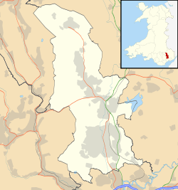
Pen Tranch is a village and a community in Torfaen, South East Wales.
It lies to the west of Pontypool in the valley leading west to Crumlin. It lies in the historic county of Monmouthshire and the preserved county of Gwent.
The area includes the electoral wards of Pontnewynydd, Snatchwood, and Wainfelin for Torfaen County Borough Council.
References
- ↑ "2011 Census:Quick Statistics:Population Density for Pen Tranch". Office for National Statistics. Retrieved 29 Nov 2013.
- ↑ "2011 Census:Key Statistics:Key Figures for Pen Tranch". Office for National Statistics. Retrieved 25 Nov 2013.
| Principal settlements |  | |
|---|---|---|
| Electoral wards | ||
| Communities | ||
| Places of interest | ||
| Rivers and canals | ||
| Topics | ||
This article is issued from Wikipedia - version of the 3/19/2016. The text is available under the Creative Commons Attribution/Share Alike but additional terms may apply for the media files.