Pelican Bay, Florida
| Pelican Bay, Florida | |
|---|---|
| Census-designated place | |
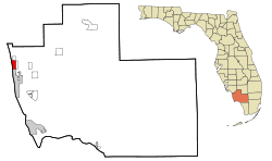 Location in Collier County and the state of Florida | |
| Coordinates: 26°13′59″N 81°48′33″W / 26.23306°N 81.80917°WCoordinates: 26°13′59″N 81°48′33″W / 26.23306°N 81.80917°W | |
| Country |
|
| State |
|
| County |
|
| Area | |
| • Total | 3.4 sq mi (8.7 km2) |
| • Land | 2.9 sq mi (7.6 km2) |
| • Water | 0.4 sq mi (1.0 km2) |
| Elevation | 13 ft (4 m) |
| Population (2010) | |
| • Total | 6,346 |
| • Density | 2,153/sq mi (831.3/km2) |
| Time zone | Eastern (EST) (UTC-5) |
| • Summer (DST) | EDT (UTC-4) |
| FIPS code | 12-55650[1] |
| GNIS feature ID | 1853275[2] |
Pelican Bay is a census-designated place (CDP) in Collier County, Florida, United States. The population was 6,346 at the 2010 census.[3] It is part of the Naples–Marco Island Metropolitan Statistical Area.
Geography
Pelican Bay is located in northwestern Collier County at 26°13′59″N 81°48′32″W / 26.23306°N 81.80889°W.[4] It is part of the area known as North Naples and is located just south of Naples Park and west of Pine Ridge. It is bordered to the south by the city of Naples, to the east by U.S. Route 41 (the Tamiami Trail), to the north by Vanderbilt Beach Road, and to the west by the Gulf of Mexico.
According to the United States Census Bureau, the CDP has a total area of 3.4 square miles (8.7 km2), of which 2.9 square miles (7.6 km2) is land and 0.39 square miles (1.0 km2), or 11.87%, is water.[3]
Demographics
As of the census[1] of 2000, there were 5,686 people, 3,005 households, and 2,166 families residing in the CDP. The population density was 1,754.0 people per square mile (677.6/km²). There were 5,738 housing units at an average density of 1,770.0/sq mi (683.8/km²). The racial makeup of the CDP was 99.21% White, 0.09% African American, 0.04% Native American, 0.47% Asian, 0.07% from other races, and 0.12% from two or more races. Hispanic or Latino of any race were 0.91% of the population.
There were 3,005 households out of which 3.5% had children under the age of 18 living with them, 70.0% were married couples living together, 1.5% had a female householder with no husband present, and 27.9% were non-families. 25.6% of all households were made up of individuals and 16.6% had someone living alone who was 65 years of age or older. The average household size was 1.84 and the average family size was 2.12.
In the CDP the population was spread out with 3.4% under the age of 18, 0.7% from 18 to 24, 4.2% from 25 to 44, 33.9% from 45 to 64, and 57.8% who were 65 years of age or older. The median age was 67 years. For every 100 females there were 84.5 males. For every 100 females age 18 and over, there were 84.0 males.
The median income for a household in the CDP was $102,762, and the median income for a family was $127,920. Males had a median income of $0 versus $44,286 for females. The per capita income for the CDP was $89,063. About 1.9% of families and 2.8% of the population were below the poverty line, including none of those under age 18 and 1.6% of those age 65 or over.
References
- 1 2 "American FactFinder". United States Census Bureau. Retrieved 2008-01-31.
- ↑ "US Board on Geographic Names". United States Geological Survey. 2007-10-25. Retrieved 2008-01-31.
- 1 2 "Geographic Identifiers: 2010 Demographic Profile Data (G001): Pelican Bay CDP, Florida". U.S. Census Bureau, American Factfinder. Retrieved July 16, 2014.
- ↑ "US Gazetteer files: 2010, 2000, and 1990". United States Census Bureau. 2011-02-12. Retrieved 2011-04-23.
Municipalities and communities of Collier County, Florida, United States | ||
|---|---|---|
| Cities | 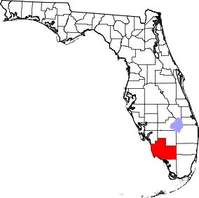 | |
| CDPs | ||
| Unincorporated communities | ||