Pelican, Alaska
| Pelican | |
|---|---|
| City | |
| Motto: Closest to the fish | |
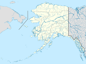 Pelican Location in Alaska | |
| Coordinates: 57°57′30″N 136°13′27″W / 57.95833°N 136.22417°WCoordinates: 57°57′30″N 136°13′27″W / 57.95833°N 136.22417°W | |
| Country | United States |
| State | Alaska |
| Census Area | Hoonah-Angoon |
| Incorporated | October 3, 1943 |
| Government | |
| • Mayor | Patricia Phillips[1] |
| • State senator | Bert Stedman (R) |
| • State rep. | Jonathan Kreiss-Tomkins (D) |
| Area | |
| • Total | 0.7 sq mi (1.8 km2) |
| • Land | 0.6 sq mi (1.5 km2) |
| • Water | 0.1 sq mi (0.3 km2) |
| Elevation | 217 ft (66 m) |
| Population (2007)[2] | |
| • Total | 131 |
| • Density | 280.5/sq mi (108.3/km2) |
| Time zone | Alaska (AKST) (UTC-9) |
| • Summer (DST) | AKDT (UTC-8) |
| ZIP code | 99832 |
| Area code | 907 |
| FIPS code | 02-59650 |
Pelican (Tlingit: K'udeis'X̱'e) is a city in the northwestern part of Chichagof Island in Hoonah-Angoon Census Area in the U.S. state of Alaska. As of the 2000 census, the population of the city is 163.
Geography
Pelican is located on the east side of Lisianski Inlet, a body of water that opens into Lisianski Strait and Cross Sound, on Chichagof Island at coordinates 57°57′30″N 136°13′27″W / 57.95833°N 136.22417°W (57.958431, -136.224069).[3]
According to the United States Census Bureau, the city has a total area of 0.7 square miles (1.8 km2), of which 0.6 square miles (1.6 km2) is land and 0.1 square miles (0.26 km2) (17.14%) is water.
Climate
According to the Köppen climate classification system, Pelican has an Oceanic climate (Cfb).
| Climate data for Pelican | |||||||||||||
|---|---|---|---|---|---|---|---|---|---|---|---|---|---|
| Month | Jan | Feb | Mar | Apr | May | Jun | Jul | Aug | Sep | Oct | Nov | Dec | Year |
| Record high °F (°C) | 52 (11) |
53 (12) |
55 (13) |
76 (24) |
81 (27) |
87 (31) |
84 (29) |
92 (33) |
76 (24) |
68 (20) |
61 (16) |
49 (9) |
92 (33) |
| Average high °F (°C) | 33.3 (0.7) |
37.2 (2.9) |
40.2 (4.6) |
46.8 (8.2) |
53.4 (11.9) |
58.1 (14.5) |
60.7 (15.9) |
61.5 (16.4) |
56.6 (13.7) |
48 (9) |
38.9 (3.8) |
34.9 (1.6) |
47.5 (8.6) |
| Average low °F (°C) | 25.2 (−3.8) |
27.2 (−2.7) |
29.1 (−1.6) |
32.6 (0.3) |
38.3 (3.5) |
44 (7) |
48.5 (9.2) |
48.6 (9.2) |
44.1 (6.7) |
38.2 (3.4) |
30.7 (−0.7) |
27.3 (−2.6) |
36.1 (2.3) |
| Record low °F (°C) | −3 (−19) |
−2 (−19) |
5 (−15) |
15 (−9) |
26 (−3) |
29 (−2) |
38 (3) |
33 (1) |
27 (−3) |
15 (−9) |
3 (−16) |
−1 (−18) |
−3 (−19) |
| Average precipitation inches (mm) | 13.12 (333.2) |
11.75 (298.5) |
10.08 (256) |
8.21 (208.5) |
7.64 (194.1) |
4.44 (112.8) |
6.65 (168.9) |
9.85 (250.2) |
20.42 (518.7) |
24.4 (620) |
17.84 (453.1) |
15.65 (397.5) |
150.04 (3,811) |
| Average snowfall inches (cm) | 30 (76) |
17.9 (45.5) |
17.4 (44.2) |
5.4 (13.7) |
0.1 (0.3) |
0 (0) |
0 (0) |
0 (0) |
0 (0) |
0.8 (2) |
15.4 (39.1) |
22.2 (56.4) |
109.3 (277.6) |
| Average precipitation days | 20 | 17 | 19 | 17 | 18 | 16 | 20 | 19 | 21 | 23 | 20 | 19 | 229 |
| Source: [4] | |||||||||||||
Demographics
| Historical population | |||
|---|---|---|---|
| Census | Pop. | %± | |
| 1940 | 48 | — | |
| 1950 | 180 | 275.0% | |
| 1960 | 135 | −25.0% | |
| 1970 | 133 | −1.5% | |
| 1980 | 180 | 35.3% | |
| 1990 | 222 | 23.3% | |
| 2000 | 163 | −26.6% | |
| 2010 | 88 | −46.0% | |
| Est. 2015 | 91 | [5] | 3.4% |
As of the census[7] of 2000, there were 163 people, 70 households, and 41 families residing in the city. The population density was 280.5 people per square mile (108.5/km²). There were 94 housing units at an average density of 161.8 per square mile (62.6/km²). The racial makeup of the city was 72.39% White, 21.47% Native American, 1.23% Asian, 0.61% from other races, and 4.29% from two or more races. 0.61% of the population were Hispanic or Latino of any race.
There were 70 households out of which 30.0% had children under the age of 18 living with them, 41.4% were married couples living together, 5.7% had a female householder with no husband present, and 41.4% were non-families. 28.6% of all households were made up of individuals and 8.6% had someone living alone who was 65 years of age or older. The average household size was 2.30 and the average family size was 2.78.
In the city the population was spread out with 24.5% under the age of 18, 3.1% from 18 to 24, 28.2% from 25 to 44, 34.4% from 45 to 64, and 9.8% who were 65 years of age or older. The median age was 42 years. For every 100 females there were 143.3 males. For every 100 females age 18 and over, there were 146.0 males.
The median income for a household in the city was $48,750, and the median income for a family was $57,083. Males had a median income of $50,500 versus $3,750 for females. The per capita income for the city was $29,347. None of the families and 4.7% of the population were living below the poverty line.
History
Shipwreck
According to legend, many years ago when Russian ships roamed Alaska waters, one foundered in the uncharted waters of Cross Sound. Survivors rowed their lifeboat up an inlet that would later be known as Lisianski. In a sheltered cove they founded a settlement. They cleared and planted gardens, trapped and hunted game. The story goes that a shipyard was built and a ship constructed, which allowed them to return to their homeland.
When the Russian settlement died, the land again reverted to wilderness. Early hunters and trappers noticed the clearing in the woods, and found iron and copper tools along with sunken graves. They named the abandoned settlement "Sunnyside."
The Lisianski Inlet Lodge is located on the site of the old Russian settlement at Sunnyside and the owners can attest to there being "mounds" nearby in the trees that may be burial sites and of finding tools in the ground.
In the late 1970s Paul Corbin found what appears to be a spike from a Russian ship while digging a garbage pit a few hundred yards behind the Lodge. A few years later Denny Corbin found a pair of eyeglasses while digging to enforce a coffer dam in the woods behind the lodge. The eyeglasses had gold rims, blue glass and diamond shaped pieces of jade in each corner.
Mining exploration
By 1938 the Lisianski Inlet had become home to gold miners. Hjalmor Mork, Jack Ronning and the older of the Mork family boys operated the Mork mine, called the Goldwin Prospect. Besides the Mork mine there was another gold mine called the Apex, founded earlier, which can be found across the inlet from Sunnyside. The Apex-El Nido mine produced 18,000 ounces of gold. Jack Koby was developing a mine called Lucky Strike up towards the head of the inlet, and another mine was being worked at its mouth.[8] This is the Lisianski Inlet Kalle (Charley) Raatikainen found when he started looking for a place to build a town.
1938-1941 fish processing and storage development
Raatikainen was an Alaskan pioneer and fish buyer when fish made people wealthy. During the fishing season he would hardly sleep, as he bought fish and ran them from the fishing grounds to Sitka. Raatikainen would leave Deer Harbor when the last troller had unloaded for the night. He would arrive in Sitka around three in the morning awaken the crew, unload, pick up groceries and arrive back on the fishing grounds by noon. Hoping to give better and faster service to the fisherman and buyers, he began looking for a place to build a cold storage plant close to the fishing grounds.
Location and pilings
Raatikainen went to his friend Hjalmor Mork and told him what he was looking for. On August 2, 1938 Hjalmor took him to a place up the inlet near his mine and suggested the location.[8] Raatikainen found a harbor with deep water, land and a large lake with a waterfall. Located between Juneau and Sitka, the site had everything he was looking for.
Raatikainen organized a corporation and brought in a crew to start the building. On September 26, 1938, his boat the Pelican brought in Bob DeArmond as timekeeper and storekeeper, Eli Rapich as cook's helper and another cook known as Slim.[8] Others may have been Don White and Gust Savela. A. P. "Coho" Walder and his wife Martha arrived with their troller[8] and Raatikainen had one or two others with him when he brought in his fish scows. One scow was put on the beach and became the messhouse with worker quarters in the upper section. The other scow was anchored out and connected to the beach by a floating walkway. It served as a warehouse as well as living quarters for workers. The town site became known as Pelican City. Why is not known, but probably not to confuse it with Raatikainen 's boat the Pelican.
Joe and Jim Paddock came with their pile driving equipment. They used their donkey engine on the pile driver to clear timber from the cold storage site. Hjalmer Mork and Jack Ronning moved their air compressor and jackhammers up from their mine to clear rock from the cold storage site.
Building supplies
The steam schooner the SS Tongass arrived and dropped overboard tons of lumber and pilings in front of the town, despite Raatikainen's lack of funds. DeArmond was the one that had to request that the captain of the Tongass defer the payment.[8] A sawmill and other supplies were loaded on rafts and dragged ashore. The SS Tongass would be the only steamer into Pelican for the next few years with supplies but not on regular basis.
The first building erected ashore had a dual purpose. It housed a Finnish steam bath on one side and on the other a store and offices for the new corporation. During this time, Pelican was often referred to as "Finn Town".[8] The town started looking like a town when the Paddocks and Raatikainen built homes. Arthur Silverman arrived from Sitka with lumber, beer and a license to operate a beer parlor and soon was open for business.
The expense of building a cold storage, acquiring diesel engines, building a water and electric system left the company short of money. Raatikainen went to Seattle and raised money, but it was never enough. The town continued to grow, because the depression left little winter work elsewhere. Fishermen and others were willing to take food, tobacco and stock in the company for their work.
Fire and general expansion
There was a major setback when the bathhouse caught fire and the only available fire equipment was a few buckets of salt water brought up from the beach. The bath/store building was quickly replaced and would later become home to Pelican's first school. One of the first major construction sites was a two-story multipurpose building. On the first floor a kitchen and mess hall occupied one end with the office, store and later the post office on the other side. The upper floor was used for a bunkhouse. This building's second floor is still used as a bunkhouse.
Gus Savela, a Finn and Alaskan fish buyer with engineering experience oversaw the building of the dam.[8] With the sawmill that had arrived on the Tongass, the Paddock brothers built the wharf, fish house and started the boardwalk.[8] When the summer fishing season began, the men left to work other jobs or fish their boats and even Raatikainen had to take his scows to their summer stations.
Work slowed in 1939, when the Navy began building a base on Japonski Island and outside jobs became available. Even so, a post office under the name "Pelican" was established on November 27, 1939 with Bob DeArmond as first postmaster. Pelican's school opened with Arvo Wahto, of Douglas, becoming its first teacher. He would teach two generations of children before retiring in the 60's. A sawmill was built and put into operation producing the lumber to build homes adding to the permanence of the town.
In the summer of 1940 things got livelier when A. R. Breuger of Wrangell brought his floating cannery to Pelican and moored it to the dock. It brought new people and small seine boats to town, and employment to a few of the residents. By the summer of 1941 Pelican had another salmon cannery. The Cape Cross Salmon Company organized by Larry Freeburn and Pros Ganty put canning machinery and a retort in the fish house, they made a pack of more than 17,000 cases. Later, Cape Cross would build a separate cannery next to the cold storage.
Completion
Henry Roden, the former attorney general of Alaska who was helping Raatikainen raise money, finally had success when Norton Clapp agreed to participate in the project. The work of getting the cold storage plant operating immediately gathered speed. J. P. McNeil, who had been in charge of the Booth Fisheries cold storage at Sitka for many years, was hired as manager to oversee the installation of the refrigeration machinery. The hydroelectric power plant was completed and a new office and store building were attached to the cold storage.
In August 1942 the first fish was loaded into the sharp freezer. The census in 1939 gave Pelican a count of 48. In 1951 it was up to 180, it would later reach its peak at 250.
Recent history
Pelican Seafoods closed for business in July 2008. The city foreclosed on the seafood plant in 2010.[9]
References
- ↑ 2015 Alaska Municipal Officials Directory. Juneau: Alaska Municipal League. 2015. p. 123.
- ↑ "Annual Estimates of the Population for Incorporated Places in Alaska". United States Census Bureau. 2008-07-10. Retrieved 2008-07-14.
- ↑ "US Gazetteer files: 2010, 2000, and 1990". United States Census Bureau. 2011-02-12. Retrieved 2011-04-23.
- ↑ "PELICAN, ALASKA (507141)". Western Regional Climate Center. Retrieved November 18, 2015.
- ↑ "Annual Estimates of the Resident Population for Incorporated Places: April 1, 2010 to July 1, 2015". Retrieved July 2, 2016.
- ↑ "Census of Population and Housing". Census.gov. Retrieved June 4, 2015.
- ↑ "American FactFinder". United States Census Bureau. Retrieved 2008-01-31.
- 1 2 3 4 5 6 7 8 Carson, Norm (23–29 September 2009). "Settling closest to the fish: Pelican's early years". Capital City Weekly. pp. 7–8.
- ↑ Schoenfeld, Ed (7 October 2010). "Pelican forecloses on town's seafood plant". KCAW Raven Radio. Sitka. Retrieved 10 October 2010.
Municipalities and communities of Hoonah–Angoon Census Area, Alaska, United States | ||
|---|---|---|
| Cities |  | |
| CDPs | ||
| Unincorporated community | ||
| Footnotes | ‡This populated place also has portions in adjacent boroughs or census areas | |