Pelham Bay Park (IRT Pelham Line)
| Pelham Bay Park | |||||||||
|---|---|---|---|---|---|---|---|---|---|
| New York City Subway rapid transit station | |||||||||
|
Station platform | |||||||||
| Station statistics | |||||||||
| Address |
Bruckner Boulevard & Westchester Avenue Bronx, NY 10461 | ||||||||
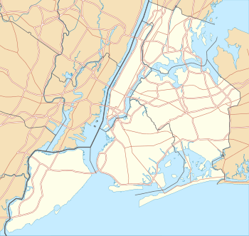
| Borough | The Bronx | ||||||||
| Locale | Pelham Bay | ||||||||
| Coordinates | 40°51′10″N 73°49′38″W / 40.852871°N 73.827138°WCoordinates: 40°51′10″N 73°49′38″W / 40.852871°N 73.827138°W | ||||||||
| Division | A (IRT) | ||||||||
| Line | IRT Pelham Line | ||||||||
| Services |
6 | ||||||||
| Transit connections |
| ||||||||
| Structure | Elevated | ||||||||
| Platforms |
1 island platform (in service) 2 side platforms (unused) | ||||||||
| Tracks | 2 | ||||||||
| Other information | |||||||||
| Opened | December 20, 1920 | ||||||||
| Accessible |
| ||||||||
| Traffic | |||||||||
| Passengers (2015) |
2,337,689[1] | ||||||||
| Rank | 211 out of 422 | ||||||||
| Station succession | |||||||||
| Next north |
(Terminal): 6 | ||||||||
| Next south |
Buhre Avenue (local): 6 Parkchester (express): no regular service | ||||||||
|
| |||||||||
| Next |
none: 6 | ||||||||
| Next |
Hunts Point Avenue: 6 | ||||||||
| |||||||||
| |||||||||
_by_David_Shankbone.jpg)


Pelham Bay Park is the northern terminal station of the IRT Pelham Line of the New York City Subway. Located by Pelham Bay Park, at the intersection of the Bruckner Expressway and Westchester Avenue in the Bronx, it is served by the 6 train at all times, except weekdays in the peak direction, when the <6> serves it.
Station layout
| P Platform level |
Side platform, not in service | |
| West track | ← (No service: Parkchester) | |
| Island platform, doors will open on the left or right | ||
| East track | ← (No service: Parkchester) | |
| Side platform, not in service | ||
| M | Mezzanine | Station agent, MetroCard vending machines, fare control |
| G | Street Level | Exit/ Entrance |
This is an elevated station which has two tracks, one island platform and two disused side platforms. The tracks end at bumper blocks at the north end of the platforms. The station was formerly set up as a Spanish solution with alighting passengers using the side platforms and boarding passengers using the island platform. Now all passengers use the island platform.
During 2005, rooms were located on the side platforms for temporary crew use while the crew quarters at the north end of the station was rebuilt. At the south end is a staff-only crossover bridge between the center and west side platform. It also used to connect to the east side platform but that portion has been removed. There is also a tower and crew facilities at the south end. There are old style signs which are covered over on the main platform.
Fare control is in the mezzanine below the platforms. There are two staircases, an escalator, and an elevator that lead to Westchester Avenue. There is also a pedestrian bridge from the station entrance that crosses the Bruckner Expressway and leads to Pelham Bay Park. The elevators were renovated from Monday, June 8, 2015 to April 2016.[2]

Pelham Bay Park is the only New York City Subway terminal that does not use numerical track labels, but rather track labels based on the compass points of the world (i.e. North track, South track).[3] Punch boxes exist, however, at the south end of the island platform where the corresponding track numbers (Track 1 and 2) are used,
In 1981, the MTA listed the station among the 69 most deteriorated stations in the subway system.[4]
Unbuilt line expansion
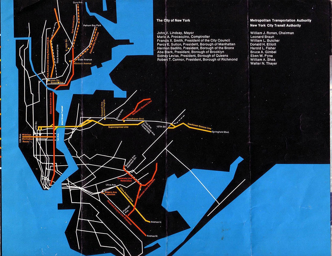
In 1968, the Program for Action was proposed, and as part of the project, the Pelham Line would have been extended to a modern terminal in the Co-op City housing complex, with the conversion of the line to IND standards, making this station no longer a terminus.[5][6][7][8] Due to the 1975–76 fiscal crisis that affected the city, most of the remaining projects did not have funding, so they were declined. Expected to be completed by the mid-1970s and early 1980s,[9][10] lines for the Program for Action had to be reduced or canceled altogether due to the 1970s fiscal crisis.[11]
The Taking of Pelham One Two Three superstition
In the novel The Taking of Pelham One Two Three by Morton Freedgood and its film adaptations (the 1974 original and the 1998 and 2009 remakes), the train that gets hijacked leaves the Pelham Bay Park station at 1:23 p.m. (hence the title). Realizing that it would become too much of a reminder to the public, after the 1974 film's release, the New York City Transit Authority, for many years, banned any schedule of a train leaving this station either at 1:23 in the afternoon or in the morning. Eventually this policy was rescinded, but due to the superstitions involved, dispatchers have continued to avoid scheduling a Manhattan-bound train to leave at 1:23.[12]
Nearby points of interest
References
- ↑ "Facts and Figures: Annual Subway Ridership". Metropolitan Transportation Authority. Retrieved 2016-04-19.
- ↑ "mta.info | Station Information". web.mta.info. Retrieved 2016-03-25.
- ↑ Tricarico, Michael (12 April 2004). "Track labels with service sign and 6 train on East track". www.nycsubway.org. Pelham Bay Park: www.nycsubway.org. Retrieved 27 July 2016.
- ↑ Gargan, Edward A. (June 11, 1981). "AGENCY LISTS ITS 69 MOST DETERIORATED SUBWAY STATIONS". The New York Times. Retrieved 13 August 2016.
- ↑ "Full text of "Metropolitan transportation, a program for action. Report to Nelson A. Rockefeller, Governor of New York."". Internet Archive. November 7, 1967. Retrieved October 1, 2015.
- ↑ Feinman, Mark. "The New York Transit Authority in the 1970s". nycsubway.org. Retrieved April 23, 2015.
- ↑ "1968 NYCTA Expansion Plans (Picture)". Second Avenue Sagas. Retrieved December 2013. Check date values in:
|access-date=(help) - ↑ Program for Action maps from thejoekorner.com
- ↑ "New Line May Get Double Trackage: Transit Unit Shift on Queens Super-Express". The New York Times. February 21, 1971. Retrieved September 26, 2015.
- ↑ Burks, Edward C. (October 24, 1973). "Work Begun on Queens Subway Extension". The New York Times. Retrieved September 26, 2015.
- ↑ Joseph B. Raskin (November 1, 2013). The Routes Not Taken: A Trip Through New York City's Unbuilt Subway System. Fordham University Press. ISBN 978-0-8232-5369-2. Retrieved August 12, 2015.
- ↑ Dwyer, Jim (1991). Subway lives : 24 hours in the life of the New York City subway. New York: Crown. ISBN 0-517-58445-X.
External links
| Wikimedia Commons has media related to Pelham Bay Park (IRT Pelham Line). |
- nycsubway.org – IRT Pelham Line: Pelham Bay Park
- Station Reporter — 6 Train
- The Subway Nut — Pelham Bay Park Pictures
- Burr Avenue entrance from Google Maps Street View
- Bruckner Boulevard entrance from Google Maps Street View