Pelham, Georgia
| Pelham, Georgia | |
|---|---|
| City | |
|
Pelham City Hall | |
 Location in Mitchell County and the state of Georgia | |
| Coordinates: 31°7′36″N 84°9′10″W / 31.12667°N 84.15278°WCoordinates: 31°7′36″N 84°9′10″W / 31.12667°N 84.15278°W | |
| Country | United States |
| State | Georgia |
| County | Mitchell |
| Government | |
| • Mayor | James T. Eubanks |
| • City Manager | Jim Hedges |
| Area | |
| • Total | 4 sq mi (10.5 km2) |
| • Land | 4 sq mi (10.5 km2) |
| • Water | 0 sq mi (0 km2) |
| Elevation | 361 ft (110 m) |
| Population (2010) | |
| • Total | 3,898 |
| • Density | 950.73/sq mi (393/km2) |
| Time zone | Eastern (EST) (UTC-5) |
| • Summer (DST) | EDT (UTC-4) |
| ZIP code | 31779 |
| Area code(s) | 229 |
| FIPS code | 13-59976[1] |
| GNIS feature ID | 0320347[2] |

Pelham is a city in Mitchell County, Georgia, in the United States. The population was 3,898 at the 2010 census. Pelham is on the crossroads of US 19 and State Route 93 and is about 38 miles (61 km) south of Albany and about 26 miles (42 km) north of Thomasville.[3]
History
Pelham was incorporated in 1881 and named in honor of American Civil War officer John Pelham.
Seasonal events
Slice of Sizzlin' Summer in the Park
The Annual Easter Egg Hunt
Christmas Parade
April Cool Day
Pelham Wildlife Festival
Geography and climate
Pelham is at 31°7′36″N 84°9′10″W / 31.12667°N 84.15278°W (31.126629, -84.152703).[4]
According to the United States Census Bureau, the city has a total area of 4.1 square miles (11 km2), of which, 4.1 square miles (11 km2) of it is land and 0.25% is water.
Pelham has a humid subtropical climate, characterized by humid summers and mild winters. It gets 52 inches of rain per year. The number of days with any measurable precipitation is 90. Pelham has on average 233 sunny days per year. The July high is around 93 degrees Fahrenheit. The January low is 39 degrees Fahrenheit.
Demographics
| Historical population | |||
|---|---|---|---|
| Census | Pop. | %± | |
| 1880 | 168 | — | |
| 1890 | 385 | 129.2% | |
| 1900 | 945 | 145.5% | |
| 1910 | 1,880 | 98.9% | |
| 1920 | 2,640 | 40.4% | |
| 1930 | 2,762 | 4.6% | |
| 1940 | 2,579 | −6.6% | |
| 1950 | 4,365 | 69.3% | |
| 1960 | 4,609 | 5.6% | |
| 1970 | 4,539 | −1.5% | |
| 1980 | 4,306 | −5.1% | |
| 1990 | 3,869 | −10.1% | |
| 2000 | 4,126 | 6.6% | |
| 2010 | 3,898 | −5.5% | |
| Est. 2015 | 3,708 | [5] | −4.9% |
As of the census[1] of 2000, there were 4,126 people, 1,467 households and 999 families in the city. The population density was 1,019.2 people per square mile (393.3/km²). There were 1,591 housing units at an average density of 393.0 per square mile (151.7/km²). The racial makeup of the city was 56.13% African American, 41.66% White, 0.24% Native American, 0.46% Asian, 0.02% Pacific Islander, 0.78% from other races, and 0.70% from two or more races. Hispanic or Latino of any race were 1.43% of the population.
There were 1,467 households, out of which 33.9% had children younger than 18 living with them, 35.2% were married couples living together, 28.4% had a female householder with no husband present, and 31.9% were non-families. 28.8% of all households were made up of individuals and 14.7% had someone living alone who was 65 years of age or older. The average household size was 2.60 and the average family size was 3.21.
In the city, the population was spread out with 32.1% younger than 18, 9.8% from 18 to 24, 23.1% from 25 to 44, 18.2% from 45 to 64, and 16.7% who were 65 or older. The median age was 33 years. For every 100 females there were 90.0 males. For every 100 females age 18 and older, there were 72.8 males.
The median income for a household in the city was $20,040, and the median income for a family was $24,968. Males had a median income of $21,476 versus $17,161 for females. The per capita income for the city was $10,703. About 29.6% of families and 33.6% of the population were below the poverty line, including 47.0% of those younger than 18 and 19.5% of those age 65 or older.
Education
The Pelham City School District holds pre-school to grade 12, and consists of one elementary school, a middle school and a high school.[7] The district has 101 full-time teachers and over 1,627 students.[8]
- Pelham Elementary School
- Pelham City Middle School
- Pelham High School
Notable people
- Donnie Cochran - former commander of the Blue Angels Precision Air team and first black member
- Don Griffin - two-time Super Bowl winner with San Francisco 49'ers
References
- 1 2 "American FactFinder". United States Census Bureau. Retrieved 2008-01-31.
- ↑ "US Board on Geographic Names". United States Geological Survey. 2007-10-25. Retrieved 2008-01-31.
- ↑ "Mitchell County Georgia". www.mitchellcountyga.net. Retrieved 2016-01-15.
- ↑ "US Gazetteer files: 2010, 2000, and 1990". United States Census Bureau. 2011-02-12. Retrieved 2011-04-23.
- ↑ "Annual Estimates of the Resident Population for Incorporated Places: April 1, 2010 to July 1, 2015". Retrieved July 2, 2016.
- ↑ "Census of Population and Housing". Census.gov. Retrieved June 4, 2015.
- ↑ Georgia Board of Education, Retrieved June 24, 2010.
- ↑ School Stats, Retrieved June 24, 2010.
Municipalities and communities of Mitchell County, Georgia, United States | ||
|---|---|---|
| Cities | 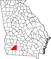 | |
| Town | ||
| Unincorporated communities | ||
| Footnotes | ‡This populated place also has portions in an adjacent county or counties | |