Patikul, Sulu
| Patikul | |
|---|---|
| Municipality | |
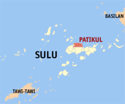 Map of Sulu with Patikul highlighted | |
.svg.png) Patikul Location within the Philippines | |
| Coordinates: 06°04′N 121°06′E / 6.067°N 121.100°ECoordinates: 06°04′N 121°06′E / 6.067°N 121.100°E | |
| Country | Philippines |
| Region | Autonomous Region in Muslim Mindanao (ARMM) |
| Province | Sulu |
| District | 1st district of Sulu |
| Barangays | 30 |
| Government[1] | |
| • Mayor | Kabir Hayudini |
| Population (2010)[2] | |
| • Total | 62,287 |
| Time zone | PST (UTC+8) |
| ZIP code | 7401 |
| Dialing code | +63 (0)68 |
| Income class | 3rd |
Patikul is a third class municipality in the province of Sulu, Philippines. According to the 2010 census, it has a population of 62,287 people.[2] The municipality is known for being a stronghold of the Abu Sayyaf insurgent group.
Barangays
Patikul is politically subdivided into 30 barangays.[2]
- Anuling
- Bakong
- Bangkal
- Bonbon
- Buhanginan (Darayan)
- Bungkaung
- Danag
- Gandasuli
- Igasan
- Kabbon Takas
- Kadday Mampallam
- Kan Ague
- Kaunayan
- Langhub
- Latih
- Liang
- Maligay
- Mauboh
- Pangdanon
- Panglayahan
- Pansul
- Patikul Higad
- Sandah
- Taglibi (Pob.)
- Tandu-Bagua
- Tanum
- Taung
- Timpok
- Tugas
- Umangay
Demographics
| Population census of Patikul | ||
|---|---|---|
| Year | Pop. | ±% p.a. |
| 1990 | 30,455 | — |
| 1995 | 30,699 | +0.15% |
| 2000 | 34,396 | +2.47% |
| 2007 | 56,805 | +7.16% |
| 2010 | 42,036 | −10.38% |
| Source: National Statistics Office[2] | ||
References
- ↑ "Official City/Municipal 2013 Election Results". Intramuros, Manila, Philippines: Commission on Elections (COMELEC). 1 July 2013. Retrieved 5 September 2013.
- 1 2 3 4 "Total Population by Province, City, Municipality and Barangay: as of May 1, 2010" (PDF). 2010 Census of Population and Housing. National Statistics Office. Retrieved 27 August 2014.
External links
- Philippine Standard Geographic Code
- Philippine Census Information
- Local Governance Performance Management System
 |
Hadji Panglima Tahil | Sulu Sea | | |
| Jolo | |
Sulu Sea | ||
| ||||
| | ||||
| Indanan | Talipao | Old Panamao |
Jolo (capital) | |
| Municipalities | |
This article is issued from Wikipedia - version of the 11/5/2016. The text is available under the Creative Commons Attribution/Share Alike but additional terms may apply for the media files.