Parma, New York
| Parma | |
| Town | |
| Country | United States |
|---|---|
| State | New York |
| County | Monroe |
| Elevation | 325 ft (99.1 m) |
| Coordinates | 43°15′N 77°47′W / 43.250°N 77.783°WCoordinates: 43°15′N 77°47′W / 43.250°N 77.783°W |
| Area | 42.9 sq mi (111.1 km2) |
| - land | 42.0 sq mi (109 km2) |
| - water | 1.0 sq mi (3 km2), 2.33% |
| Population | 15,633 (2010) |
| Density | 372/sq mi (144/km2) |
| Established | 1808 |
| Town Supervisor | Peter N. McCann (R) First elected 2009
|
| Timezone | EST (UTC-5) |
| - summer (DST) | EDT (UTC-4) |
| ZIP code | 14468 |
| Area code | 585 |
 Location in Monroe County and the state of New York. | |
 Location of New York in the United States | |
| Website: http://www.parmany.org/ | |
Parma is a town in Monroe County, New York, United States. The population was 15,633 at the 2010 census.
The Town of Parma, then in Genesee County, was organized in 1808, named after Parma in Italy.
Geography
According to the United States Census Bureau, the town has a total area of 42.9 square miles (111 km2), of which, 42.0 square miles (109 km2) of it is land and 1.0 square mile (2.6 km2) of it (2.28%) is water.
The town is bordered on the north by the southern shore of Lake Ontario, on the west by the towns of Hamlin, Clarkson and Sweden, on the south by the town of Ogden and on the east by the town of Greece.
Demographics
| Historical population | |||
|---|---|---|---|
| Census | Pop. | %± | |
| 1820 | 1,342 | — | |
| 1830 | 2,639 | 96.6% | |
| 1840 | 2,652 | 0.5% | |
| 1850 | 2,947 | 11.1% | |
| 1860 | 2,904 | −1.5% | |
| 1870 | 2,864 | −1.4% | |
| 1880 | 3,180 | 11.0% | |
| 1890 | 2,912 | −8.4% | |
| 1900 | 2,814 | −3.4% | |
| 1910 | 2,954 | 5.0% | |
| 1920 | 2,923 | −1.0% | |
| 1930 | 3,222 | 10.2% | |
| 1940 | 3,387 | 5.1% | |
| 1950 | 4,049 | 19.5% | |
| 1960 | 6,277 | 55.0% | |
| 1970 | 10,748 | 71.2% | |
| 1980 | 12,585 | 17.1% | |
| 1990 | 13,873 | 10.2% | |
| 2000 | 14,822 | 6.8% | |
| 2010 | 15,633 | 5.5% | |
| Est. 2014 | 15,863 | [1] | 1.5% |
As of the census[3] of 2000, there were 14,822 people, 5,283 households, and 4,030 families residing in the town. The population density was 353.2 people per square mile (136.4/km²). There were 5,502 housing units at an average density of 131.1 per square mile (50.6/km²). The racial makeup of the town was 97.08% White, 1.29% African American, 0.18% Native American, 0.52% Asian, 0.03% Pacific Islander, 0.24% from other races, and 0.67% from two or more races. Hispanic or Latino of any race were 1.12% of the population.
There were 5,283 households out of which 38.7% had children under the age of 18 living with them, 64.1% were married couples living together, 8.4% had a female householder with no husband present, and 23.7% were non-families. 18.9% of all households were made up of individuals and 6.2% had someone living alone who was 65 years of age or older. The average household size was 2.77 and the average family size was 3.20.
In the town the population was spread out with 28.3% under the age of 18, 6.6% from 18 to 24, 30.2% from 25 to 44, 24.8% from 45 to 64, and 10.0% who were 65 years of age or older. The median age was 37 years. For every 100 females there were 98.8 males. For every 100 females age 18 and over, there were 96.4 males.
The median income for a household in the town was $53,189, and the median income for a family was $60,686. Males had a median income of $42,566 versus $29,381 for females. The per capita income for the town was $22,431. About 2.2% of families and 4.1% of the population were below the poverty line, including 5.6% of those under age 18 and 5.0% of those age 65 or over.
History
The Town of Parma was established on April 8, 1808, named after Parma, Italy.
Government
The town is governed by a Town Board consisting of a Town Supervisor and four Councilpersons, all elected by registered town voters.
Public school
The Hilton Central School District comprises the majority of the town with the southern portion in the Spencerport Central School District and a southwestern portion in the Brockport Central School District. http://www.hilton.k12.ny.us
Communities and locations in Parma
- Hilton - village in the northern part of the town
- Parma Center
- Parma Corners
Notable people
- John Harris Baker, U.S. Representative from Indiana and United States federal judge
- George Baldwin Smith, Politician
- Cathy Turner, American short track speed skater & Two time Olympic Gold Medalist
References
- ↑ "Annual Estimates of the Resident Population for Incorporated Places: April 1, 2010 to July 1, 2014". Retrieved June 4, 2015.
- ↑ "Census of Population and Housing". Census.gov. Archived from the original on May 11, 2015. Retrieved June 4, 2015.
- ↑ "American FactFinder". United States Census Bureau. Archived from the original on September 11, 2013. Retrieved 2008-01-31.
External links
Municipalities and communities of Monroe County, New York, United States | ||
|---|---|---|
| City | 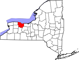 | |
| Towns | ||
| Villages | ||
| CDPs | ||
| Other hamlets | ||
| Footnotes | ‡This populated place also has portions in an adjacent county or counties | |