Parma, Missouri
| Parma, Missouri | |
|---|---|
| City | |
 Location of Parma, Missouri | |
| Coordinates: 36°36′48″N 89°49′3″W / 36.61333°N 89.81750°WCoordinates: 36°36′48″N 89°49′3″W / 36.61333°N 89.81750°W | |
| Country | United States |
| State | Missouri |
| County | New Madrid |
| Government | |
| • Mayor[1] | Tyus Byrd |
| Area[2] | |
| • Total | 0.69 sq mi (1.79 km2) |
| • Land | 0.69 sq mi (1.79 km2) |
| • Water | 0 sq mi (0 km2) |
| Elevation | 279 ft (85 m) |
| Population (2010)[3] | |
| • Total | 713 |
| • Estimate (2012[4]) | 679 |
| • Density | 1,033.3/sq mi (399.0/km2) |
| Time zone | Central (CST) (UTC-6) |
| • Summer (DST) | CDT (UTC-5) |
| ZIP code | 63870 |
| Area code(s) | 573 |
| FIPS code | 29-56342[5] |
| GNIS feature ID | 0724048[6] |
| Website | www.parma-mo.com |
Parma is a city in New Madrid County, Missouri, United States. The population was 713 at the 2010 census.
History
Parma was first incorporated as a village in 1900.
At the turn of the 20th century, Parma contained two saw mills.[7]
In 1903, Parma, along with the neighboring community of Lotta, was incorporated as a village, retaining the name "Parma."[8]
It became a fourth class city in 1905.[9]
On April 14, 2015, Tyus Byrd was sworn in as the first African-American woman mayor of Parma. Byrd succeeded Randall Ramsey, who had been mayor of Parma for a total of 37 years. Shortly before Byrde was to be sworn in, four of the city's six police officers resigned, along with the city's clerk and the supervisor of water treatment.[10][11][12]
Geography
Parma is located at 36°36′48″N 89°49′03″W / 36.613352°N 89.817455°W.[13]
According to the United States Census Bureau, the city has a total area of 0.69 square miles (1.79 km2), all of it land.[2]
Demographics
| Historical population | |||
|---|---|---|---|
| Census | Pop. | %± | |
| 1910 | 905 | — | |
| 1920 | 1,241 | 37.1% | |
| 1930 | 1,051 | −15.3% | |
| 1940 | 1,187 | 12.9% | |
| 1950 | 1,163 | −2.0% | |
| 1960 | 1,060 | −8.9% | |
| 1970 | 1,051 | −0.8% | |
| 1980 | 1,081 | 2.9% | |
| 1990 | 995 | −8.0% | |
| 2000 | 852 | −14.4% | |
| 2010 | 713 | −16.3% | |
| Est. 2015 | 665 | [14] | −6.7% |
2010 census
As of the census[3] of 2010, there were 713 people, 283 households, and 196 families residing in the city. The population density was 1,033.3 inhabitants per square mile (399.0/km2). There were 342 housing units at an average density of 495.7 per square mile (191.4/km2). The racial makeup of the city was 67.46% White, 29.45% Black or African American, 0.14% Native American, 0.56% Native Hawaiian or Pacific Islander, 1.12% from other races, and 1.26% from two or more races. Hispanic or Latino of any race were 2.81% of the population.
There were 283 households of which 36.4% had children under the age of 18 living with them, 42.4% were married couples living together, 22.6% had a female householder with no husband present, 4.2% had a male householder with no wife present, and 30.7% were non-families. 25.4% of all households were made up of individuals and 10.6% had someone living alone who was 65 years of age or older. The average household size was 2.52 and the average family size was 2.97.
The median age in the city was 39.8 years. 26.2% of residents were under the age of 18; 7.8% were between the ages of 18 and 24; 22.5% were from 25 to 44; 28.6% were from 45 to 64; and 15% were 65 years of age or older. The gender makeup of the city was 48.9% male and 51.1% female.
2000 census
As of the census[5] of 2000, there were 852 people, 333 households, and 229 families residing in the city. The population density was 1,325.6 people per square mile (514.0/km²). There were 383 housing units at an average density of 595.9 per square mile (231.1/km²). The racial makeup of the city was 57.39% White, 41.55% African American, 0.12% from other races, and 0.94% from two or more races. Hispanic or Latino of any race were 0.82% of the population.
There were 333 households out of which 30.6% had children under the age of 18 living with them, 47.4% were married couples living together, 18.6% had a female householder with no husband present, and 31.2% were non-families. 28.5% of all households were made up of individuals and 14.7% had someone living alone who was 65 years of age or older. The average household size was 2.56 and the average family size was 3.11.
In the city the population was spread out with 27.3% under the age of 18, 9.4% from 18 to 24, 25.8% from 25 to 44, 21.0% from 45 to 64, and 16.4% who were 65 years of age or older. The median age was 36 years. For every 100 females there were 85.6 males. For every 100 females age 18 and over, there were 78.4 males.
The median income for a household in the city was $18,804, and the median income for a family was $23,333. Males had a median income of $24,444 versus $15,804 for females. The per capita income for the city was $11,031. About 29.5% of families and 34.1% of the population were below the poverty line, including 53.8% of those under age 18 and 15.0% of those age 65 or over.
Climate
Climate is characterized by relatively long, hot summers and cool winters with evenly distributed precipitation throughout the year. The Köppen Climate Classification subtype for this climate is "Cfa" (Humid Subtropical Climate).[16]
References
- ↑ Twaits, Allison (14 April 2015). "Officers, city officials resign after new mayor elected". KFVS12. Retrieved 19 April 2015.
- 1 2 "US Gazetteer files 2010". United States Census Bureau. Archived from the original on January 24, 2012. Retrieved 2012-07-08.
- 1 2 "American FactFinder". United States Census Bureau. Retrieved 2012-07-08.
- ↑ "Population Estimates". United States Census Bureau. Archived from the original on June 17, 2013. Retrieved 2013-05-30.
- 1 2 "American FactFinder". United States Census Bureau. Archived from the original on September 11, 2013. Retrieved 2008-01-31.
- ↑ "US Board on Geographic Names". United States Geological Survey. 2007-10-25. Retrieved 2008-01-31.
- ↑ Williams, Walter (1904). The State of Missouri. p. 459.
- ↑ "New Madrid County Place Names, 1928–1945". The State Historical Society of Missouri. Archived from the original on June 24, 2016. Retrieved November 19, 2016.
- ↑ "List of place names in New Madrid County". New Madrid County official website. Retrieved 24 April 2015.
- ↑ "Officers, city officials resign after new mayor elected". KFVS Channel 12 News. Retrieved 20 April 2015.
- ↑ "Black Mayor Is Voted In and a Small Town's Staff Empties Out". The New York Times. Retrieved 24 April 2015.
- ↑ "Resignations in tiny Parma, Mo., baffle town's first black mayor". St. Louis Post-Dispatch. Retrieved 24 April 2015.
- ↑ "US Gazetteer files: 2010, 2000, and 1990". United States Census Bureau. 2011-02-12. Retrieved 2011-04-23.
- ↑ "Annual Estimates of the Resident Population for Incorporated Places: April 1, 2010 to July 1, 2015". Retrieved July 2, 2016.
- ↑ "Census of Population and Housing". Census.gov. Archived from the original on May 11, 2015. Retrieved June 4, 2015.
- ↑ Climate Summary for Parma, Missouri
External links
Municipalities and communities of New Madrid County, Missouri, United States | ||
|---|---|---|
| Cities | 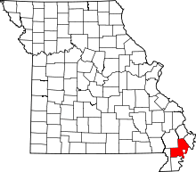 | |
| Village | ||
| Townships |
| |
| Unincorporated communities | ||
| Ghost towns | ||
| Footnotes | ‡This populated place also has portions in an adjacent county or counties | |