Parkdale, Oregon
| Parkdale, Oregon | |
|---|---|
| Census-designated place (CDP) | |
|
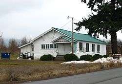
Parkdale grange hall | |
 Location of Parkdale, Oregon | |
| Coordinates: 45°31′1″N 121°35′49″W / 45.51694°N 121.59694°W | |
| Country | United States |
| State | Oregon |
| County | Hood River |
| Area | |
| • Total | 0.6 sq mi (1.6 km2) |
| • Land | 0.6 sq mi (1.6 km2) |
| • Water | 0.0 sq mi (0.0 km2) |
| Elevation | 1,726 ft (526 m) |
| Population (2000) | |
| • Total | 266 |
| • Density | 419.1/sq mi (161.8/km2) |
| Time zone | Pacific (PST) (UTC-8) |
| • Summer (DST) | PDT (UTC-7) |
| ZIP code | 97041 |
| Area code(s) | 458 and 541 |
| FIPS code | 41-56500[1] |
| GNIS feature ID | 1147441[2] |
Parkdale is an unincorporated community in Hood River County, Oregon, United States. For statistical purposes, the United States Census Bureau has defined Parkdale as a census-designated place (CDP). The census definition of the area may not precisely correspond to local understanding of the area with the same name. As of the 2000 census, the population was 266.
History
Parkdale was founded by David Eccles and R. J. McIsaac in 1910 to serve as a terminus for the Mount Hood Railroad.
Geography
Parkdale is located at 45°31′1″N 121°35′49″W / 45.51694°N 121.59694°W (45.516976, -121.596923).[3]
According to the United States Census Bureau, the CDP has a total area of 0.6 square miles (1.6 km2), all of it land.
Climate
This region experiences warm (but not hot) and dry summers, with no average monthly temperatures above 71.6 °F. According to the Köppen Climate Classification system, Parkdale has a warm-summer Mediterranean climate, abbreviated "Csb" on climate maps.[4]
| Climate data for Parkdale | |||||||||||||
|---|---|---|---|---|---|---|---|---|---|---|---|---|---|
| Month | Jan | Feb | Mar | Apr | May | Jun | Jul | Aug | Sep | Oct | Nov | Dec | Year |
| Record high °F (°C) | 65 (18) |
66 (19) |
77 (25) |
83 (28) |
97 (36) |
99 (37) |
102 (39) |
101 (38) |
96 (36) |
87 (31) |
69 (21) |
62 (17) |
102 (39) |
| Average high °F (°C) | 41.6 (5.3) |
45.4 (7.4) |
52.6 (11.4) |
58.8 (14.9) |
66.2 (19) |
72.7 (22.6) |
80.5 (26.9) |
80.8 (27.1) |
74.4 (23.6) |
62 (17) |
47.7 (8.7) |
39 (4) |
60.1 (15.6) |
| Average low °F (°C) | 27.5 (−2.5) |
28.2 (−2.1) |
31.8 (−0.1) |
35.1 (1.7) |
40.1 (4.5) |
45 (7) |
48.8 (9.3) |
48.2 (9) |
42.7 (5.9) |
36.3 (2.4) |
31.5 (−0.3) |
26.2 (−3.2) |
36.8 (2.7) |
| Record low °F (°C) | −10 (−23) |
−13 (−25) |
10 (−12) |
21 (−6) |
24 (−4) |
28 (−2) |
34 (1) |
34 (1) |
15 (−9) |
10 (−12) |
−10 (−23) |
−13 (−25) |
−13 (−25) |
| Average precipitation inches (mm) | 5.7 (145) |
3.97 (100.8) |
3.39 (86.1) |
2.17 (55.1) |
1.5 (38) |
1.03 (26.2) |
0.33 (8.4) |
0.42 (10.7) |
0.91 (23.1) |
2.69 (68.3) |
6.07 (154.2) |
5.74 (145.8) |
33.92 (861.6) |
| Average snowfall inches (cm) | 15.1 (38.4) |
10.1 (25.7) |
3.9 (9.9) |
0.8 (2) |
0 (0) |
0 (0) |
0 (0) |
0 (0) |
0 (0) |
0.2 (0.5) |
6.7 (17) |
17.4 (44.2) |
54.2 (137.7) |
| Average precipitation days | 16 | 13 | 15 | 12 | 10 | 6 | 2 | 3 | 5 | 10 | 18 | 16 | 126 |
| Source: [5] | |||||||||||||
Geology
The geology of Parkdale is dominated by the geology of Mount Hood, a nearby stratovolcano about 8 miles to the south of the town. A six-thousand-year-old lava flow is named after the town. It flowed north from the Upper Hood River Valley.
Demographics
As of the census[1] of 2000, there were 266 people, 88 households, and 68 families residing in the CDP. The population density was 419.1 people per square mile (163.0/km²). There were 92 housing units at an average density of 145.0 per square mile (56.4/km²). The racial makeup of the CDP is 80.08% White, 4.51% Native American, 0.75% Asian, 11.65% from other races, and 3.01% from two or more races. Hispanic or Latino of any race were 23.31% of the population.
There were 88 households out of which 43.2% had children under the age of 18 living with them, 58.0% were married couples living together, 10.2% had a female householder with no husband present, and 22.7% were non-families. 15.9% of all households were made up of individuals and 4.5% had someone living alone who was 65 years of age or older. The average household size was 2.95 and the average family size was 3.21.
In the CDP the population was spread out with 30.5% under the age of 18, 10.2% from 18 to 24, 26.7% from 25 to 44, 21.8% from 45 to 64, and 10.9% who were 65 years of age or older. The median age was 34 years. For every 100 females there were 133.3 males. For every 100 females age 18 and over, there were 122.9 males.
The median income for a household in the CDP was $31,786, and the median income for a family was $34,375. Males had a median income of $52,679 versus $30,313 for females. The per capita income for the CDP was $18,091. About 8.0% of families and 19.7% of the population were below the poverty line, including 33.3% of those under the age of eighteen and none of those sixty five or over.
See also
References
- 1 2 "American FactFinder". United States Census Bureau. Archived from the original on September 11, 2013. Retrieved 2008-01-31.
- ↑ "US Board on Geographic Names". United States Geological Survey. 2007-10-25. Retrieved 2008-01-31.
- ↑ "US Gazetteer files: 2010, 2000, and 1990". United States Census Bureau. 2011-02-12. Retrieved 2011-04-23.
- ↑ Climate Summary for Parkdale, Oregon
- ↑ "PARKDALE 1 NNE, OR (356466)". Western Regional Climate Center. Retrieved November 26, 2015.
Coordinates: 45°31′01″N 121°35′49″W / 45.516976°N 121.596923°W
Municipalities and communities of Hood River County, Oregon, United States | ||
|---|---|---|
| Cities | 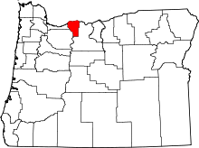 | |
| CDPs | ||
| Other unincorporated communities | ||