Papatoetoe
| Papatoetoe | |
|---|---|
 St George Street, Town Centre. | |
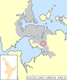 Papatoetoe's location in Auckland. | |
| Basic information | |
| Local authority | Auckland Council |
| Population | 39,585 (2001) |
| Facilities | |
| Train station(s) | Papatoetoe Train Station |
| Surrounds | |
| North | Middlemore |
| Northeast | Hunters Corner, Otara |
| East | Flat Bush |
| Southeast | Puhinui |
| South | Puhinui |
| Southwest | (Towards Manukau Harbour) |
| West | (Towards Auckland Airport) |
| Northwest | Māngere East |
Papatoetoe is a suburb in the Auckland conurbation in northern New Zealand. One of the larger suburbs of the area commonly known as South Auckland, it is located to the northwest of central Manukau, and 18 kilometres southeast of Auckland city centre.
Papatoetoe is a Māori name, which can be loosely translated as 'undulating area where the toetoe is the predominant feature',[1] making it named after the 'Prince of Wales' feather (or toetoe / toi toi), which grew abundantly in the swampy parts of the region. Due to some confusion over the spelling, the area was known as Papatoitoi for many years.
History
People have lived in the Papatoetoe area for almost the entire time of human settlement in New Zealand. For both the original Māori and the first English settlers, the Papatoetoe area was handily located close to the narrowest points between Auckland's two great harbours, where waka could be ported over land. It was also rich in fertile soil.[1]
Inlets run from Papatoetoe eastward to the Waitemata Harbour and westward to the Manukau Harbour. Thus for travellers past and present the routes south to the Waikato River and the north to the Auckland isthmus - Tamaki-makau-rau (Tamaki coveted by many) - have always been through Papatoetoe.
The definition of the Papatoetoe Highway district in 1865 and the Papatoetoe Town Board in 1919 helped establish the town. The first council Papatoetoe Borough Council was created in 1946 followed by the Papatoetoe City Council in 1965. The Papatoetoe City Council was merged into the Manukau City Council in 1989. Papatoetoe is now a suburb in the Manukau Ward which is part of the Auckland Council.[2]
The area's main population growth occurred after World War II, when many returning service men received housing in the area. By 1980, population growth had mostly ceased, with all available land taken up, though some infill housing growth occurred later. The population in 2006 had a median age of 31, with 34% being NZ Europeans, 33% Asians, 26% Pacific Islanders and 16% Maori.[1]
Town centre
Manukau City Council has in early 2009 announced plans to spend millions revitalising the town's centre in the St. George Street area. New apartment buildings and nearby sports facilities (centred on a NZ$12 million multisports centre) are to encourage new shops to the area, which has deteriorated in the past, partly due to competition from shopping malls.[3]
Papatoetoe Historical Society
Papatoetoe Historical Society was established in 1988 with the aim to gather the historical artifacts and information from the Papatoetoe district. The collection held includes a collation of information on Local Body members, schools as they developed, the origin and meaning of street names, women of the district (book available), people of the surrounding farming district, newspaper cuttings and information on local organisations. The society has also developed an archive collection which includes photographs, books, booklets, plans and posters. These collections can be viewed at the Papatoetoe Historical Society museum which is housed in the old Papatoetoe Council works depot at 91 Cambridge Terrace, Papatoetoe.[4]
In 2012 Papatoetoe celebrated 150 years of civic life. The Papatoetoe 150 was initiated by the Papatoetoe Historical society to increase awareness of history and promote community organisations.
Rugby union
Papatoetoe Rugby Football Club was established in 1946 and plays home matches at the Papatoetoe Sport Complex on Great South Road.
Rugby league
Papatoetoe is home to the Papatoetoe Panthers who are affiliated with the Auckland Rugby League.
Association football
Papatoetoe is home to Papatoetoe AFC who compete in the Lotto Sport Italia NRFL Division 1A. Papatoetoe is home to Papatoetoe United who play from the sports complex on Great South Road and are affiliated with Auckland Football Federation.
Cricket
Papatoetoe is home to the Papatoetoe Cricket Club who play in the Auckland Cricket Championship.
Tennis
Papatoetoe is home to two tennis clubs, Papatoetoe Tennis Club located at Papatoetoe Sports Complex and Sunnyside Tennis Club located in the Sunnyside Domain. Both clubs are affiliated to Auckland Tennis. Sunnyside Tennis Club was formed originally as Puhunui Tennis Club in 1955.
Education
Primary education
Papatoetoe has eight primary schools in its zone:
- Holy Cross School is a coeducational full primary school (years 1-8) integrated with the state system. Founded in 1953, it has a roll of 596 and a decile rating of 2.[5]
- Papatoetoe Central School is a coeducational state contributing primary school (years 1-6) with a roll of 707 and a decile rating of 4. Founded in 1857, the school moved to its current site in 1872.[6][7]
- Papatoetoe East School is a coeducational state contributing primary school (years 1-6). It was established in 1958 and currently has a roll of 503 and a decile rating of 3.[8]
- Papatoetoe North School is a coeducational state contributing primary school (years 1-6). It was established in 1959 and currently has a roll of 751 and a decile rating of 3.[9]
- Papatoetoe South School is a coeducational state contributing primary school (years 1-6). It has a decile rating of 2 and a roll of 605.[10]
- Papatoetoe West School is a coeducational state contributing primary school (years 1-6) which opened in 1949. It has a decile rating of 3 and a roll of 758.[11]
- South Auckland Seventh-day Adventist School is a coeducational full primary school (years 1-8) integrated with the state system. it has a roll of 248 and a decile rating of 2.[12]
- Puhinui School is a coeducational state contributing primary school (years 1-6). It has a decile rating of 3 and a roll of 575.[13]
Papatoetoe has two intermediate schools:
Secondary education
Papatoetoe has two secondary schools:
Mayors
- 1953-1959 C.J. Mahon
- 1959-1965 Lee Murdoch
- 1965-1986 Bob White
- 1986-1987 Allan Brewster
Notable people
- Barry Crump - Author, poet
- Ricki Herbert - Soccer player - Played National Level for the All Whites and is their current coach. Also played for New Zealand in Soccer World Cup Finals 1982
- Trevor Meale - Cricketer
- Gary Troup - Played club cricket in Papatoetoe going on to represent New Zealand 1976 - 1986
- Heather Matthews (née Thompson) - Silver Medalist 1978 Commonwealth Games (3000 m). MBE - Services To Sport, Papatoetoe Sports Person of the Year.
- Tyree Tautogia - Part of highly successful rap group Smashproof[14]
- David Dallas - Hip Hop Artist
- Phil Goff - Former Labour Party Leader, Foreign and Defence Minister, lived in Papatoetoe and attended Papatoetoe High School
Attractions

- Murals in Old Papatoetoe
- "Picnic Scene" by Ron van Dam (near Wallace Road corner)
- "Papatoetoe General Store" by Christine Trout (Papatoetoe Mall)
- "Bottle O" by Christine Trout (Papatoetoe Mall)
- "Cameos" by Claudia Pond-Eyley (near Town Hall)
- "Old Papatoetoe Logo" by Ron van Dam (near Shirley Road)
- "St George St – 1930" by Merv Appleton (Rangitoto Road.
- Historical cemeteries at Manukau Memorial Gardens and St John's Presbyterian Church.
- Historic landmarks including
- Old Railway Station
- Cambria House and associated historic gardens (Puhinui Road )
- Old Children's home (now in Wyllie Road)
References
- 1 2 3 Papatoetoe Community Board Meeting, 28 June 2010 (from the 2006 Census Profile, Manukau City Council. Accessed 2011-02-02.)
- ↑ http://www.papatoetoe150.co.nz/
- ↑ Facelift to help town centre fight the malls - The New Zealand Herald, Wednesday 25 March, Page A8
- ↑ http://www.nzhistoricalsocieties.org.nz/members/papatoetoe.htm
- ↑ Te Kete Ipurangi schools database: Holy Cross School (Papatoetoe)
- ↑ Te Kete Ipurangi schools database: Papatoetoe Central School
- ↑ "Papatoetoe Central School". 2011. Retrieved 13 June 2012.
- ↑ Te Kete Ipurangi schools database: Papatoetoe East School
- ↑ Te Kete Ipurangi schools database: Papatoetoe North School
- ↑ Te Kete Ipurangi schools database: Papatoetoe South School
- ↑ Te Kete Ipurangi schools database: Papatoetoe West School
- ↑ Te Kete Ipurangi schools database: South Auckland Seventh-day Adventist School
- ↑ Te Kete Ipurangi schools database: Puhinui School
- ↑ Hughes, Andrew (October–November 2006). "Feature: Tyree - It's Now or Never". NZ Musician Magazine. 13 (2). Retrieved 2009-10-27.
Papatoetoe municipalities' publications
- Papatoetoe City Council Statement of Objectives for Second District Scheme Review, 1981
- Smytheman, Ivy F. and Tonson, Albert E. (1962). Our first hundred years: an historical record of Papatoetoe
Books
- Auckland Provincial Handbook 1925-1926
- Davidson, Janet (1984). The PreHistory of New Zealand, Auckland: Longman Paul.
- Gadd, Bernard (1987). The City of Toetoe - A History of Papatoetoe, Auckland: The Dunmore Press, ISBN 0-86469-073-8 (pbk.).
- New Zealand Yearbooks (1906 ff.). Wellington: Government Printer.
- Oliver, William Hosking and Williams Bridget R. (eds) (1981). The Oxford History of New Zealand. Wellington: Oxford University Press.
- Scholefield, G.H. (1940). A Dictionary of New Zealand Biography, Wellington: Government Printer.
- Sedal, Venia Iris (1982). A Brief History of Otahuhu, Otahuhu Borough Council.
- Searle, Ernest Johns (1981). City of Volcanoes, a Geology of Auckland, Auckland: Longman Paul.
- Tonson, Albert E. (1966). Old Manukau, Auckland: Tonson.
- Williams, Herbert William (1971). A Dictionary of the Maori Language, Wellington: Government Printer.
Booklets, pamphlets and reports
- A Century of Witness, St John's Church Papatoetoe, 1854–1954
- Kiwanis Club of Papatoetoe, New Zealand District, 1971–81
- Lawlor, I. (1981). Puhinui Excavation Report, University of Auckland
- Papatoetoe and District R.S.A. Annual Reports.
- Papatoetoe Association Football Club Inc, Silver Jubilee 1959-1984
- Papatoetoe Central School, Jubilee Commemorative Magazine 1857-1952 (1982), Auckland: Woodward Publications.
- Papatoetoe District School Reunion, 106th Anniversary, 1962.
- Papatoetoe District Cricket Club 1906-2006
- Papatoetoe Fire Brigade 1928-1979
- Papatoetoe Methodist Church, Jubilee Souvenir, 1912–1962
- Simmons, D., (1980). The Creation Myth and the Origin of Auckland's Volcanoes, Auckland Institute and Museum.
- Sims, A. (1983). History of the Papatoetoe Light Opera Club.
- Sullivan, A. (1973). A site survey of lower Pukaki Creek, University of Auckland.
- Sullivan, A. (1975). Checklist of archaeological sites at Crater Hill, Papatoetoe, Paper no 37, Anthropology Department, University of Auckland.
Newspapers
- The Courier newspapers
- Papatoetoe Gazette
- Papatoetoe Independent
- Papatoetoe News
External links
BU=http%3A%2F%2Fmanukau.infospecs.co.nz%2Ffootprints%2Fsearch.htm&QF0=Coverage&QI0=Papatoetoe&TN=Footprints&AC=QBE_QUERY&RL=0&RF=Brief%20display&DL=1&DF=Full%20display&MR=5&NP=2 Photographs of Papatoetoe] held in Auckland Libraries' heritage collections.
Coordinates: 36°58′47″S 174°51′04″E / 36.979770°S 174.851224°E