Panyola
| Panyola | |
|---|---|
| Country |
|
| County | Szabolcs-Szatmár-Bereg |
| Area | |
| • Total | 12.23 km2 (4.72 sq mi) |
| Population (2001) | |
| • Total | 642 |
| • Density | 52.49/km2 (135.9/sq mi) |
| Time zone | CET (UTC+1) |
| • Summer (DST) | CEST (UTC+2) |
| Postal code | 4913 |
| Area code(s) | 44 |
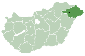
Location of Szabolcs-Szatmar-Bereg county in Hungary
Panyola is a village in Szabolcs-Szatmár-Bereg county, in the Northern Great Plain region of eastern Hungary.
Geography
It covers an area of 12.23 km2 (5 sq mi) and has a population of 642 people (2001).
External links
Coordinates: 48°03′N 22°24′E / 48.050°N 22.400°E
This article is issued from Wikipedia - version of the 2/6/2014. The text is available under the Creative Commons Attribution/Share Alike but additional terms may apply for the media files.