Panicheri Gap
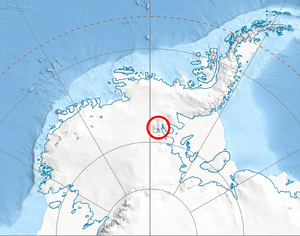
Panicheri Gap (Bulgarian: Паничерска седловина, ‘Panicherska Sedlovina’ \pa-ni-'cher-ska se-dlo-vi-'na\) is the flat, ice-covered saddle of elevation 2100 m in north-central Sentinel Range in Ellsworth Mountains, Antarctica, linking Bangey Heights to the north to Maglenik Heights to the south. It is part of the glacial divide between Kopsis Glacier to the east and Ellen Glacier to the west.
The gap is named after the settlement of Panicheri in Southern Bulgaria.
Location
Panicheri Gap is centred at 78°06′28″S 85°40′40″W / 78.10778°S 85.67778°WCoordinates: 78°06′28″S 85°40′40″W / 78.10778°S 85.67778°W. US mapping in 1961, updated in 1988.
Maps
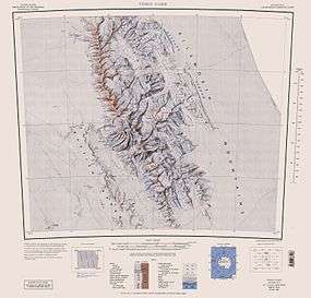
- Vinson Massif. Scale 1:250 000 topographic map. Reston, Virginia: US Geological Survey, 1988.
References
- Panicheri Gap. SCAR Composite Antarctic Gazetteer.
- Bulgarian Antarctic Gazetteer. Antarctic Place-names Commission. (details in Bulgarian, basic data in English)
This article includes information from the Antarctic Place-names Commission of Bulgaria which is used with permission.