Paloma Creek South, Texas
| Paloma Creek South | |
|---|---|
| Census-designated place | |
 Paloma Creek South Location within the state of Texas | |
| Coordinates: 33°12′59″N 96°56′4″W / 33.21639°N 96.93444°WCoordinates: 33°12′59″N 96°56′4″W / 33.21639°N 96.93444°W | |
| Country | United States |
| State | Texas |
| County | Denton |
| Area | |
| • Total | 0.9 sq mi (2.3 km2) |
| • Land | 0.9 sq mi (2.3 km2) |
| • Water | 0.0 sq mi (0.0 km2) |
| Population (2010) | |
| • Total | 2,753 |
| • Density | 3,100/sq mi (1,200/km2) |
| Time zone | Central (CST) (UTC-6) |
| • Summer (DST) | CDT (UTC-5) |
| ZIP codes | 76227, 75068 |
| Area code(s) | 972 |
Paloma Creek South is a census-designated place (CDP) in eastern Denton County, Texas, United States. It is part of the Paloma Creek master-planned community. As of the 2010 census, Paloma Creek South had a population of 2,753.[1]
Geography
Paloma Creek South is located south of U.S. Route 380 in an unincorporated area governed by the Denton County Fresh Water Supply Districts 8-A, 8-B, 11-A, 11-B, and 11-C.
Education
Many children living in Paloma Creek attend schools within the Denton Independent School District. They attend Paloma Creek Elementary School, Navo Middle School, and Denton High School or Denton Ryan High School. Students have been offered enrollment at Savannah Elementary when PC Elementary had full classes. There is an active homeschool community. A good number of the houses in the southern area of the community are located within the Little Elm Independent School District.[2]
See also
References
- ↑ "Profile of General Population and Housing Characteristics: 2010 Demographic Profile Data (DP-1): Paloma Creek South CDP, Texas". U.S. Census Bureau, American Factfinder. Retrieved July 3, 2012.
- ↑ palomacreek.com. "Paloma Creek Schools". Retrieved 2009-06-22.
External links
Municipalities and communities of Denton County, Texas, United States | ||
|---|---|---|
| Cities | 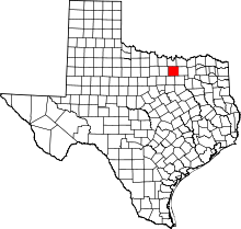 | |
| Towns | ||
| CDPs | ||
| Unincorporated communities | ||
| Ghost towns | ||
| Footnotes | ‡This populated place also has portions in an adjacent county or counties | |
