Interstate 520
| ||||||||||
|---|---|---|---|---|---|---|---|---|---|---|
_map.svg.png) | ||||||||||
| Route information | ||||||||||
| Length: | 23.34 mi[1] (37.56 km) | |||||||||
| Existed: | 1980[2] – present | |||||||||
| Major junctions | ||||||||||
| West end: |
| |||||||||
|
| ||||||||||
| East end: |
| |||||||||
| Highway system | ||||||||||
| ||||||||||

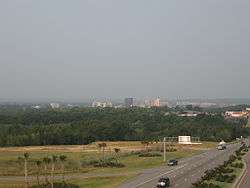
Interstate 520 (I-520) is a 23.34-mile (37.56 km) auxiliary Interstate Highway that encircles most of Augusta, Georgia and North Augusta, South Carolina as a three-quarter beltway around the western, southern, and eastern parts of the Augusta metropolitan area. It begins at I-20 in the northern part of Augusta, and ends at I-20 in the northern part of North Augusta, South Carolina. I-520 is also known as Bobby Jones Expressway and the Deputy James D. Paugh Memorial Highway in Georgia and Palmetto Parkway in South Carolina. In Georgia, the road also carries unsigned State Route 415.
Route description
I-520 begins at an interchange with I-20 (Carl Sanders Highway) in the northern part of Augusta. At this interchange, the roadway continues as Georgia State Route 232 (SR 232), which keeps the Bobby Jones Expressway name. The interstate travels to the south-southeast. After passing the Augusta Exchange shopping complex, east of Doctors Hospital, it has an interchange with Wheeler Road and Marks Church Road. After a slight western jog, I-520 continues to the south-southeast and meets Wrightsboro Road, which leads to Augusta Mall. About 1 mile (1.6 km) later is an interchange with US 78/US 278/SR 10 (Gordon Highway). The freeway curves to the southeast, passing by Glenn Hills Middle School and Glenn Hills High School, to an interchange with US 1/SR 4 (Deans Bridge Road). It passes by a campus of Augusta Technical College and the Richmond County Technical Career Magnet School, before curving to the east-southeast and meeting an interchange with Windsor Springs Road and US 25/SR 121 (Peach Orchard Road). After a curve to the east is an interchange with SR 56 (Mike Padgett Highway), which is east of Southside Elementary School and northeast of East-Central Regional Hospital. I-520 curves to the east-northeast and has an interchange with Doug Barnard Parkway (formerly signed as SR 56 Spur). The interstate gradually curves to the northeast and has an interchange with Laney-Walker Boulevard and SR 28 (Sand Bar Ferry Road). Just over 1,000 feet (300 m) later, it crosses the Savannah River into South Carolina and the city limits of North Augusta. I-520 curves to the north-northwest, to an interchange with US 1/US 78/US 278 (only signed as "US 1"). The highway curves back to the north-northeast and has an interchange with SC 126 (Clearwater Road). During a slight westward shift is an interchange with US 25/SC 121 (Edgefield Road). Just north-northeast of there, I-520 meets its eastern terminus, another interchange with I-20.
In Georgia, I-520 is known as Bobby Jones Expressway for professional golfer Bobby Jones; in South Carolina it is known as Palmetto Parkway for the sabal palmetto, the state tree. Exits 2–3 are known as Deputy James D. Paugh Memorial Highway after a Richmond County sheriff's deputy who was killed at exit 3 when responding to reports of a gunman who was shooting at passing cars.[3] I-520 loses its state route designation in South Carolina, as that state does not co-number its interstates with state highway numbers.
History
I-520 was constructed in stages, with the first opening in 1980 between I-20 in Augusta and Doug Barnard Parkway (exit 10). The section between Doug Barnard Parkway and Laney-Walker Boulevard (exit 16) opened in July 1998. On June 22, 2004, the section between Laney-Walker Boulevard and US 1/US 78/US 278 (exit 17) opened to traffic, with I-520 entering South Carolina.[4] Phase 2 of the Palmetto Parkway stretching from exit 17 to I-20 in North Augusta opened on December 17, 2009. With the completion of this final stretch I-520, it became a loop that begins and ends at I-20, thus violating the numbering standard for Interstates, as loops technically should begin with even numbers (e.g., I-620). This is because I-520 was originally planned as only a spur and when later extended to a loop, it was not renumbered. In January 2015 4.7 miles of I-520 were expanded to three lanes after starting work in February 2012 for a cost of $33 million.[5]
Exit list
In accordance with MUTCD guidelines for auxiliary interstates, exit numbering is continuous across the state line and does not reset.
| State | County | Location | mi | km | Exit | Destinations | Notes |
|---|---|---|---|---|---|---|---|
| Georgia | Richmond | Augusta | 0.0 | 0.0 | 1A/1B | Western terminus of I-520; eastern terminus of SR 232; signed as exits 1A (west) and 1B (east) eastbound | |
| 0.4 | 0.64 | 1C | Wheeler Road | Westbound ramps connect to Marks Church Road. | |||
| 1.9 | 3.1 | 2 | Wrightsboro Road – Daniel Field | ||||
| 3.1 | 5.0 | 3 | Signed as exits 3A (west) and 3B (east). Interchange designated Deputy James D. Paugh Memorial Interchange. | ||||
| 5.3 | 8.5 | 5 | |||||
| 7.2 | 11.6 | 7 | |||||
| 8.7 | 14.0 | 9 | |||||
| 9.9 | 15.9 | 10 | Former SR 56 Spur | ||||
| 14.5 | 23.3 | 16 | |||||
| Savannah River | 15.5 | 24.9 | Georgia–South Carolina state line | ||||
| South Carolina | Aiken | North Augusta | 17.2 | 27.7 | 17 | Eastbound exit and westbound entrance; only signed as "US 1". | |
| 20.2 | 32.5 | 21 | |||||
| 21.8 | 35.1 | 22 | |||||
| 22.9 | 36.9 | 23 | Eastern terminus; signed as exits 23A (west) and 23B (east). | ||||
| 1.000 mi = 1.609 km; 1.000 km = 0.621 mi | |||||||
See also
-
.svg.png) Georgia (U.S. state) portal
Georgia (U.S. state) portal -
 South Carolina portal
 -
 U.S. Roads portal
 - Central Savannah River Area
References
- ↑ Staff writer (December 31, 2013). "FHWA Route Log and Finder List: Table 2 - Auxiliary Routes". Washington, D.C.: Federal Highway Administration. Retrieved April 5, 2014.
- ↑ Georgia State Highway System (PDF) (Map). Cartography by GSHD. Georgia State Highway Department. March 1, 1980. Retrieved July 10, 2016.
- ↑ Staff writer. "2011-2012 Regular Session - HR 1103: Deputy James D. Paugh Memorial Highway; Richmond County; dedicate" (PDF). Atlanta, Georgia: Georgia State Senate. Retrieved April 5, 2014.
- ↑ Staff writer. "Transportation". Augusta, Georgia: Augusta.gov. Retrieved April 5, 2014.
- ↑ "News 12". wrdw. wrdw-tv. Retrieved 12 October 2015.
External links
-
 Media related to Interstate 520 at Wikimedia Commons
 - Interstate Guide-Interstate 520
- Southeast Roads-Interstate 520
1Cancelled | ||