Palhers
| Palhers | |
|---|---|
|
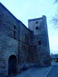
The Commandery of Palhers | |
 Palhers | |
|
Location within Occitanie region  Palhers | |
| Coordinates: 44°31′16″N 3°17′56″E / 44.5211°N 3.2989°ECoordinates: 44°31′16″N 3°17′56″E / 44.5211°N 3.2989°E | |
| Country | France |
| Region | Occitanie |
| Department | Lozère |
| Arrondissement | Mende |
| Canton | Marvejols |
| Intercommunality | Gévaudan |
| Government | |
| • Mayor (2008–2014) | André Raymond[1] |
| Area1 | 8.59 km2 (3.32 sq mi) |
| Population (1999)2 | 172 |
| • Density | 20/km2 (52/sq mi) |
| Time zone | CET (UTC+1) |
| • Summer (DST) | CEST (UTC+2) |
| INSEE/Postal code | 48107 / 48100 |
| Elevation |
668–1,022 m (2,192–3,353 ft) (avg. 685 m or 2,247 ft) |
|
1 French Land Register data, which excludes lakes, ponds, glaciers > 1 km² (0.386 sq mi or 247 acres) and river estuaries. 2 Population without double counting: residents of multiple communes (e.g., students and military personnel) only counted once. | |
Palhers is a commune in the Lozère département in southern France.
See also
References
| Wikimedia Commons has media related to Palhers. |
This article is issued from Wikipedia - version of the 2/1/2015. The text is available under the Creative Commons Attribution/Share Alike but additional terms may apply for the media files.