Palestine, Arkansas
| Palestine, Arkansas | |
|---|---|
| City | |
 | |
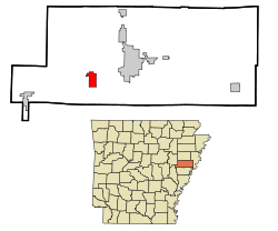 Location in St. Francis County and the state of Arkansas | |
| Coordinates: 34°58′25″N 90°54′22″W / 34.97361°N 90.90611°WCoordinates: 34°58′25″N 90°54′22″W / 34.97361°N 90.90611°W | |
| Country | United States |
| State | Arkansas |
| County | St. Francis |
| Area | |
| • Total | 3.2 sq mi (8.4 km2) |
| • Land | 3.2 sq mi (8.3 km2) |
| • Water | 0 sq mi (0.1 km2) |
| Elevation | 210 ft (64 m) |
| Population (2000) | |
| • Total | 741 |
| • Density | 231.6/sq mi (88.2/km2) |
| Time zone | Central (CST) (UTC-6) |
| • Summer (DST) | CDT (UTC-5) |
| FIPS code | 05-53150 |
| GNIS feature ID | 0083241 |
Palestine is a city in St. Francis County, Arkansas, United States, along the L'Anguille River. The population was 681 at the 2010 census, a decline from 741 in 2000.
Geography
Palestine is located at 34°58′25″N 90°54′22″W / 34.97361°N 90.90611°W (34.973480, -90.905994).[1]
According to the United States Census Bureau, the city has a total area of 3.2 square miles (8.3 km2), of which 3.2 square miles (8.3 km2) is land and 0.04 square miles (0.10 km2) (0.62%) is water.
Demographics
| Historical population | |||
|---|---|---|---|
| Census | Pop. | %± | |
| 1890 | 163 | — | |
| 1900 | 196 | 20.2% | |
| 1910 | 173 | −11.7% | |
| 1920 | 297 | 71.7% | |
| 1930 | 209 | −29.6% | |
| 1940 | 345 | 65.1% | |
| 1950 | 420 | 21.7% | |
| 1960 | 532 | 26.7% | |
| 1970 | 755 | 41.9% | |
| 1980 | 976 | 29.3% | |
| 1990 | 711 | −27.2% | |
| 2000 | 741 | 4.2% | |
| 2010 | 681 | −8.1% | |
| Est. 2015 | 623 | [2] | −8.5% |
As of the census[4] of 2000, there were 741 people, 299 households, and 209 families residing in the city. The population density was 230.2 people per square mile (88.9/km²). There were 321 housing units at an average density of 99.7 per square mile (38.5/km²). The racial makeup of the city was 85.96% White, 13.23% Black or African American, 0.13% from other races, and 0.67% from two or more races. 0.27% of the population were Hispanic or Latino of any race.
There were 299 households out of which 33.4% had children under the age of 18 living with them, 52.2% were married couples living together, 15.1% had a female householder with no husband present, and 30.1% were non-families. 27.1% of all households were made up of individuals and 15.4% had someone living alone who was 65 years of age or older. The average household size was 2.48 and the average family size was 3.01.
In the city the population was spread out with 26.7% under the age of 18, 9.6% from 18 to 24, 26.2% from 25 to 44, 23.3% from 45 to 64, and 14.2% who were 65 years of age or older. The median age was 36 years. For every 100 females there were 81.6 males. For every 100 females age 18 and over, there were 81.0 males.
The median income for a household in the city was $24,904, and the median income for a family was $36,023. Males had a median income of $28,661 versus $18,816 for females. The per capita income for the city was $14,462. About 16.7% of families and 17.2% of the population were below the poverty line, including 17.5% of those under age 18 and 19.0% of those age 65 or over.
Government
Wallace Emerson was mayor of Palestine for 15 years until his death in 1990. Willetta Carol was instituted as mayor from 1990-2005. Becky Dunn was elected mayor of Palestine in 2006. Billy Shafer has been the mayor since 2010.
Education
Public education for elementary and secondary school students is available from the Palestine–Wheatley School District, which results in graduation from Palestine–Wheatley High School. In the late 1980s, the former Palestine School District (and Palestine High School) merged with the nearby Wheatley School District (and Wheatley High School).
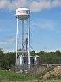
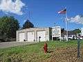
Gallery


References
| Wikimedia Commons has media related to Palestine, Arkansas. |
- ↑ "US Gazetteer files: 2010, 2000, and 1990". United States Census Bureau. 2011-02-12. Retrieved 2011-04-23.
- ↑ "Annual Estimates of the Resident Population for Incorporated Places: April 1, 2010 to July 1, 2015". Retrieved July 2, 2016.
- ↑ "Census of Population and Housing". Census.gov. Retrieved June 4, 2015.
- ↑ "American FactFinder". United States Census Bureau. Retrieved 2008-01-31.
Municipalities and communities of St. Francis County, Arkansas, United States | ||
|---|---|---|
| Cities |  | |
| Towns | ||
| Unincorporated communities | ||
| Footnotes | ‡This populated place also has portions in an adjacent county or counties | |