Pahoa, Hawaii
| Pahoa, Hawaii Pāhoa | |
|---|---|
| Census-designated place | |
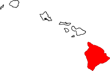
 Location in Hawaii County and the state of Hawaii | |
| Country | United States |
| State | Hawaii |
| Counties | Hawaii |
| Settled | early 1900s |
| Government | |
| • Mayor | Billy Kenoi |
| • Managing Director | Wally Lau |
| • County Clerk | Stewart Maeda |
| Area | |
| • Total | 2.19 sq mi (5.6 km2) |
| • Land | 2.19 sq mi (5.6 km2) |
| • Water | 0 sq mi (0 km2) 0% |
| Elevation | 655 ft (199.6 m) |
| Population (2010) | |
| • Total | 945 |
| • Density | 410.9/sq mi (160.2/km2) |
| Time zone | HST (UTC-10:00) |
| ZIP code | 96778 |
| Area code(s) | 808 |
| Hawaii does not participate in Daylight Saving Time | |
Pāhoa[1] is a census-designated place (CDP) in Hawai‘i County, Hawai‘i, United States located in the District of Puna. The population was 962 at the 2000 census. The population dropped by 1.8% to 945 at the 2010 census.[2]
Geography and environment
According to the United States Census Bureau, the CDP has a total area of 2.3 square miles (6.0 km2), all of it land. Soils underlying the Pāhoa area are volcanic in origin, deriving from the currently active Kilauea Volcano. (Earth Metrics Inc., 1986) Kilauea is one of the Earth's most active volcanoes, with the January, 2006 eruption being the longest rift zone eruption in Kilauea's 200 year recorded history. (Volcanology, 2007) The volcanic soils underlying Pāhoa are considered to have been generated by lava flows within the last 125 to 500 years. For example, the eruption of 1840 is known to have deposited a lava flow within 1.5 miles (2.4 km) of Pāhoa.
Demographics
As of the census of 2010, there were 945 people in 321 households residing in the CDP. The population density was 410.9 people per square mile (160.2/km²). There were 356 housing units at an average density of 154.8 per square mile (60.3/km²). The racial makeup of the CDP was 14.92% White, 0.42% African American, 1.48% American Indian & Alaska Native, 43.49% Asian, 12.59% Native Hawaiian & Pacific Islander, 0.95% from other races, and 26.14% from two or more races. Hispanic or Latino of any race were 6.56% of the population.[2]
There were 321 households out of which 24.9% had children under the age of 18 living with them. The average household size was 2.94.[2]
In the Pahoa CDP the population was spread out with 22.3% under the age of 18, 7.3% from 18 to 24, 12.0% from 25 to 34, 18.1% from 35 to 49, 23.0% from 50 to 64, and 17.4% who were 65 years of age or older. For every 100 females there were 105.0 males. For every 100 males age 18 over there were 95.2 females.[2]
The median income for a household in the CDP at the 2000 census was $33,333, and the median income for a family in 2000 was $43,571. Males had a median income of $26,103 in 2000 versus $23,571 for females. The per capita income for the CDP in 2000 was $13,850. About 15.7% of families and 18.0% of the population were below the poverty line in 2000, including 28.9% of those under age 18 and 5.2% of those age 65 or over.
Culture
In the Hawaiian language, the word 'pāhoa' means dagger or knife.[3] The Pāhoa held pointing downwards, such as the statue at Pāhoa High and Intermediate School, is a symbol of peace and strength. It is unknown when the indigenous Hawaiians settled the area during pre-contact times, but the deep, rich soil and important protected archeological sites in the area suggest a long history of habitation. Legends associated with the Pāhoa area are referenced in Hawaii's ancient oral history, i.e., in the Pele and Hi'iaka Myth.[4]
There are two primary schools in the Pāhoa area, Pāhoa Elementary School and Keonepoko Elementary School, which is located in the Hawaiian Beaches subdivision. There are two secondary schools in Pāhoa, Pahoa High and Intermediate School located on Pāhoa Village Road and the Hawaii Academy of Arts and Sciences.
2014 Lava flow
In June 2014, a lava flow dubbed the June 27th flow started flowing from a vent the Pu'u O'o cone, in a northeast direction towards the villages of Kaohe Homesteads and Pahoa.[5][6]

In early September it appeared that the lava flow was en route to the small community of Kaohe Homesteads. Community leaders and state officials began to draw up plans for evacuations and the mayor signed an emergency proclamation as the flow approached to within 0.8 miles, a distance it was expected to cover in approximately a week.[7] On September 13, a release from the Hawaiian Volcano Observatory stated that the flow had begun to shift away from the subdivision as it had interacted with both the cracks and down-dropped blocks within the East Rift Zone of Kīlauea volcano and a natural valley that leveled away from Kaohe Homesteads.[8]
The lava flow then advanced on Pahoa. On October 25, the flow had reached the town's recycling facility, which was closed and relocated as a result.[9] The flow was quickly advancing on a nearby cemetery and triggered the first series of evacuations.[10][11] On November 10, the flow claimed one home.[12]
Officials feared that the lava would cover Hawaii Route 130, the only route in and out of Pahoa and of the entire lower Puna section of the island. On October 22, The National Park Service announced that it would help state and county officials create an emergency route along 8 miles of the buried Chain of Craters Road in order to help Puna residents who would potentially lose access to the rest of Hawai‘i .[13] Construction of the Chain of Craters alternate route began by making a path over a wall of lava rock covering the road in Hawaii Volcanoes National Park.[14] The eruption eventually stopped short of Route 130, and work on the emergency route was called off in November 2014.
References
- ↑ Mary Kawena Pukui, Samuel Hoyt Elbert and Esther T. Mookini (2004). "lookup of Pāhoa". in Place Names of Hawai'i. Ulukau, the Hawaiian Electronic Library, University of Hawaii Press.
- 1 2 3 4 Website Services & Coordination Staff, 301-763-2157. "US Census Bureau - 2010 Population Finder - Pahoa CDP -". Retrieved 29 October 2014.
- ↑ Mary Kawena Pukui and Samuel Hoyt Elbert (2003). "lookup of pāhoa". in Hawaiian Dictionary. Ulukau, the Hawaiian Electronic Library, University of Hawaii Press.
- ↑ Emerson, Nathaniel B. (1915). Pele and Hiiaka : a myth from Hawaii (Rev. ed.). Hilo, Hawaii: Edith Kanakaʻole Foundation. ISBN 9780976450801. Retrieved 27 October 2014.
- ↑ Choi, Kenny (27 June 2014). "New Video: Pu'u O'o crater develops new outlet for lava". KITV 4. kitv.com. Retrieved 27 October 2014.
- ↑ "Lava on track to reach Pahoa in two weeks". Honolulu Star Advertiser. 9 September 2014. Retrieved 27 October 2014.
- ↑ Nakaso, Dan; Moseley, Megan (4 September 2014). "Big Isle resident vows to stay until lava burns house". Honolulu Star Advertiser. Retrieved 27 October 2014.
- ↑ "Lava slows, misses first homes for now". Volcano Discovery. Retrieved 27 October 2014.
- ↑ "Pahoa Transfer Station to Close Friday". Big Island Now. 23 October 2014. Retrieved 27 October 2014.
- ↑ "Lava enters Pahoa cemetery grounds". KITV 4. kitv.com. 26 October 2014. Retrieved 26 October 2014.
- ↑ "Lava nears, evacuations loom". West Hawaii Today. Stevens Media. 26 October 2014. Retrieved 26 October 2014.
- ↑ "First house claimed by Puna lava flow". Retrieved 11 November 2014.
- ↑ Ferracane, Jessica. ""End of the Road" will close during emergency route construction". National Park Service: Hawaii Volcano National Park. NPS. Retrieved 26 October 2014.
- ↑ "Lava-clearing to begin on Ka'u side of historic road". West Hawaii Today. Stephens Media. 22 October 2014. Retrieved 26 October 2014.
Further reading
- Earth Metrics Inc., C. Michael Hogan, Engineering Report for the Pahoa Main Post Office, Pahoa, Hawaii 96778, published by the U.S. Postal Service, Western Regional Office, San Bruno, California, September 5, 1986
- Hawaii Center for Volcanology (2007)
- Pahoa, Hawaii Profile (2000)
- Pahoa High and Intermediate School (2006)
External links
- U.S. Geological Survey Geographic Names Information System: Pāhoa
- Pahoa, Hawaii Photographs
- Hawaiian Volcano Observatory-USGS daily flow map
Coordinates: 19°29′38″N 154°56′46″W / 19.494°N 154.946°W