Page, Australian Capital Territory
| Page Canberra, Australian Capital Territory | |||||||||||||
|---|---|---|---|---|---|---|---|---|---|---|---|---|---|
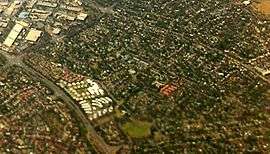 Aerial view of Page, from the west. | |||||||||||||
 Page, shaded in pink. | |||||||||||||
| Population | 2,880 (2011 census)[1] | ||||||||||||
| • Density | 2,220/km2 (5,740/sq mi) | ||||||||||||
| Postcode(s) | 2614 | ||||||||||||
| Area | 1.3 km2 (0.5 sq mi) | ||||||||||||
| District | Belconnen] | ||||||||||||
| Territory electorate(s) | Ginninderra | ||||||||||||
| Federal Division(s) | Fenner | ||||||||||||
| |||||||||||||
Page is a residential suburb in the Belconnen district of Canberra, located within the Australian Capital Territory, Australia. The suburb is named in honour of Sir Earle Page, a former Prime Minister. Streets in Page are named in honour of Australian scientists.[2]
Demography
As at the 2011 Australian census, Page had a population of 2,880 people.[1]
Political representation
For the purposes of Australian federal elections for the House of Representatives, Page is in the Fenner.[3]
For the purposes of Australian Capital Territory elections for the ACT Legislative Assembly, Page is in the Ginninderra electorate.[4]
Geology
Silurian age Green grey rhyodacite of the Walker Volcanics underlie the south and center of the suburb. A lens of limestone is found just to the west of the center of the suburb. The mid west has purple and green-grey dacite of the Walker Volcanics that was deposited before the rhyodacite. The north east has purple rhyodacite from the Deakin Volcanics. The Page north west has pink rhyolite from the Deakin Volcanics.[5]
References
| Wikimedia Commons has media related to Page, Australian Capital Territory. |
- 1 2 Australian Bureau of Statistics (31 October 2012). "Page (State Suburb)". 2011 Census QuickStats. Retrieved 12 February 2014.
- ↑ "Suburb Name search results". ACT Environment and Sustainable Development. Retrieved 12 February 2014.
- ↑ "Profile of the electoral division of Fenner (ACT)". Current federal electoral divisions. Australian Electoral Commission. 8 February 2016. Retrieved 29 May 2016.
- ↑ "Electorates 2012 election". Electorates. ACT Electoral Commission. 5 July 2012. Retrieved 17 December 2013.
- ↑ Henderson G A M and Matveev G, Geology of Canberra, Queanbeyan and Environs 1:50000 1980.
Coordinates: 35°14′18″S 149°02′57″E / 35.23833°S 149.04917°E