PD Draw
| PD Draw | |
|---|---|
| Coordinates | 40°43′23″N 74°07′17″W / 40.72295°N 74.12126°WCoordinates: 40°43′23″N 74°07′17″W / 40.72295°N 74.12126°W |
| Carries |
Central Railroad of New Jersey Newark and New York Newark and Elizabeth Branch (1912-1967) |
| Crosses | Passaic River |
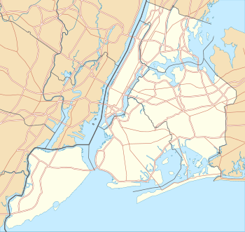
| Locale |
Newark and Kearny Northeastern New Jersey, USA |
| Owner | Conrail |
| Characteristics | |
| Design | Swing bridge |
| Longest span | 212 feet (65 m) (removed) |
| History | |
| Opened | 1912[1] |
| Closed | 1976 |
 PD Draw The first crossing of the Passaic River 1.2 miles from the river mouth at Newark Bay in the Port of New York and New Jersey, | |
The PD Draw is a partially dismantled railroad bridge on the Passaic River between Newark and Kearny in the US state of New Jersey. It was built as part of Central Railroad of New Jersey branch known as the Newark and New York Railroad. The swing bridge is the first crossing upstream from Newark Bay at mile point 1.2.[2]
At the north end of the bay at Kearny Point, the mouths of both the Passaic and the Hackensack River meet at the tip of a peninsula once known as New Barbadoes Neck. In order to build the line, the CNJ built bridges across the rivers, with service beginning in 1869.[3] The original bridge was replaced in 1888. In 1912, the 212-foot (65 m) swing span was relocated 185 feet (56 m) upstream to create another bridge on a new alignment.[1] The entire line across the rivers and Kearny Point was raised about 30 feet (9.1 m) to avoid conflicts with maritime traffic in the newly developing Port Newark.[4]
In February 1946, a freighter damaged the HD Draw over the Hackensack,[5] and when it was decided not to repair that bridge the railroad discontinued through service from its Communipaw Terminal in Jersey City.[6] To minimize maintenance costs, the bridge over the Pasaic was reduced from two tracks to one in 1955.[7]
In October 1970, in what was determined to be an act of sabotage, a 22-car freight train that included five engines was secretly assembled at the nearby railyard and intentionally let plunge from the bridge left in the open position, a standard procedure during overnight hours.[8][9]
The Kearny station was an important stop for the railroad as it was within walking distance of the Western Electric plant and other key industries, such as the Federal Shipbuilding and Drydock Company. Until the Aldene Plan was implemented in May 1967, the PD Draw was used for local passenger service between Kearny and CNJ's Broad Street Station and for local freight train service. The railroad also ran through-train service from point on its mainline and Newark Branch to the Kearny station; the last such service was a weekday rush-hour train between Kearny and Plainfield on April 29, 1967. After the Aldene Plan took effect, the bridge was used for a few years for local freight operations, but was taken out of service with the creation of Conrail on April 1, 1976.
The center span of the bridge has been removed. The abutments and piers remain in place.[2] The New Jersey Department of Transportation is considering building a new bridge along the alignment.[2][10][11] Studies are being conducted as part of an extensive project conceived to facilitate freight transshipment through the Port of New York and New Jersey known as Portway. A new bridge could include a rail component. The new structure would allow for a dual bridge crossing in combination with the Lincoln Highway Passaic River Bridge.[12]
See also
- Hackensack Drawbridge
- Timeline of Jersey City area railroads
- List of crossings of the Lower Passaic River
- List of bridges, tunnels, and cuts in Hudson County, New Jersey
- List of crossings of the Hackensack River
References
- 1 2 "An Unusual Bridge-Moving Operation", Popular Mechanics Magazine, p. 26, July 1912, retrieved 2012-08-08
- 1 2 3 "Lower Passaic River Restoration Project Commercial Navigation Analysis" (PDF). United States Army Corps of Engineers. July 2, 2010 (2nd Revision). Retrieved 2012-08-05.
The abutments of a formerly utilized railroad freight bridge (Central Railroad of NJ) lie at approximately RM 1.2. These abutments limit channel width to 145 feet. However, NJDOT is currently investigating the feasibility of a new Lower Passaic River Bridge within the existing alignment of the former railroad freight bridge. If construction of the new bridge was to move forward, the derelict structure at RM 1.2 would be removed and would be replaced with a structure designed with adequate horizontal and vertical clearance for typical vessel traffic on the Lower Passaic River
Check date values in:|date=(help) - ↑ "Opening of the Newark and New-York Railroad". New York Times. July 24, 1869. Retrieved 2011-02-21.
- ↑ "Dredge Hackensack River Improving Newark Meadows Section for Development". New York Times. February 9, 1913. Retrieved 2011-02-16.
- ↑ "Steamer Wrecks Bridge in Jersey 6000-Ton Coal Ship Shears Off Two Spans of Central Railroad Structure", The New York Times, February 4, 1946
- ↑ Schmidt, W.H. (May 1946), "Costliest Railroad Now Half Abandoned", Trains Magazine
- ↑ Baer, Chris Baer (May 5, 2003). "Newark and New York Branch". Retrieved 2012-08-13.
- ↑ "22-Car Freight Train Plunges Into the Passaic River", The New York Times, October 6, 1970, retrieved 2012-09-15
- ↑ Olsen, Kevin K, A Great Convneincy A Maritime History of the Passaic River, Hackensack River and Newark Bay, American History Imprints, ISBN 978-0-9753667-7-6
- ↑ "Port Newark/Elizabeth Northern NJ Rail Terminals". Port Connector Projects New Jersey-New York. Waterfront Coalition. Retrieved 2012-08-09.
- ↑ Portway Extensions Concept Development Study (PDF) (Report). NJDOT. September 26, 2003.
New crossing of the Passaic River using abandoned railroad alignment and infrastructure, supplementing the existing Route 1&9 Truck crossing. The new crossing is intended to connect Doremus Avenue and Central Avenue.
- ↑ "Portway-Passaic River Crossing" (PDF). FY 2010-2011 Studies and Development. NJDOT. Retrieved 2012-08-08.
This project will study Doremus Avenue, Passaic River Crossing and Central Avenue over Route 1&9T as one project because of their connectivity. The areas of the project service industrial and commercial facilities in a section of Newark and the southern section of Kearny. The purpose of the proposed improvement is to create a connection with NJ Turnpike at Interchange 15E and Route 1&9T, and/or another variation of the two. The improved section will serve to improve access to/from trucking distribution facilities along Doremus Avenue and the NJ Turnpike and will help reduce truck traffic on Route 1&9T. It will range from replacing the existing Route 1&9T bridge to providing dual bridge structures. The reconfiguration of Central Avenue/Route 1&9T interchange may provide four 12-foot travel lanes and two 12-foot shoulders to improve flow and safety. The proposed geometry will primarily follow the existing alignment except at the interchange. Sidewalks could be provided within the proposed berm. A rail crossing on the same facility will also be investigated as part of this project.
Additional reference
- Brennan, William J. (1993), Jersey Central Lines in Colo, 2, Morning Sun Books, ISBN 978-1-878887-19-1
External links
- Flickr: Image Abandoned CNJ Passaic River Swing Bridge
- Flickr: Image Abandoned CNJ Passaic River Swing Bridge