Pääjärvi (Lammi)
For other uses, see Pääjärvi.
| Pääjärvi | |
|---|---|
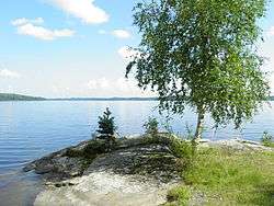 | |
| Location | Hämeenlinna, Hämeenkoski |
| Coordinates | 61°04′N 25°08′E / 61.06°N 25.13°ECoordinates: 61°04′N 25°08′E / 61.06°N 25.13°E |
| Lake type | Natural |
| Primary inflows | Putulanjoki river |
| Primary outflows | Teuronjoki river |
| Catchment area | Kokemäenjoki |
| Basin countries | Finland |
| Surface area | 13.444 km2 (5.191 sq mi) |
| Average depth | 14.83 m (48.7 ft) |
| Max. depth | 85 m (279 ft) |
| Water volume | 0.199 km3 (0.048 cu mi) |
| Shore length1 | 36.59 km (22.74 mi) |
| Surface elevation | 102.9 m (338 ft) |
| Frozen | December–April |
| Islands | Etolansaaret, Lamminsaari, Kalliosaari |
| References | [1] |
| 1 Shore length is not a well-defined measure. | |
Pääjärvi is a medium-sized lake in Finland. It is situated on the border between the city of Hämeenlinna in the Tavastia Proper region and the municipality of Hämeenkoski in the Päijänne Tavastia region.[1]
The lake drains through the Teuronjoki river into the lake Mommilanjärvi and from there through the Puujoki River into Lake Kernaalanjärvi and from there through the Hiidenjoki River into Lake Vanajavesi and it is thus a part of the Kokemäenjoki basin that drains the western third of the Finnish Lakeland.
See also
References
- 1 2 Pääjärvi in Järviwiki Web Service. Finnish Environment Institute. Retrieved 2014-03-19. (English)
This article is issued from Wikipedia - version of the 10/7/2015. The text is available under the Creative Commons Attribution/Share Alike but additional terms may apply for the media files.