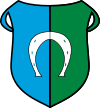
Ozorków
| Ozorków | |||
|---|---|---|---|
|
St. Joseph Church in Ozorków | |||
| |||
 Ozorków | |||
| Coordinates: 51°58′0″N 19°17′0″E / 51.96667°N 19.28333°E | |||
| Country |
| ||
| Voivodeship | Łódź | ||
| County | Zgierz | ||
| Gmina | Ozorków (urban gmina) | ||
| Government | |||
| • Mayor | Jacek Socha | ||
| Area | |||
| • Total | 15.47 km2 (5.97 sq mi) | ||
| Highest elevation | 155 m (509 ft) | ||
| Lowest elevation | 130 m (430 ft) | ||
| Population (2006) | |||
| • Total | 20,571 | ||
| • Density | 1,300/km2 (3,400/sq mi) | ||
| Time zone | CET (UTC+1) | ||
| • Summer (DST) | CEST (UTC+2) | ||
| Postal code | 95-035, 95-036 | ||
| Car plates | EZG | ||
| Website | http://www.umozorkow.pl/ | ||
Ozorków [ɔˈzɔrkuf] (1943-1945: Brunnstadt, Hebrew: אוזורקוב) is a town in central Poland with 20,731 inhabitants (2004), located on the Bzura River. It is located in the Łódź Voivodeship (since 1999), having previously been in Łódź Metro Voivodeship (1975–1998).
History
The city's history dates back to the fifteenth century. In 1415 a small village with inaccessible forests and swamps, belonging to the Szczawiński family was mentioned in one of the Polish chronicles. In 1807, the future owner of Ozorków, Ignacy Starzyński, hoping to expand his textile business, brought 19 drapers from Saxony to the village. In 1815, their number has risen to 117, while the city of Łódź had 331.
A year later, in 1816, the village was granted city rights and became the capital of the Ozorków county. In 1817 the Schlösserow family, who came from Aachen, settled in the city and founded the first modern cotton mill. Ozorków was the first settlement that experienced the modern development of cotton and wool industry near the Bzura River and later that spread to Zgierz and Łódź, creating the largest Polish center of the textile industry. Because of the rapidly growing industry started running out of space, already in 1820 business families purchased farmlands from nearby villages. In 1828 the town population rose to 5669 people. Ozorków was inhabited by large population of Jewish and German citizens, therefore a synagogue and an Evangelical Church was built in the upcoming years, which also turned the town into a multicultural settlement. In the thirties, Karl Schlösser built a factory in the centre of the town, which also greatly influenced the population. After the fall of the November Uprising, the city underwent a stagnation caused by the loss of orders for the army of Congress Poland, repressive tariff barriers, the growing role of Zgierz and Łódź, as well as the displacement of the market for cotton and wool fabrics. In 1866, under the control of Polish Count Feliks Łubieński, Ozorków became a protected city of the Russian Empire, which resulted in greater investment opportunities.
World War I caused a further economic decline of the city. It was not until the period of independent statehood that is became more attractive for foreign and domestic investors. Already in the early twenties, Ozorków received a railway connection with Łódź and Kutno, and with the electrification of the city carried in 1928, a tramway was built between Ozorków, Zgierz and Łódź (between 1922 and 1928 the line was operated by a steam tram). During the interwar period (1918-1939) two public primary schools as well as a recreational centre were built in the city.
The time of the Nazi occupation was a tragic period in the history of the city. The city was incorporated directly into the Third Reich and between 1943 and 1945 it was called Brunnstadt. The extermination policy of the occupier (the murder of 6-thousand Jews and the harsh treatment of the Polish population) resulted in a drastic population decrease. The historical synagogue located on Wyszyński street was completely destroyed by the Nazi troops.
After 1945, there was an expansion and modernization of the cotton and wool industry applied by the new socialist government. In 1950s the development of housing and urban infrastructure resulted in rapid population increase.
Today Ozorków is rapidly increasing in the role of services and slowly loses its former industrial character.
Notable residents
- Samuel Reshevsky, chessmaster
- Aron Brand, pediatric cardiologist
References
External links
- Ozorków.net - Miasto i Gmina Ozorków
- Oficjalna strona Gminy Ozorków
- OzoGaleria - pictures gallery from Ozorków
| Wikimedia Commons has media related to Ozorków. |
Coordinates: 51°58′N 19°17′E / 51.967°N 19.283°E


