Oxford (CDP), New Jersey
| Oxford, New Jersey | |
|---|---|
| Census-designated place | |
|
| |
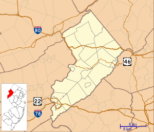
 Map of Oxford CDP in Warren County | |
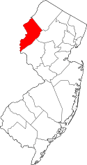
 Oxford, New Jersey  Oxford, New Jersey  Oxford, New Jersey Oxford CDP's location in Warren County (Inset: Location of Warren County in New Jersey). | |
| Coordinates: 40°48′22″N 75°00′05″W / 40.806004°N 75.001467°WCoordinates: 40°48′22″N 75°00′05″W / 40.806004°N 75.001467°W[1][2] | |
| Country |
|
| State |
|
| County | Warren |
| Township | Oxford |
| Area[1] | |
| • Total | 0.694 sq mi (1.798 km2) |
| • Land | 0.689 sq mi (1.785 km2) |
| • Water | 0.005 sq mi (0.014 km2) 0.76% |
| Elevation[3] | 505 ft (154 m) |
| Population (2010 Census)[4] | |
| • Total | 1,090 |
| • Density | 1,581.8/sq mi (610.7/km2) |
| Time zone | Eastern (EST) (UTC-5) |
| • Summer (DST) | EDT (UTC-4) |
| ZIP code | 07863[5] |
| Area code(s) | 908 |
| FIPS code | 3455500[1][6][7] |
| GNIS feature ID | 02389632[1][8] |
Oxford is an unincorporated community and census-designated place (CDP) located within Oxford Township in Warren County, New Jersey, United States,[9] that was created as part of the 2010 United States Census.[10][11][12] As of the 2010 Census, the CDP's population was 1,090.[4]
Geography
According to the United States Census Bureau, the CDP had a total area of 0.694 square miles (1.798 km2), including 0.689 square miles (1.785 km2) of land and 0.005 square miles (0.014 km2) of water (0.76%).[1][2]
Demographics
| Historical population | |||
|---|---|---|---|
| Census | Pop. | %± | |
| 1990 | 1,767 | — | |
| 2000 | 2,283 | 29.2% | |
| 2010 | 1,090 | −52.3% | |
| Population Sources: 1990-2010[12] 2000[13] 2010[4] | |||
Census 2010
The 2010 United States Census counted 1,090 people, 455 households, and 287.1 families residing in the CDP. The population density was 1,581.8 per square mile (610.7/km2). The CDP contained 514 housing units at an average density of 745.9 per square mile (288.0/km2). The racial makeup of the CDP was 97.61% (1,064) White, 0.18% (2) Black or African American, 0.00% (0) Native American, 0.73% (8) Asian, 0.00% (0) Pacific Islander, 0.37% (4) from other races, and 1.10% (12) from two or more races. Hispanics or Latinos of any race were 2.66% (29) of the population.[4]
Out of a total of 455 households, 23.7% had children under the age of 18 living with them, 46.2% were married couples living together, 12.3% had a female householder with no husband present, and 36.9% were non-families. 30.3% of all households were made up of individuals, and 14.9% had someone living alone who was 65 years of age or older. The average household size was 2.38 and the average family size was 3.00.[4]
In the CDP, 20.1% of the population were under the age of 18, 7.9% from 18 to 24, 25.4% from 25 to 44, 28.8% from 45 to 64, and 17.8% who were 65 years of age or older. The median age was 43.5 years. For every 100 females the census counted 96.4 males, but for 100 females at least 18 years old, it was 91.9 males.[4]
Census 2000
As of the 2000 United States Census[6] there were 2,283 people, 878 households, and 611 families residing in the CDP. The population density was 167.9/km2 (434.6/mi2). There were 930 housing units at an average density of 68.4/km2 (177.0/mi2). The racial makeup of the CDP was 96.54% White, 1.23% African American, 0.22% Native American, 0.53% Asian, 0.66% from other races, and 0.83% from two or more races. Hispanic or Latino of any race were 3.50% of the population.[13]
There were 878 households out of which 37.1% had children under the age of 18 living with them, 58.2% were married couples living together, 6.5% had a female householder with no husband present, and 30.4% were non-families. 26.4% of all households were made up of individuals and 12.1% had someone living alone who was 65 years of age or older. The average household size was 2.60 and the average family size was 3.18.[13]
In the CDP the population was spread out with 27.5% under the age of 18, 4.9% from 18 to 24, 36.0% from 25 to 44, 20.3% from 45 to 64, and 11.3% who were 65 years of age or older. The median age was 36 years. For every 100 females there were 97.3 males. For every 100 females age 18 and over, there were 95.2 males.[13]
The median income for a household in the CDP was $53,281, and the median income for a family was $64,375. Males had a median income of $45,833 versus $31,210 for females. The per capita income for the CDP was $23,563. About 2.6% of families and 4.0% of the population were below the poverty line, including 2.1% of those under age 18 and 8.1% of those age 65 or over.[13]
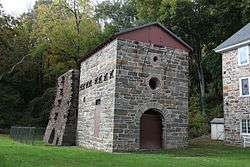
Points of interest
References
- 1 2 3 4 5 Gazetteer of New Jersey Places, United States Census Bureau. Accessed July 21, 2016.
- 1 2 US Gazetteer files: 2010, 2000, and 1990, United States Census Bureau. Accessed September 4, 2014.
- ↑ U.S. Geological Survey Geographic Names Information System: Oxford Census Designated Place, Geographic Names Information System. Accessed June 3, 2013.
- 1 2 3 4 5 6 DP-1 - Profile of General Population and Housing Characteristics: 2010 Demographic Profile Data for Oxford CDP, New Jersey, United States Census Bureau. Accessed June 3, 2013.
- ↑ Look Up a ZIP Code for Oxford, NJ, United States Postal Service. Accessed September 27, 2012.
- 1 2 American FactFinder, United States Census Bureau. Accessed September 4, 2014.
- ↑ A Cure for the Common Codes: New Jersey, Missouri Census Data Center. Accessed June 3, 2013.
- ↑ US Board on Geographic Names, United States Geological Survey. Accessed September 4, 2014.
- ↑ Locality Search, State of New Jersey. Accessed April 19, 2015.
- ↑ GCT-PH1 - Population, Housing Units, Area, and Density: 2010 - County -- County Subdivision and Place from the 2010 Census Summary File 1 for Warren County, New Jersey, United States Census Bureau. Accessed June 3, 2013.
- ↑ 2006-2010 American Community Survey Geography for New Jersey, United States Census Bureau. Accessed June 3, 2013.
- 1 2 New Jersey: 2010 - Population and Housing Unit Counts - 2010 Census of Population and Housing (CPH-2-32), United States Census Bureau, p. III-5, August 2012. Accessed June 3, 2013. "Warren County—Name Changes: Beattystown CDP name corrected from Beatyestown; New CDPs: Allamuchy (formed from part of deleted Allamuchy-Panther Valley CDP), Anderson, Allamuchy, Blairstown, Brainards, Bridgeville, Broadway, Brookfield, Buttzville, Columbia, Delaware, Delaware Park, Finesville, Great Meadows (formed from part of deleted Great Meadows-Vienna CDP and additional area), Greenwich, Hainesburg, Harmony, Hope, Hutchinson, Johnsonburg, Lopatcong Overlook, Marksboro, Mountain Lake, Mount Hermon, New Village, Panther Valley (formed from part of deleted Allamuchy-Panther Valley CDP), Port Colden, Port Murray, Silver Lake, Stewartsville, Upper Pohatcong, Upper Stewartsville, and Vienna (formed from part of deleted Great Meadows-Vienna and additional area);"
- 1 2 3 4 5 DP-1 - Profile of General Demographic Characteristics: 2000 from the Census 2000 Summary File 1 (SF 1) 100-Percent Data for Oxford CDP, New Jersey, United States Census Bureau. Accessed June 3, 2013.