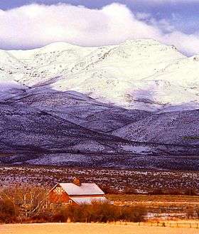
Owyhee Mountains
| Owyhee Mountains | |
|---|---|
 | |
| Highest point | |
| Peak | Hayden Peak[1] (Owyhee County, Idaho) |
| Elevation | 2,561 m (8,402 ft) |
| Dimensions | |
| Length | 40 mi (64 km) NNW-SSE |
| Geography | |
| Country | United States |
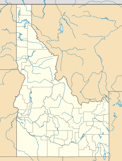
| State | Idaho, and Oregon |
| District | Owyhee County, Idaho and Malheur County, Oregon |
| Range coordinates | 42°58′51″N 116°39′31″W / 42.9808°N 116.6586°WCoordinates: 42°58′51″N 116°39′31″W / 42.9808°N 116.6586°W |
| Parent range | Owyhee Mountain Range |
| Topo map | USGS Cinnabar Mountain |
The Owyhee Mountains are a mountain range in Owyhee County, Idaho and Malheur County, Oregon.[2]
Mahogany Mountain and the associated volcanic craters of the Lake Owyhee volcanic field are in the Owyhee Mountains of Oregon just east of the Owyhee Reservoir on the Owyhee River.[3]
The southeastern end of the range including the old mining area west of Silver City is referred to as the Silver City Range.[4] About 8.3 kilometres (5.2 mi) west of Silver City is the De Lamar ghost town in Jordan Creek below the mine workings on De Lamar Mountain to the south.[4] The area was active in the late 1880s. In the 1970s mining began again with the development of open pit silver–gold mines on De Lamar Mountain.[5][6]
References
- ↑ Cinnabar Mountain, Idaho, 7.5 Minute Topographic Quadrangle, USGS, 1990
- 1 2 "Owyhee Mountains". Geographic Names Information System. United States Geological Survey.
- ↑ Cummings, Michael L., et al., Stratigraphic and structural evolution of the middle Miocene synvolcanic Oregon-Idaho graben, Geological Society of America Bulletin, 2000; v. 112, no. 5; pp. 668-682
- 1 2 Murphy, Idaho, 30x60 Minute Topographic Quadrangle, USGS, 1986
- ↑ Bonnichsen, Bill; Epithermal Gold and Silver Deposits Silver City–De Lamar District, Idaho, University of Idaho, Idaho Geological Survey, Technical Report 83-4, 1983 PDF
- ↑ De Lamar, Idaho, 7.5 Minute Topographic Quadrangle, USGS, 1990
Further reading
- Adams, Mildretta (1986) Sagebrush Post Offices, A History of the Owyhee Country, Idaho State University Press ISBN 978-0937834138
This article is issued from Wikipedia - version of the 9/4/2016. The text is available under the Creative Commons Attribution/Share Alike but additional terms may apply for the media files.