Overton, Nebraska
| Overton, Nebraska | |
|---|---|
| Village | |
|
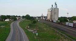
Overton, seen looking eastward from County Road 444 overpass | |
 Location of Overton, Nebraska | |
| Coordinates: 40°44′22″N 99°32′14″W / 40.73944°N 99.53722°WCoordinates: 40°44′22″N 99°32′14″W / 40.73944°N 99.53722°W | |
| Country | United States |
| State | Nebraska |
| County | Dawson |
| Area[1] | |
| • Total | 0.54 sq mi (1.40 km2) |
| • Land | 0.54 sq mi (1.40 km2) |
| • Water | 0 sq mi (0 km2) |
| Elevation | 2,320 ft (707 m) |
| Population (2010)[2] | |
| • Total | 594 |
| • Estimate (2012[3]) | 589 |
| • Density | 1,100.0/sq mi (424.7/km2) |
| Time zone | Central (CST) (UTC-6) |
| • Summer (DST) | CDT (UTC-5) |
| ZIP codes | 68834, 68863 |
| Area code(s) | 308 |
| FIPS code | 31-37770[4] |
| GNIS feature ID | 0831932[5] |
Overton is a village in Dawson County, Nebraska, United States. It is part of the Lexington, Nebraska Micropolitan Statistical Area. The population was 594 at the 2010 census.
History
Overton had its start by the building of the Union Pacific Railroad through that territory.[6] The town was first settled in 1873.[7]
The Plectron company, which manufactured alert radio receivers used by fire departments, was started in Overton in 1955; it moved operations to Lexington, Nebraska in the 1980s[8]
Geography
Overton is located at 40°44′22″N 99°32′14″W / 40.73944°N 99.53722°W (40.739556, -99.537358).[9]
According to the United States Census Bureau, the village has a total area of 0.54 square miles (1.40 km2), all of it land.[1]
Demographics
| Historical population | |||
|---|---|---|---|
| Census | Pop. | %± | |
| 1900 | 255 | — | |
| 1910 | 574 | 125.1% | |
| 1920 | 515 | −10.3% | |
| 1930 | 600 | 16.5% | |
| 1940 | 491 | −18.2% | |
| 1950 | 497 | 1.2% | |
| 1960 | 523 | 5.2% | |
| 1970 | 538 | 2.9% | |
| 1980 | 633 | 17.7% | |
| 1990 | 547 | −13.6% | |
| 2000 | 646 | 18.1% | |
| 2010 | 594 | −8.0% | |
| Est. 2015 | 573 | [10] | −3.5% |
2010 census
As of the census[2] of 2010, there were 594 people, 227 households, and 163 families residing in the village. The population density was 1,100.0 inhabitants per square mile (424.7/km2). There were 274 housing units at an average density of 507.4 per square mile (195.9/km2). The racial makeup of the village was 95.1% White, 0.7% Native American, 0.2% Asian, 3.0% from other races, and 1.0% from two or more races. Hispanic or Latino of any race were 10.4% of the population.
There were 227 households of which 37.0% had children under the age of 18 living with them, 52.9% were married couples living together, 11.5% had a female householder with no husband present, 7.5% had a male householder with no wife present, and 28.2% were non-families. 24.7% of all households were made up of individuals and 8.8% had someone living alone who was 65 years of age or older. The average household size was 2.62 and the average family size was 3.14.
The median age in the village was 35.4 years. 30% of residents were under the age of 18; 6.5% were between the ages of 18 and 24; 26.5% were from 25 to 44; 25.2% were from 45 to 64; and 12% were 65 years of age or older. The gender makeup of the village was 54.5% male and 45.5% female.
2000 census
As of the census[4] of 2000, there were 646 people, 254 households, and 175 families residing in the village. The population density was 1,186.8 people per square mile (461.9/km²). There were 291 housing units at an average density of 534.6 per square mile (208.1/km²). The racial makeup of the village was 92.72% White, 0.31% African American, 0.46% Native American, 0.15% Asian, 5.42% from other races, and 0.93% from two or more races. Hispanic or Latino of any race were 9.13% of the population.
There were 254 households out of which 33.9% had children under the age of 18 living with them, 56.7% were married couples living together, 7.5% had a female householder with no husband present, and 31.1% were non-families. 28.0% of all households were made up of individuals and 12.2% had someone living alone who was 65 years of age or older. The average household size was 2.54 and the average family size was 3.13.
In the village the population was spread out with 29.4% under the age of 18, 7.7% from 18 to 24, 28.2% from 25 to 44, 20.3% from 45 to 64, and 14.4% who were 65 years of age or older. The median age was 36 years. For every 100 females there were 120.5 males. For every 100 females age 18 and over, there were 105.4 males.
As of 2000 the median income for a household in the village was $31,389, and the median income for a family was $38,194. Males had a median income of $27,102 versus $17,188 for females. The per capita income for the village was $14,941. About 9.7% of families and 12.7% of the population were below the poverty line, including 24.4% of those under age 18 and 7.8% of those age 65 or over.
See also
References
- 1 2 "US Gazetteer files 2010". United States Census Bureau. Retrieved 2012-06-24.
- 1 2 "American FactFinder". United States Census Bureau. Retrieved 2012-06-24.
- ↑ "Population Estimates". United States Census Bureau. Retrieved 2013-05-29.
- 1 2 "American FactFinder". United States Census Bureau. Retrieved 2008-01-31.
- ↑ "US Board on Geographic Names". United States Geological Survey. 2007-10-25. Retrieved 2008-01-31.
- ↑ "Overton, Dawson County". Center for Advanced Land Management Information Technologies. University of Nebraska. Retrieved 4 August 2014.
- ↑ Burr, George L. (1921). History of Hamilton and Clay Counties, Nebraska, Volume 1. S.J. Clarke Publishing Company. p. 107.
- ↑ http://www.wallaceradio.com/plectronhistory.html
- ↑ "US Gazetteer files: 2010, 2000, and 1990". United States Census Bureau. 2011-02-12. Retrieved 2011-04-23.
- ↑ "Annual Estimates of the Resident Population for Incorporated Places: April 1, 2010 to July 1, 2015". Retrieved July 2, 2016.
- ↑ "Census of Population and Housing". Census.gov. Retrieved June 4, 2015.
| Wikimedia Commons has media related to Overton, Nebraska. |
Municipalities and communities of Dawson County, Nebraska, United States | ||
|---|---|---|
| Cities | ||
| Villages | ||
| CDP | ||
| Unincorporated communities | ||
| Former communities | ||