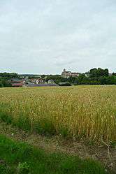
Oulchy-le-Château
| Oulchy-le-Château | ||
|---|---|---|
 | ||
| ||
 Oulchy-le-Château | ||
|
Location within Hauts-de-France region  Oulchy-le-Château | ||
| Coordinates: 49°12′18″N 3°22′09″E / 49.205°N 3.3692°ECoordinates: 49°12′18″N 3°22′09″E / 49.205°N 3.3692°E | ||
| Country | France | |
| Region | Hauts-de-France | |
| Department | Aisne | |
| Arrondissement | Soissons | |
| Canton | Oulchy-le-Château | |
| Intercommunality | Oulchy le Château | |
| Government | ||
| • Mayor (2008–2014) | Jean-Pierre Brioux | |
| Area1 | 15.08 km2 (5.82 sq mi) | |
| Population (2008)2 | 848 | |
| • Density | 56/km2 (150/sq mi) | |
| Time zone | CET (UTC+1) | |
| • Summer (DST) | CEST (UTC+2) | |
| INSEE/Postal code | 02580 / 02210 | |
| Elevation |
87–178 m (285–584 ft) (avg. 83 m or 272 ft) | |
|
1 French Land Register data, which excludes lakes, ponds, glaciers > 1 km² (0.386 sq mi or 247 acres) and river estuaries. 2 Population without double counting: residents of multiple communes (e.g., students and military personnel) only counted once. | ||

Oulchy-le-Château is a commune in the Aisne department in Hauts-de-France in northern France.
Geography
The town is located about 106 km (66 mi) from Paris, between Soissons to the north and Château-Thierry to the south. It is directly accessible by highway.
Towns, villages and localities
- Cugny-lès-Crouttes, located to the east
History
On the night of 2/3 March 1814, the area was taken by imperial troops commanded by Captain Parquin. In 1976, the commune of Cugny-lès-Crouttes was absorbed.
Population
| Historical population | ||
|---|---|---|
| Year | Pop. | ±% |
| 1962 | 679 | — |
| 1968 | 721 | +6.2% |
| 1975 | 759 | +5.3% |
| 1982 | 788 | +3.8% |
| 1990 | 856 | +8.6% |
| 1999 | 849 | −0.8% |
| 2008 | 848 | −0.1% |
Sights
- War memorial, on which 41 names are inscribed[1]
- War memorial of Cugny-lès-Crouttes, on which 5 names are inscribed[2]
- Monument in memory of Captain Parquin[3][4]
- Many public baths[5]
- The Ghosts of Landowski - 1919-1935 by Paul Landowski. This group consists of 7 stone soldiers, 8 meters (26 ft) high, each reflecting a weapon and erected on Chalmont hill[6] at the site of the Second battle of the Marne.
Personalities
- Gérard Titus-Carmel, painter and poet, lived and worked in the commune for more than thirty years
Economics and sports
The village contains a bakery, supermarket, butcher shops, pharmacy, doctor, nightclub, police, garage and gasoline. The town contains a football stadium and two tennis courts.
See also
References
| Wikimedia Commons has media related to Oulchy-le-Château. |
This article is issued from Wikipedia - version of the 11/9/2016. The text is available under the Creative Commons Attribution/Share Alike but additional terms may apply for the media files.