Otter Creek Township, Vigo County, Indiana
| Otter Creek Township | |
|---|---|
| Township | |
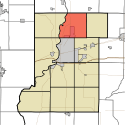 Location in Vigo County | |
| Coordinates: 39°33′43″N 87°20′53″W / 39.56194°N 87.34806°WCoordinates: 39°33′43″N 87°20′53″W / 39.56194°N 87.34806°W | |
| Country | United States |
| State | Indiana |
| County | Vigo |
| Government | |
| • Type | Indiana township |
| Area | |
| • Total | 35.61 sq mi (92.2 km2) |
| • Land | 35.24 sq mi (91.3 km2) |
| • Water | 0.37 sq mi (1.0 km2) 1.04% |
| Elevation | 509 ft (155 m) |
| Population (2010) | |
| • Total | 9,069 |
| • Density | 257.3/sq mi (99.3/km2) |
| ZIP codes | 47805, 47874 |
| GNIS feature ID | 453699 |
Otter Creek Township is one of twelve townships in Vigo County, Indiana, United States. As of the 2010 census, its population was 9,069 and it contained 3,917 housing units.[1]
History
Markle House and Mill Site was listed on the National Register of Historic Places in 1979.[2]
Geography
According to the 2010 census, the township has a total area of 35.61 square miles (92.2 km2), of which 35.24 square miles (91.3 km2) (or 98.96%) is land and 0.37 square miles (0.96 km2) (or 1.04%) is water.[1]
Cities, towns, villages
- North Terre Haute
- Terre Haute (north edge)
Unincorporated communities
Adjacent townships
- Florida Township, Parke County (northeast)
- Nevins Township (east)
- Lost Creek Township (southeast)
- Harrison Township (southwest)
- Sugar Creek Township (southwest)
- Fayette Township (west)
- Clinton Township, Vermillion County (northwest)
Cemeteries
The township contains ten cemeteries: Denny, Evans, Haven, Kennedy, Markles, Phillips, Roselawn Memorial Park, Steveson, Stewart and Wood.
Airports and landing strips
- Sky King Airport
School districts
Political districts
- Indiana's 8th congressional district
- State House District 42
- State House District 43
- State Senate District 38
References
- United States Census Bureau 2007 TIGER/Line Shapefiles
- United States Board on Geographic Names (GNIS)
- IndianaMap
- 1 2 "Population, Housing Units, Area, and Density: 2010 - County -- County Subdivision and Place -- 2010 Census Summary File 1". United States Census. Retrieved 2013-05-10.
- ↑ National Park Service (2010-07-09). "National Register Information System". National Register of Historic Places. National Park Service.
External links
- Indiana Township Association
- United Township Association of Indiana
- Vigo County, Indiana, official website
- History of Otter Creek Township
Municipalities and communities of Vigo County, Indiana, United States | ||
|---|---|---|
| City | ||
| Towns | ||
| Townships | ||
| CDPs | ||
| Other unincorporated communities |
| |
| Footnotes | ‡This populated place also has portions in an adjacent county or counties | |
This article is issued from Wikipedia - version of the 9/9/2016. The text is available under the Creative Commons Attribution/Share Alike but additional terms may apply for the media files.