Osterburg, Pennsylvania
| Osterburg, Pennsylvania | |
|---|---|
| Unincorporated community | |
 Osterburg Location within the state of Pennsylvania | |
| Coordinates: 40°10′10″N 78°31′13″W / 40.16944°N 78.52028°WCoordinates: 40°10′10″N 78°31′13″W / 40.16944°N 78.52028°W | |
| Country | United States |
| State | Pennsylvania |
| County | Bedford |
| Townships | King, East St. Clair |
| Time zone | Eastern (EST) (UTC-5) |
| • Summer (DST) | EDT (UTC-4) |
| ZIP codes | 16667 |
Osterburg is a small unincorporated community in Bedford County, Pennsylvania, United States, between Bedford, Claysburg, and Imler. The ZIP Code for Osterburg is 16667. It is part of the Chestnut Ridge School District.
Economy
Logging and dairy farming are leading parts of the economy of the Osterburg area. Local businesses include Osterburg Post Office, Slick's Ivy Stone Restaurant,[1] Osterburg Diesel, First Commonwealth Bank,[2] and Osterburg Country Store as well as Peights windows.
Education
Public schools
Osterburg is served by the Chestnut Ridge School District which operates two elementary schools, one middle school, and one high school.[3]
Higher and post-secondary education
- Allegany College of Maryland- Bedford Campus[4]
Recreation
Although small, there are many recreational activities in the Osterburg area. Bobs Creek is 13.1 miles (21.1 km) long and has been determined by American Whitewater to be a class I-III section for rafting and kayaking.[5] Blue Knob State Park is also nearby and provides swimming, camping, hunting, fishing, hiking, snowmobiling, cross country skiing and downhill skiing.[6]
Transportation
Osterburg is a half mile from access to I-99 and US 220, with easy access to Altoona, Bellefonte, Bedford, and the Pennsylvania Turnpike.
References
- ↑ http://www.slicksivystone.com/
- ↑ https://www.fcbanking.com/Banking/onlinebanking.html
- ↑ Chestnut Ridge School District. crsd.k12.pa.us. Retrieved on 2014-08-27.
- ↑ Allegany College of Maryland allegany.edu/x120.xml. Retrieved 2014-08-27.
- ↑ http://www.riverfacts.com/rivers/12778.html
- ↑ http://www.dcnr.state.pa.us/stateparks/parks/blueknob.aspx
Municipalities and communities of Bedford County, Pennsylvania, United States | ||
|---|---|---|
| Boroughs | 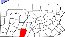 | |
| Townships | ||
| CDPs | ||
| Unincorporated communities | ||