Osceola, Iowa
| Osceola, Iowa | |
|---|---|
| City | |
|
Clarke County Courthouse in Osceola | |
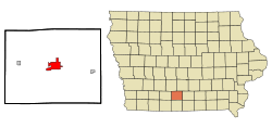 Location of Osceola, Iowa | |
| Coordinates: 41°2′3″N 93°46′6″W / 41.03417°N 93.76833°WCoordinates: 41°2′3″N 93°46′6″W / 41.03417°N 93.76833°W | |
| Country |
|
| State |
|
| County | Clarke |
| Government | |
| • Mayor | Thomas J. Kedley |
| • City Administrator | Ty Wheeler |
| Area[1] | |
| • Total | 6.68 sq mi (17.30 km2) |
| • Land | 6.48 sq mi (16.78 km2) |
| • Water | 0.20 sq mi (0.52 km2) |
| Elevation | 1,142 ft (348 m) |
| Population (2010)[2] | |
| • Total | 4,929 |
| • Estimate (2012[3]) | 5,035 |
| • Density | 760.6/sq mi (293.7/km2) |
| Time zone | Central (CST) (UTC-6) |
| • Summer (DST) | CDT (UTC-5) |
| ZIP code | 50213 |
| Area code(s) | 641 |
| FIPS code | 19-59835 |
| GNIS feature ID | 0459906 |
Osceola is a city in Clarke County, Iowa, United States. The population was 4,929 at the 2010 census. It is the county seat of Clarke County.[4]
Geography
Osceola is located at 41°2′3″N 93°46′6″W / 41.03417°N 93.76833°W (41.034179, -93.768354),[5] at the junction of Interstate 35 and U.S. Routes 34 and 69. It lies 35 miles (56 km) north of the Missouri border, and about 40 miles south of Des Moines.
According to the United States Census Bureau, the city has a total area of 6.68 square miles (17.30 km2), of which, 6.48 square miles (16.78 km2) is land and 0.20 square miles (0.52 km2) is water.[1]
History
Osceola was named after a Seminole Indian leader of the same name.[7] Osceola is an anglicised form of Asiyahola: assi, from a ceremonial yaupon holly tea or "black drink" and yaholi, the name of a Creek god intoned when the drink was served.
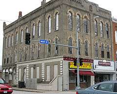
The Masonic Building stands on the public square in Osceola. Built in 1872, this Italianate building was used by Osceola Lodge No. 77 of the Ancient Free & Accepted Masons, and the main floor was a bank and hardware store. This building was placed on the Iowa Historic Preservation Alliance’s Most Endangered list due to its poor repair and lack of preservation plan.[8][9] In 2011 the building was renovated with help from various grants. The second and third floors were converted into upscale apartments. The China Star restaurant was remodeled and now utilizes both halves of the lower level. The exterior received an overdue face lift to restore the building to its original appearance. All of the windows were replaced and the stucco was repaired and painted. Structural improvements included foundation work and a new roof. The front entrances were replaced with a more traditional wood columns and tall glass windows.
Lakeside Casino Resort operates on West Lake. The river boat-themed casino has been in continuous operation since about 2000, although it has been bought and sold twice since it has opened. Terrible Herbst gaming purchased the casino around 2005. After a major renovation to the complex, which included a $1 million 132-foot-tall sign along the adjacent interstate, took place around 2006. The parent company filed for bankruptcy and the casino was sold yet again. The original and familiar Lakeside name was brought back and the large cowboy sign along the interstate was converted into a slightly smaller, more traditional sign.
A Pilot truck stop was built in late 2010 along the interstate, in place of the former Terribles Casino gas station.
Demographics
| Osceola historical population | ||
|---|---|---|
| Year | Pop. | ±% |
| 1870 | 1,298 | — |
| 1880 | 1,769 | +36.3% |
| 1890 | 2,120 | +19.8% |
| 1900 | 2,505 | +18.2% |
| 1910 | 2,416 | −3.6% |
| 1920 | 2,684 | +11.1% |
| 1930 | 2,871 | +7.0% |
| 1940 | 3,281 | +14.3% |
| 1950 | 3,422 | +4.3% |
| 1960 | 3,350 | −2.1% |
| 1970 | 3,124 | −6.7% |
| 1980 | 3,750 | +20.0% |
| 1990 | 4,164 | +11.0% |
| 2000 | 4,659 | +11.9% |
| 2010 | 4,929 | +5.8% |
| 2014 | 4,949 | +0.4% |
| 2015 | 4,972 | +0.5% |
| Source: "American FactFinder". United States Census Bureau. Source: | ||
2010 census
As of the census[2] of 2010, there were 4,929 people, 1,974 households, and 1,208 families residing in the city. The population density was 760.6 inhabitants per square mile (293.7/km2). There were 2,184 housing units at an average density of 337.0 per square mile (130.1/km2). The racial makeup of the city was 91.0% White, 0.6% African American, 0.4% Native American, 0.6% Asian, 0.1% Pacific Islander, 6.2% from other races, and 1.2% from two or more races. Hispanic or Latino of any race were 17.6% of the population.
There were 1,974 households of which 32.3% had children under the age of 18 living with them, 45.4% were married couples living together, 11.5% had a female householder with no husband present, 4.3% had a male householder with no wife present, and 38.8% were non-families. 32.8% of all households were made up of individuals and 15.8% had someone living alone who was 65 years of age or older. The average household size was 2.43 and the average family size was 3.10.
The median age in the city was 36.8 years. 26.1% of residents were under the age of 18; 9.3% were between the ages of 18 and 24; 23.5% were from 25 to 44; 23.8% were from 45 to 64; and 17.3% were 65 years of age or older. The gender makeup of the city was 48.5% male and 51.5% female.
2000 census
As of the census[11] of 2000, there were 4,659 people, 1,945 households, and 1,229 families residing in the city. The population density was 798.2 people per square mile (308.0/km²). There were 2,118 housing units at an average density of 362.9 per square mile (140.0/km²). The racial makeup of the city was 95.73% White, 0.11% African American, 0.19% Native American, 0.58% Asian, 0.06% Pacific Islander, 2.75% from other races, and 0.58% from two or more races. Hispanic or Latino of any race were 6.25% of the population.
There were 1,945 households out of which 29.8% had children under the age of 18 living with them, 49.7% were married couples living together, 10.1% had a female householder with no husband present, and 36.8% were non-families. 31.7% of all households were made up of individuals and 17.4% had someone living alone who was 65 years of age or older. The average household size was 2.36 and the average family size was 2.98.
Age spread: 25.6% under the age of 18, 8.5% from 18 to 24, 25.6% from 25 to 44, 21.4% from 45 to 64, and 18.8% who were 65 years of age or older. The median age was 38 years. For every 100 females there were 89.9 males. For every 100 females age 18 and over, there were 85.1 males.
The median income for a household in the city was $32,701, and the median income for a family was $45,263. Males had a median income of $31,674 versus $21,684 for females. The per capita income for the city was $17,244. About 5.2% of families and 7.6% of the population were below the poverty line, including 13.3% of those under age 18 and 7.7% of those age 65 or over.
Transportation
Amtrak, the national passenger rail system, provides service to Osceola, operating its California Zephyr daily in both directions between Chicago, Illinois, and Emeryville, California, across the bay from San Francisco. A bus connection is available from Osceola to Des Moines.
Notable people
- Dwight Harken, surgeon and cardiac surgery innovator [12]
- Edgar Howard, Lieutenant Governor of Nebraska and sixth-term member of the United States House of Representatives
- Kim Reynolds, Lieutenant Governor of Iowa and former Clarke County Treasurer
- W. Ward Reynoldson, Chief Justice of the Iowa Supreme Court
Gallery
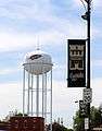 Osceola water tower
 Main Street in Osceola
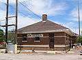 Amtrak Station in Osceola
References
- 1 2 "US Gazetteer files 2010". United States Census Bureau. Retrieved 2012-05-11.
- 1 2 "American FactFinder". United States Census Bureau. Retrieved 2012-05-11.
- ↑ "Population Estimates". United States Census Bureau. Retrieved 2013-05-23.
- ↑ "Find a County". National Association of Counties. Retrieved 2011-06-07.
- ↑ "US Gazetteer files: 2010, 2000, and 1990". United States Census Bureau. 2011-02-12. Retrieved 2011-04-23.
- ↑ endangered
- ↑ Federal Writers' Project (1940). South Dakota place-names, v.1-3. University of South Dakota. p. 54.
- ↑ Cedar Rapids Gazette, Cedar Rapids historic buildings make 'most endangered' list
- ↑ "Everything You Always Wanted to Know About Aging". Retrieved October 10, 2016.
- ↑ "Census of Population and Housing". Census.gov. Retrieved June 4, 2015.
- ↑ "American FactFinder". United States Census Bureau. Retrieved 2008-01-31.
- ↑ "Dwight Harken, 83, the Pioneer of Surgery on the Heart, Is Dead". The New York Times. August 29, 1993. Retrieved October 10, 2016.
External links
| Wikimedia Commons has media related to Osceola, Iowa. |
- City-Data Comprehensive Statistical Data and more about Osceola
Municipalities and communities of Clarke County, Iowa, United States | ||
|---|---|---|
| Cities | ||
| Townships | ||