Ormsby, Minnesota
| Ormsby, Minnesota | |
|---|---|
| City | |
 Location of Ormsby, Minnesota | |
| Coordinates: 43°50′57″N 94°41′51″W / 43.84917°N 94.69750°W | |
| Country | United States |
| State | Minnesota |
| Counties | Watonwan, Martin |
| Government | |
| • Type | Mayor – Council |
| • Mayor | Nick Hager |
| Area[1] | |
| • Total | 0.35 sq mi (0.91 km2) |
| • Land | 0.35 sq mi (0.91 km2) |
| • Water | 0 sq mi (0 km2) |
| Elevation | 1,204 ft (367 m) |
| Population (2010)[2] | |
| • Total | 131 |
| • Estimate (2012[3]) | 130 |
| • Density | 374.3/sq mi (144.5/km2) |
| Time zone | Central (CST) (UTC-6) |
| • Summer (DST) | CDT (UTC-5) |
| ZIP code | 56162 |
| Area code(s) | 507 |
| FIPS code | 27-48562[4] |
| GNIS feature ID | 0648995[5] |
Ormsby is a city in Martin and Watonwan counties in the U.S. state of Minnesota. The population was 131 at the 2010 census.[6]
The community is located between St. James and Sherburn on Minnesota State Highway 4.
History
Ormsby was platted in 1899, and named after one "Colonel Ormsby, of Emmetsburg, Iowa".[7] A post office has been in operation at Ormsby since 1900.[8] Ormsby was incorporated in 1902.[7]
Geography
According to the United States Census Bureau, the city has a total area of 0.35 square miles (0.91 km2), all of it land.[1]
Demographics
| Historical population | |||
|---|---|---|---|
| Census | Pop. | %± | |
| 1910 | 112 | — | |
| 1920 | 115 | 2.7% | |
| 1930 | 107 | −7.0% | |
| 1940 | 183 | 71.0% | |
| 1950 | 190 | 3.8% | |
| 1960 | 221 | 16.3% | |
| 1970 | 199 | −10.0% | |
| 1980 | 181 | −9.0% | |
| 1990 | 159 | −12.2% | |
| 2000 | 154 | −3.1% | |
| 2010 | 131 | −14.9% | |
| Est. 2015 | 128 | [9] | −2.3% |
2010 census
As of the census[2] of 2010, there were 131 people, 65 households, and 41 families residing in the city. The population density was 374.3 inhabitants per square mile (144.5/km2). There were 68 housing units at an average density of 194.3 per square mile (75.0/km2). The racial makeup of the city was 91.6% White, 7.6% Native American, and 0.8% from two or more races. Hispanic or Latino of any race were 1.5% of the population.
There were 65 households of which 13.8% had children under the age of 18 living with them, 53.8% were married couples living together, 3.1% had a female householder with no husband present, 6.2% had a male householder with no wife present, and 36.9% were non-families. 33.8% of all households were made up of individuals and 20% had someone living alone who was 65 years of age or older. The average household size was 2.02 and the average family size was 2.51.
The median age in the city was 52.3 years. 14.5% of residents were under the age of 18; 7.7% were between the ages of 18 and 24; 15.2% were from 25 to 44; 36.7% were from 45 to 64; and 26% were 65 years of age or older. The gender makeup of the city was 48.1% male and 51.9% female.
2000 census
As of the census[4] of 2000, there were 154 people, 65 households, and 46 families residing in the city. The population density was 429.8 people per square mile (165.2/km²). There were 68 housing units at an average density of 189.8 per square mile (72.9/km²). The racial makeup of the city was 98.70% White, 0.65% Asian, 0.65% from other races. Hispanic or Latino of any race were 0.65% of the population.
There were 65 households out of which 36.9% had children under the age of 18 living with them, 63.1% were married couples living together, 6.2% had a female householder with no husband present, and 27.7% were non-families. 26.2% of all households were made up of individuals and 18.5% had someone living alone who was 65 years of age or older. The average household size was 2.37 and the average family size was 2.85.
In the city the population was spread out with 24.0% under the age of 18, 7.1% from 18 to 24, 26.6% from 25 to 44, 23.4% from 45 to 64, and 18.8% who were 65 years of age or older. The median age was 41 years. For every 100 females there were 83.3 males. For every 100 females age 18 and over, there were 91.8 males.
The median income for a household in the city was $37,500, and the median income for a family was $47,188. Males had a median income of $33,750 versus $14,063 for females. The per capita income for the city was $16,954. About 2.7% of families and 6.0% of the population were below the poverty line, including 12.5% of those under the age of eighteen and none of those sixty five or over.
References
- 1 2 "US Gazetteer files 2010". United States Census Bureau. Retrieved 2012-11-13.
- 1 2 "American FactFinder". United States Census Bureau. Retrieved 2012-11-13.
- ↑ "Population Estimates". United States Census Bureau. Retrieved 2013-05-28.
- 1 2 "American FactFinder". United States Census Bureau. Retrieved 2008-01-31.
- ↑ "US Board on Geographic Names". United States Geological Survey. 2007-10-25. Retrieved 2008-01-31.
- ↑ "2010 Census Redistricting Data (Public Law 94-171) Summary File". American FactFinder. United States Census Bureau. Retrieved 27 April 2011.
- 1 2 Upham, Warren (1920). Minnesota Geographic Names: Their Origin and Historic Significance. Minnesota Historical Society. p. 575.
- ↑ "Watonwan County". Jim Forte Postal History. Retrieved 14 August 2015.
- ↑ "Annual Estimates of the Resident Population for Incorporated Places: April 1, 2010 to July 1, 2015". Retrieved July 2, 2016.
- ↑ "Census of Population and Housing". Census.gov. Retrieved June 4, 2015.
Municipalities and communities of Martin County, Minnesota, United States | ||
|---|---|---|
| Cities | 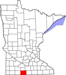 | |
| Townships | ||
| Unincorporated community | ||
| Footnotes | ‡This populated place also has portions in an adjacent county or counties | |
Municipalities and communities of Watonwan County, Minnesota, United States | ||
|---|---|---|
| Cities | 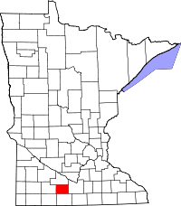 | |
| Townships | ||
| Unincorporated communities | ||
| Footnotes | ‡This populated place also has portions in an adjacent county or counties | |
Coordinates: 43°50′54″N 94°41′52″W / 43.84833°N 94.69778°W