Orkland
| Orkland herad | |
|---|---|
| Former Municipality | |
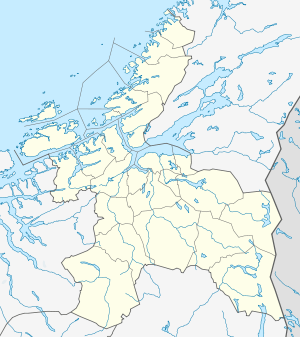 Orkland herad Location in Sør-Trøndelag | |
| Coordinates: 63°11′17″N 09°45′58″E / 63.18806°N 9.76611°ECoordinates: 63°11′17″N 09°45′58″E / 63.18806°N 9.76611°E | |
| Country | Norway |
| Region | Trøndelag |
| County | Sør-Trøndelag |
| District | Orkdalen |
| Adm. Center | Vormstad |
| Area[1] | |
| • Total | 169 km2 (65 sq mi) |
| Time zone | CET (UTC+01:00) |
| • Summer (DST) | CEST (UTC+02:00) |
| ISO 3166 code | NO-1637 |
| Created from | Orkdal in 1920 |
| Merged into | Orkdal in 1963 |
Orkland is a former municipality in Sør-Trøndelag county, Norway. The municipality encompassed the southern third of the present-day municipality of Orkdal. The main church of the municipality was Moe Church, just south of Vormstad. Most of the population in the 169-square-kilometre (65 sq mi) municipality was based in the Orkdalen valley along the river Orklaelva and near the lake Hostovatnet. The main village areas were Vormstad, Svorkmo, and Hoston.[1]
History
The municipality of Orkland was originally a part of the municipality of Orkdal (see formannskapsdistrikt), but on 1 July 1920 it was separated from Orkdal to form a new municipality of its own. Initially, it had a population of 1,760. On 1 January 1963, the municipalities of Orkland, Orkanger, Orkdal, and Geitastrand were merged to form a new, larger municipality of Orkdal. Prior to the merger, Orkland had a population of 1,707.[2]
References
- 1 2 Store norske leksikon. "Orkland" (in Norwegian). Retrieved 2011-01-26.
- ↑ Jukvam, Dag (1999). "Historisk oversikt over endringer i kommune- og fylkesinndelingen" (PDF) (in Norwegian). Statistisk sentralbyrå.