Orbost
| Orbost Victoria | |||||||
|---|---|---|---|---|---|---|---|
 Marshall's Commonwealth Hotel in Orbost | |||||||
 Orbost | |||||||
| Coordinates | 37°42′0″S 148°27′0″E / 37.70000°S 148.45000°ECoordinates: 37°42′0″S 148°27′0″E / 37.70000°S 148.45000°E | ||||||
| Population | 2,493 (2011 census)[1] | ||||||
| Postcode(s) | 3888 | ||||||
| Elevation | 41 m (135 ft) | ||||||
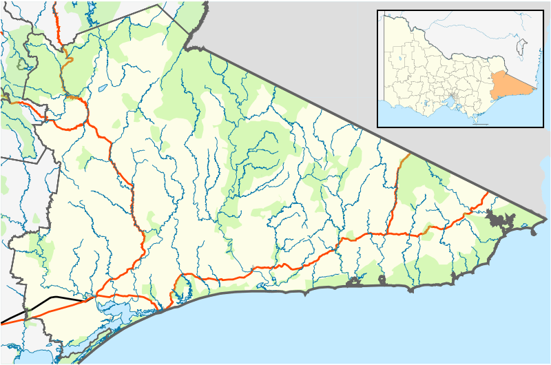
| Location |
| ||||||
| LGA(s) | Shire of East Gippsland | ||||||
| State electorate(s) | Gippsland East | ||||||
| Federal Division(s) | Gippsland | ||||||
| |||||||
Orbost is a town in the Shire of East Gippsland, Victoria, Australia, 375 kilometres (233 mi) east of Melbourne and 235 kilometres (146 mi) south of Canberra where the Princes Highway crosses the Snowy River. It is about 16 kilometres (10 mi) from the town of Marlo on the coast of Bass Strait. At the 2006 census, Orbost had a population of 2452. Orbost is the service centre for the primary industries of beef, dairy cattle, and sawmilling. More recently, tourism has become an important industry, being the major town close to several national parks, including the Snowy River National Park, Alpine National Park, Errinundra National Park, Croajingolong National Park and Cape Conran Coastal Park.
History
Peter Imlay established the Snowy River Station for grazing in 1842, and his brother the Newmerella run nearby. In 1845 the land was sold to Norman McLeod, who named the area after Orbost farm in the northwest of Isle of Skye, in Scotland.
Gold was discovered in the mid-1850s in the Bendoc area, in the mountains north of Orbost, which brought an influx of people to the district. By 1868 it was estimated that there was a population of 500 miners and squatters in the vicinity of Bendoc.
The Cameron family settled on the rich alluvial river flats in 1876, followed by many other selectors, many of them Scottish migrants. The Post Office opened on 1 December 1880 named Neumerella (sic) and was renamed Orbost in 1883. A Newmerella office opened in 1889 and closed in 1897, then reopened in 1921.[2] The township was proclaimed in 1890 and a bridge constructed across the Snowy River and a telegraph office established. Sawmills were established in the area and the first batch of sawn timber was cut at Orbost in 1882. By the late 1890s produce was regularly being exported to Melbourne via coastal trading vessels sailing up the Snowy River to Orbost. The railway from Melbourne arrived in 1916, allowing further agricultural settlement up the valley, and exploitation of native hardwood forests for timber and railway sleepers.

For most of the 20th century, Orbost was a fairly prosperous local centre for the forestry and agricultural industries and a supply point for smaller towns in the area. In the 1950s and 1960s several new sawmills were opened to exploit the native forests north and east of Orbost. By the 1980s logging of East Gippsland native forests had become an environmental issue. This resulted in the creation or extension of National Parks in the area, and a steady decline in forestry and sawmilling jobs. The general rural decline of the area and its economy saw the railway close in the mid-1980s and the population drop from around 4000 to around 2000 by the start of the 21st century. Logging and forestry continues to be a contentious issue in 2004 and 2005 in the Goolengook Valley, near the Errinundra National Park.
The Snowy Mountains Scheme resulted in the waters of the Snowy River being diverted to the Murray and Murrumbidgee Rivers and associated irrigation schemes. During the 1990s the low level of water in the Snowy River was a major concern, with a political campaign to increase the flow of water from the dam at Jindabyne. Independent candidate from the Orbost district, Craig Ingram, was elected in 1999, and re-elected in 2002, to the Victorian Legislative Assembly on a platform to increase the flow of water in the Snowy River.
The small rural communities of Bendoc, Bonang and Tubbut lie North East of Orbost. Delegate in NSW is the next major town geographically across the NSW/Vic Border from Orbost.
Climate
Orbost has a mild temperate climate with warm summers and mild to cool winters.
| Climate data for Orbost (1883-2011) | |||||||||||||
|---|---|---|---|---|---|---|---|---|---|---|---|---|---|
| Month | Jan | Feb | Mar | Apr | May | Jun | Jul | Aug | Sep | Oct | Nov | Dec | Year |
| Record high °C (°F) | 45.2 (113.4) |
44.6 (112.3) |
39.8 (103.6) |
36.5 (97.7) |
28.9 (84) |
24.4 (75.9) |
25.0 (77) |
28.1 (82.6) |
35.0 (95) |
34.9 (94.8) |
42.7 (108.9) |
40.6 (105.1) |
45.2 (113.4) |
| Average high °C (°F) | 25.5 (77.9) |
25.4 (77.7) |
23.8 (74.8) |
20.9 (69.6) |
17.7 (63.9) |
15.2 (59.4) |
14.8 (58.6) |
16.0 (60.8) |
17.9 (64.2) |
19.8 (67.6) |
21.6 (70.9) |
23.6 (74.5) |
20.2 (68.4) |
| Average low °C (°F) | 13.3 (55.9) |
13.5 (56.3) |
12.0 (53.6) |
9.3 (48.7) |
7.1 (44.8) |
5.2 (41.4) |
4.2 (39.6) |
4.8 (40.6) |
6.3 (43.3) |
8.3 (46.9) |
10.2 (50.4) |
11.8 (53.2) |
8.8 (47.8) |
| Record low °C (°F) | 4.4 (39.9) |
4.0 (39.2) |
2.8 (37) |
−0.6 (30.9) |
−0.2 (31.6) |
−2.4 (27.7) |
−3.2 (26.2) |
−2.2 (28) |
−1.0 (30.2) |
0.7 (33.3) |
1.7 (35.1) |
3.3 (37.9) |
−3.2 (26.2) |
| Average rainfall mm (inches) | 66.5 (2.618) |
59.6 (2.346) |
66.1 (2.602) |
73.7 (2.902) |
70.3 (2.768) |
85.0 (3.346) |
67.6 (2.661) |
59.2 (2.331) |
70.9 (2.791) |
77.1 (3.035) |
72.3 (2.846) |
78.1 (3.075) |
846.4 (33.321) |
| Average rainy days (≥ 0.2mm) | 8.1 | 7.1 | 8.3 | 8.9 | 10.2 | 11.3 | 10.9 | 10.4 | 11.6 | 11.6 | 10.1 | 9.3 | 117.8 |
| Source: Bureau of Meteorology[3] | |||||||||||||
Sports teams
The town is represented in the sport of Australian rules football by the Orbost-Snowy Rovers in the East Gippsland Football League.[4]
The town also boasts a field hockey club which fields junior, women's and men's sides in the East Gippsland Hockey Association.
Golfers play at the course of the Orbost Golf Club on the Bonang Highway.[5]
Transport

Orbost straddles the Princes Highway. The town was connected to Melbourne via the Orbost railway line in 1916, and operated until 1987, principally carrying timber and farming produce. In the early days of the railway's operation dedicated passenger trains ran but these ceased by the 1930s. The track infrastructure was dismantled in 1994. The line traversed a mixture of farmland, hills and heavily forested country. It included numerous bridges, including the Stoney Creek Trestle Bridge, the largest of its kind in Victoria.[6] Public transport services are provided to the town by V/Line, a coach bus service between Canberra and Bairnsdale, that operates three times per week.[7]
Orbost has a regional airport, Orbost Airport YORB (RBS).
Current profile
The national parks are showcased in events such as The Wilderness Bike Ride, a community event managed out of Orbost, which won the Best Event 2004 Regional Tourism Award for East Gippsland.
The Orbost region has four State primary schools, one Catholic primary school, and Orbost Secondary College (Government).
Notable people from Orbost
- Percival Bazeley, scientist
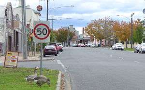 The main street of Orbost, entering from the south.
 - Richard Dalla-Riva, politician
- Jennifer Hansen, TV presenter[8]
- Sarah Hanson-Young, politician[9]
- Nick Heyne, Current Australian rules footballer with the St.Kilda Football Club
- Craig Ingram, politician[9]
- Jennings Carmichael (aka Grace Jennings Carmichael), poet
- Charlie Lynn, politician
- Tim Matthews, Paralympic athlete[10]
- Molly Meldrum, music critic, journalist, TV presenter
- Peter Nixon, politician
- Brett Prentice, historian
- Lindsay Tanner, politician[9]
- Michael Voss, former Australian rules footballer and former coach of the Brisbane Lions in the AFL
- Brett Voss, Former Australian Rules Footballer St Kilda Football Club
- Harry Firth, Australian motorsport legend. Winner of first Bathurst race in 1963.
References
- ↑ Australian Bureau of Statistics (31 October 2012). "Orbost (State Suburb)". 2011 Census QuickStats. Retrieved 2013-03-28.
- ↑ Premier Postal History, Post Office List, retrieved 2008-04-11
- ↑ "ORBOST (COMPARISON)". Climate statistics for Australian locations. Bureau of Meteorology. March 2013. Retrieved 20 March 2013.
- ↑ Full Points Footy, Orbost Snowy Rovers, archived from the original on April 30, 2008, retrieved 2008-07-25
- ↑ Golf Select, Orbost, retrieved 2009-05-11
- ↑ "Rail » Infrastructure » Orbost Line". Vicsig Railways site. VICSIG. 1997–2009. Retrieved 2009-11-08. External link in
|work=(help) - ↑ "Capital Link timetable" (PDF). V/Line. 28 April 2013. Retrieved 11 January 2014.
- ↑ Jennifer, Hansen. "Jennifer Hansen: The Official Website". Retrieved 5 July 2013.
- 1 2 3 Spicer, Victoria (9 July 2009). "Solo Man: A Natural Politician". CraigIngram.com. Craig Ingram. Retrieved 24 February 2011.
- ↑ "Australians at the 1996 Atlanta Paralympics: Athletes". Australian Sports Commission. Archived from the original on 20 January 2000. Retrieved 12 January 2012.
External links
![]() Media related to Orbost at Wikimedia Commons
Media related to Orbost at Wikimedia Commons
- Orbost District Website
- Wilderness Bike Ride
- Orbost - a brief history
- Orbost District Chamber of Commerce & Industry