California State Route 57
| ||||
|---|---|---|---|---|
| Orange Freeway | ||||
|
State Route 57 highlighted in red; unconstructed portion in purple | ||||
| Route information | ||||
| Defined by Streets and Highways Code § 357 | ||||
| Maintained by Caltrans | ||||
| Length: | 25.84 mi[1][2] (41.59 km) | |||
| History: | State highway in 1931; numbered in 1964 | |||
| Major junctions | ||||
| South end: |
| |||
| North end: |
| |||
| Location | ||||
| Counties: | Orange, Los Angeles | |||
| Highway system | ||||
| ||||


State Route 57 (SR 57), also known as the Orange Freeway for most of its length, is a north–south state highway in the Greater Los Angeles Area of California. It connects the interchange of Interstate 5 (I-5) and SR 22 near downtown Orange, locally known as the Orange Crush, to the Glendora Curve interchange with I-210 and SR 210 in Glendora. The highway provides a route across several spurs of the Peninsular Ranges, linking the Los Angeles Basin with the Pomona Valley and San Gabriel Valley.
A predecessor to this road ran through Brea Canyon by the early 20th century and was added to the state highway system. The freeway was built in stages during the 1950s, one of which included the Brea Canyon Freeway; SR 57 was designated as part of the 1964 state highway renumbering. The final portion of the present-day Orange Freeway was not completed until the mid 1970s. The latest piece of SR 57 to be added was formerly part of I-210, after SR 210 was legislatively extended to San Bernardino in 1998. An unconstructed extension from Santa Ana south to Huntington Beach remains in the legal definition of SR 57, and has been studied as a toll road above the Santa Ana River.
Route description

SR 57 begins at the Orange Crush interchange near downtown Orange, where it meets the northwest–southeast Santa Ana Freeway (I-5) and the east–west Garden Grove Freeway (SR 22). The Orange Crush interchange, which had long been considered a major bottleneck, was rebuilt in the 1990s and 2000s.[3][4] The freeway heads north from the junction and soon crosses to the west side of the Santa Ana River, continuing north through suburban portions of Anaheim and passing next to Anaheim Regional Transportation Intermodal Center, Angel Stadium and Honda Center. In northern Anaheim, SR 57 meets the Riverside Freeway (SR 91). SR 57 briefly passes through Placentia and Fullerton, providing access to California State University, Fullerton. As it crosses Imperial Highway (SR 90) near the Brea Mall and enters Brea, SR 57 enters more rugged terrain before climbing through Brea Canyon, the gap between the Chino Hills and Puente Hills. Near the rim of the canyon, the highway curves north out of the Brea Canyon, and descends slightly to a junction with the Pomona Freeway (SR 60) in Diamond Bar, right on the edge of the San Gabriel Valley.[5]
A short overlap carries SR 57 traffic on the same roadway as SR 60. The two routes head northeast through an arm of the San Gabriel Valley; after they split, SR 57 ascends slightly and then slopes through the edge of the Puente Hills and into the west end of the Pomona Valley. Here it meets the San Bernardino Freeway (I-10) and Chino Valley Freeway (SR 71) at the four-level Kellogg Hill Interchange. In the north half of that interchange, SR 57 enters the San Jose Hills, climbing to its highest elevation before descending back into the connected San Gabriel and Pomona Valleys and ending at the Glendora Curve interchange with the Foothill Freeway (I-210) in Glendora.[5]
High-occupancy vehicle lanes (HOV) exist in the median of SR 57 south of SR 60 in Diamond Bar. Elevated ramps allow HOV traffic bound to or from Brea Canyon to connect with I-5 towards the southeast, SR 91 towards the west, or SR 60 towards the east without entering the main lanes.[5][6]
SR 57 is legally eligible for the State Scenic Highway System through Brea Canyon, between SR 90 and SR 60,[7] though it has not officially been designated by Caltrans as such[8] because it has not successfully been through the nomination process.[9] The entire route is in the California Freeway and Expressway System,[10] and is a freeway for its entire constructed length. SR 57 is also part of the National Highway System (NHS),[11] a network of highways that are essential to the country's economy, defense, and mobility.[12] The highway from SR 1 to SR 60 in Diamond Bar is officially designated as the Orange Freeway.[13] In 2013, SR 57 had an annual average daily traffic (AADT) of 129,000 between SR 60 and Sunset Crossing Road in Diamond Bar, and 278,500 between SR 91 in Anaheim and Orangethorpe Avenue in Placentia, the latter of which was the highest AADT for the highway.[14]
History

The road through Brea Canyon was oiled dirt by the late 1910s, providing a good connection across an outbranching of the Peninsular Ranges between the Los Angeles Basin and Pomona Valley. This road left the main coast highway (Harbor Boulevard) at Fullerton and followed the present Brea Boulevard and Brea Canyon Road, merging with the Valley Boulevard from Los Angeles near Walnut and continuing east to Pomona via Valley and Pomona Boulevards.[15] Los Angeles County paved the road in concrete in early 1923,[16] and in 1931 it was added to the state highway system as a branch of Route 19. Until then, Route 19 had connected Route 9 near Claremont with Riverside, following Garey Avenue and Mission Boulevard through Pomona.[17][18]
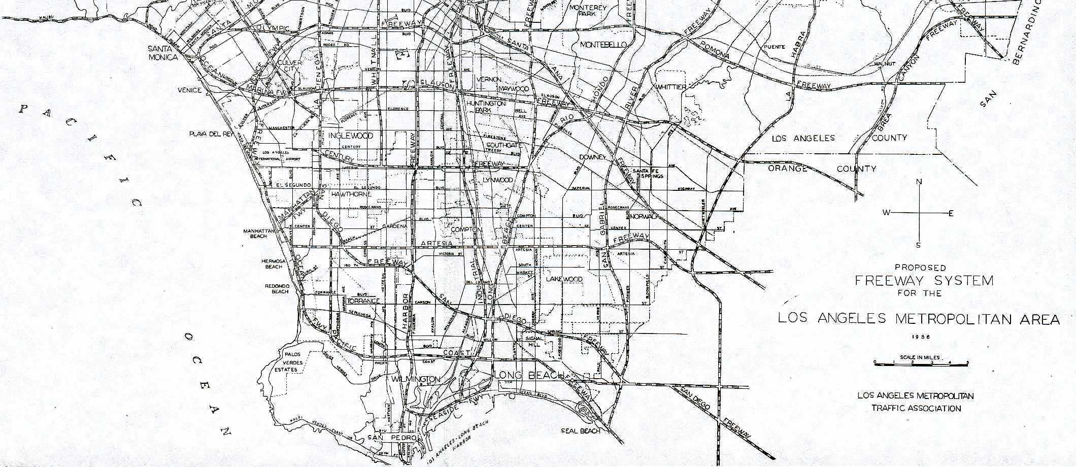
The state built a bypass of the Valley Boulevard portion of the route in the early-to-mid-1930s, leaving the old road near Diamond Bar and heading northeast through the foothills, along the present freeway alignment and Mission Boulevard.[19] To the south, the legislature added then-unrelated Route 180 along State College Boulevard in 1933, connecting Route 2 (I-5) near the Santa Ana River with Route 175 (Orangethorpe Avenue, later replaced by SR 91) near Placentia.[20][21] By 1955, the Brea Canyon Freeway was proposed to begin at the Santa Ana Freeway (I-5) near La Veta Avenue in Santa Ana and head north, paralleling Routes 180 and 19 to Pomona.[22][23][24] The portion northeast of Diamond Bar into Pomona soon became part of the planned Pomona Freeway, and the name of the remainder was changed to Orange Freeway.[25] The state legislature altered the definition of Route 19 to reflect this in 1957 by moving its south end to Santa Ana.[26]
Then, in 1957, the northernmost part of present SR 57 was added to the state highway system as part of Route 240, which the legislature designated along the route planned for I-210.[27] This became part of the proposed Temescal Freeway, later the Corona Freeway; a southerly extension of the Orange Freeway[25] to Legislative Route 60 (SR 1) near Huntington Beach was added in 1959 as Route 273. Also in 1959, the legislature created Route 272, extending the line of the Orange Freeway north from the Pomona Freeway to the Temescal Freeway, completing the proposed freeway corridor that is now SR 57.[28] When the entire route, except Route 240 which was still part of I-210, was redesignated SR 57 in the 1964 renumbering, none of these proposed freeways had been built; the only constructed segment was the old surface road from Fullerton towards Pomona.[29] The part of old Route 19 east of Route 272 became part of SR 60. As part of the same renumbering, Route 180 on State College Boulevard became Route 250,[30] which was amended the next year to provide for its deletion once that portion of the SR 57 freeway was completed (between I-5 and SR 91).[31]

A groundbreaking ceremony was held in Placentia on January 30, 1967, to begin construction of the Orange Freeway.[32] The first portion was dedicated on May 16, 1969, and opened soon after, extending north from the Riverside Freeway (SR 91) to Nutwood Avenue in Fullerton.[33] Over the next few years, the freeway was completed from SR 91 north to I-10, and I-210 was built north to the present end of SR 57; the Pomona Freeway (SR 60), which overlaps it through Diamond Bar, was constructed at the same time.[2] The last pieces of that portion were the freeway through Brea Canyon, which opened March 13, 1972,[34] and the four-level Kellogg Hill Interchange at I-10, which was dedicated May 1, 1972, and opened soon thereafter.[35] Finally, the Orange Freeway was extended south from SR 91 to I-5 in the mid-1970s,[2] allowing Route 250 to be turned back to local governments, though the subsequent deletion from the Streets and Highways Code did not take place until 1981.[36] With the extension of SR 210 around San Bernardino in 1998, the former easternmost piece of I-210 to the Kellogg Hill Interchange instead became a northerly extension of SR 57,[37] though it remains officially part of the Interstate Highway System.[11]
Future
The southerly extension to Huntington Beach remains unconstructed. In 1986, Orange County's plans were for a toll road elevated above the Santa Ana River rather than through existing neighborhoods, only extending south to the San Diego Freeway (I-405) in Costa Mesa with connections to the Corona del Mar Freeway (SR 73); this was largely inspired by congestion on SR 55 through the Santa Ana area.[38][39] The extension was considered by Caltrans as two 11.2-mile-long (18.0 km), two-lane viaducts that would cost $950 million. The toll road franchise that American Transportation Development (ATD) held for this portion of SR 57 expired in January 2001, after a request to delay the expiration until January 2007. Following this, ATD sued to restore the franchise, and this case lasted until November 2003.[40] The termination was due to ATD not beginning the construction during the first ten years of the franchise, after it had been enacted by the state legislature.[41]
In April 2009, the Orange County Transportation Authority continued to study the extension of SR 57, where the freeway would travel along the Santa Ana River and terminate at I-405 in Fountain Valley.[42]
Exit list
Except where prefixed with a letter, postmiles were measured on the road as it was in 1964, based on the alignment that existed at the time, and do not necessarily reflect current mileage. R reflects a realignment in the route since then, M indicates a second realignment, L refers an overlap due to a correction or change, and T indicates postmiles classified as temporary (for a full list of prefixes, see the list of postmile definitions).[1] Segments that remain unconstructed or have been relinquished to local control may be omitted. The numbers reset at county lines; the start and end postmiles in each county are given in the county column.
| County | Location | Postmile [1][2][14] | Exit [43][44] | Destinations | Notes | |
|---|---|---|---|---|---|---|
| Orange ORA 10.83-R22.55 | Orange | 10.83 | 1A | No access to I-5 north; southern terminus of SR 57; I-5 north exit 106 | ||
| 10.83 | — | HOV access only; southbound exit and northbound entrance | ||||
| 10.83 | 1B-C | Southbound exit and northbound entrance; SR 22 exit 14D | ||||
| 11.24 | 1D | Chapman Avenue – Orange | Southbound exit and northbound entrance | |||
| 11.80 | 1E | Orangewood Avenue | Signed as exit 1B northbound | |||
| Anaheim | 12.54 | 2 | Katella Avenue | |||
| 13.42 | 3 | Ball Road | ||||
| 14.78 | 4 | Lincoln Avenue – Anaheim | ||||
| 15.60 | 5 | SR 91 exit 31 | ||||
| | — | HOV access only; southbound exit and northbound entrance | ||||
| Placentia | 16.39 | 6A | Orangethorpe Avenue | Signed as exit 6 southbound | ||
| Fullerton | 17.30 | 6B | Chapman Avenue – Fullerton | Southbound exit is part of exit 7 | ||
| 17.57 | 7 | Nutwood Avenue | ||||
| 18.34 | 8 | Yorba Linda Boulevard | ||||
| Fullerton–Brea line | 19.86 | 9 | ||||
| Brea | 20.88 | 10 | Lambert Road | |||
| | 21.78 | 11 | Tonner Canyon Road | Northbound exit and southbound entrance | ||
| Los Angeles LA R0.00-R12.21 | Diamond Bar | R0.91 | 13 | Brea Canyon Road | Southbound exit and northbound entrance; former SR 57 | |
| R1.94 | 14 | Diamond Bar Boulevard | ||||
| R3.17 | 15 | Pathfinder Road | ||||
| Diamond Bar–Industry line | | — | Southbound exit only | |||
| R4.52 R23.56[lower-alpha 1] | 16 | Left exit; south end of SR 60 overlap; northbound exit provides direct exit ramp onto Brea Canyon Rd.; SR 60 exit 24A | ||||
| R24.45 | 24B[lower-alpha 2] | Grand Avenue – Diamond Bar | ||||
| Diamond Bar | R25.46[lower-alpha 1] R4.52 | 18 | North end of SR 60 overlap; northbound exit and southbound entrance; southbound access is via exit 18; SR 60 east exit 25 | |||
| 4.98 | 18 | Sunset Crossing Road | No northbound exit | |||
| Pomona | 6.17 | 20 | Temple Avenue | |||
| Pomona–San Dimas line | R7.72 | 21 | Signed as exits 22A (west) and 22B (east) southbound; former eastern terminus of I-210; I-10 west exit 42, east exit 42A | |||
| San Dimas | R7.94 | 22C | Southbound exit and northbound entrance | |||
| R8.71 | 22D | Via Verde / Raging Waters Drive | Signed as exit 22 northbound | |||
| R10.27 | 24A | Covina Boulevard | ||||
| R10.79 | 24B | Arrow Highway – San Dimas | ||||
| Glendora | R11.57 | 25A | Auto Centre Drive | Northbound exit and southbound entrance | ||
| R12.21 | 25B | SR 210 exit 45 | ||||
| R12.30 | — | Northern terminus of SR 57; I-210 exit 45 | ||||
1.000 mi = 1.609 km; 1.000 km = 0.621 mi
| ||||||
References
- 1 2 3 California Department of Transportation. "State Truck Route List". Sacramento: California Department of Transportation. Archived from the original (XLS file) on June 30, 2015. Retrieved June 30, 2015.
- 1 2 3 4 Staff (July 2007). "Log of Bridges on State Highways". California Department of Transportation. Retrieved February 10, 2008.
- ↑ "'Orange Crush' Gets Tighter". Los Angeles Times. January 28, 1992. p. 1.
- ↑ "Orange Crush link to shut till Monday". Orange County Register. Santa Ana, California. November 18, 2006.
- 1 2 3 Google Maps (April 8, 2011). "1.3 km NE of Placentia, CA" (Map). ACME Mapper 2.0. ACME Maps. Retrieved April 8, 2011.
- ↑ Staff (2005–2006). "Interregional HOV System Status" (PDF). California Department of Transportation. Archived from the original (PDF) on October 8, 2008. Retrieved April 9, 2011.
- ↑ California State Legislature. "Streets and Highways Code Section 260–284". California State Legislature. Retrieved April 8, 2011.
- ↑ Staff (December 7, 2007). "Officially Designated State Scenic Highways and Historic Parkways". California Department of Transportation. Retrieved April 8, 2011.
- ↑ Staff (2012). Scenic Highway Guidelines (PDF). California Department of Transportation. p. 5. Retrieved July 29, 2012.
- ↑ "Streets and Highways Code Section 250–257". California State Legislature. Retrieved April 8, 2011.
- 1 2 Federal Highway Administration. National Highway System: Los Angeles, CA (PDF) (Map). Scale not given. Federal Highway Administration. Retrieved February 5, 2012.
- ↑ Natzke, Stefan; Neathery, Mike & Adderly, Kevin (June 20, 2012). "What is the National Highway System?". National Highway System. Federal Highway Administration. Retrieved July 1, 2012.
- ↑ 2013 Named Freeways, Highways, Structures and Other Appurtenances in California (PDF). Caltrans. p. 35. Retrieved November 12, 2013.
- 1 2 Staff (2013). "All Traffic Volumes on CSHS". California Department of Transportation. Retrieved November 16, 2014.
- ↑ Staff (1919). Official Automobile Blue Book Volume Eight. The Automobile Blue Book Publishing Co. p. 530.
- ↑ "New Road Winds In and Out". Los Angeles Times. February 25, 1923. p. VI8.
- ↑ California State Assembly. "An act establishing certain additional state highways and classifying them as secondary highways". Forty-ninth Session of the Legislature. Statutes of California. State of California. Ch. 82 p. 103.
Pomona to Fullerton via Brea canyon.
- ↑ California State Assembly. "An act to establish a Streets and Highways Code, thereby consolidating and revising the law relating to public ways and all appurtenances thereto, and to repeal certain acts and parts of acts specified herein". Fifty-first Session of the Legislature. Statutes of California. State of California. Ch. 29 p. 276.
Route 19 is from: (a) Route 9 west of Claremont to Beaumont via Riverside. (b) Pomona to Fullerton via Brea Canyon.
- ↑ Rand McNally & Company (1933). Los Angeles & Vicinity (Map). Chicago: Rand McNally & Company. Retrieved February 13, 2008.
- ↑ California State Assembly. "An act to amend sections 2, 3 and 5 and to add two sections to be numbered 6 and 7 to an act entitled 'An act to provide for the acquisition of rights of way for and the construction, maintenance...". Fiftieth Session of the Legislature. Statutes of California. State of California. Ch. 767 p. 2040.
State Highway Route 2 near Orange County Hospital northerly to Hermosa Beach-Santa Ana Canyon Road.
- ↑ California State Assembly. "An act to establish a Streets and Highways Code, thereby consolidating and revising the law relating to public ways and all appurtenances thereto, and to repeal certain acts and parts of acts specified herein". Fifty-first Session of the Legislature. Statutes of California. State of California. Ch. 29 p. 286.
Route 180 is from Route 2 near Orange County Hospital northerly to Route 175.
- ↑ "Brea Canyon Freeway Plan Pushed". Los Angeles Times. July 16, 1955. p. 13.
- ↑ "Propose Four New Routes for Freeways". Valley News. Van Nuys, California. November 2, 1955.
- ↑ Los Angeles Metropolitan Traffic Association (1956). Proposed Freeway System for the Los Angeles Metropolitan Area (Map). Los Angeles: Los Angeles Metropolitan Traffic Association. Retrieved February 13, 2008.
- 1 2 Metropolitan Transportation Engineering Board (February 28, 1958). Master Plan of Freeways and Expressways (PDF) (Map). Metropolitan Transportation Engineering Board.
- ↑ California State Assembly. "An act...relating to state highway routes". 1957 Session of the Legislature. Statutes of California. State of California. Ch. 1911 p. 3342.
Route 19 is from:...(b) Pomona to Route 2 near Santa Ana.
- ↑ California State Assembly. "An act to add Section 560 to the Streets and Highways Code, relating to state highways, declaring the urgency thereof, to take effect immediately". 1957 Session of the Legislature. Statutes of California. State of California. Ch. 24 p. 578.
Route 240 is hereby added to the State Highway System, to extend from Route 4 near Glendale to Route 26 near the east boundary of Los Angeles County...
- ↑ California State Assembly. "An act to amend Sections 306, 320, 332, 351, 362, 365, 369, 374, 382, 388, 397, 407, 408, 409, 410, 415, 422, 435, 440, 446, 453, 456, 460, 467, 470, 476, 487, 492, 493, 494, 506, 521, 528, and 529...". 1959 Session of the Legislature. Statutes of California. State of California. Ch. 1062 p. 3120.
Route 272 is from Route 19 near City of Industry to Route 26 near Pomona... Route 273 is from Route 60 near Huntington Beach to Route 179 near Santa Ana.
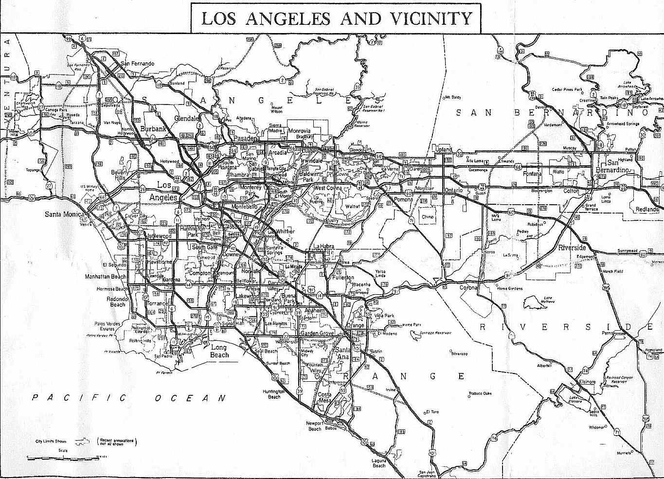
- ↑ California Division of Highways. Los Angeles and Vicinity, 1963 (Map). Sacramento: California Division of Highways. Retrieved February 13, 2008.
- ↑ California State Assembly. "An act to add Section 253 and Article 3 (commencing with Section 300) to Chapter 2 of Division 1 of, and to repeal Section 253 and Article 3 (commencing with Section 300) of Chapter 2 of Division 1 of, the...". 1963 Session of the Legislature. Statutes of California. State of California. Ch. 385 p. 1176, 1188.
Route 57 is from: (a) Route 1 near Huntington Beach to Route 22 near Santa Ana. (b) Route 5 near Santa Ana to Route 210 near Route 10 and Pomona, passing near Industry... Route 250 is from Route 5 near Orange County Hospital northerly to Route 91.
- ↑ California State Assembly. "An act to amend Sections 253, 307, 317, 322, 334, 342, 347, 349, 361, 363, 372, 373, 374, 379, 384, 390, 407, 408, 443, 455, 470, 486, 514, 517, 548, and 550 of, to add Sections 556, 557, 558, 560...". 1965 Session of the Legislature. Statutes of California. State of California. Ch. 1372 p. 3276.
This route shall cease to be a state highway when Route 57 freeway is completed from Route 5 to Route 91.
- ↑ "Work Started on Orange Freeway". Los Angeles Times. January 31, 1967. p. OC8.
- ↑ "Orange Freeway Section to Open". Independent Press-Telegram. Long Beach, California. May 17, 1969.
- ↑ Seelye, Howard (March 13, 1972). "Orange Freeway Through Canyon to Open Today". Los Angeles Times. p. D1.
- ↑ "New Freeway Hub Dedicated". Montclair Tribune. May 4, 1972.
- ↑ California State Assembly. "An act to amend...the Streets and Highways Code, relating to state highways". 1981–1982 Session of the Legislature. Statutes of California. State of California. Ch. 292 p. 1419.
- ↑ California State Assembly. "An act to amend Sections 253.1, 263.3, 263.8, 357, and 510 of, and to repeal Section 330 of, the Streets and Highways Code, relating to highways". 1997–1998 Session of the Legislature. Statutes of California. State of California. Ch. 221.
Route 57 is from:...(b) Route 5 near Santa Ana to Route 210 near San Dimas.
- ↑ Murphy, Kim (January 7, 1986). "Interest Growing in 2 Traffic Proposals for Santa Ana Area". Los Angeles Times. p. 1.
- ↑ Perlman, Jeffrey A. (July 29, 1986). "Hundreds Cheer as Panel Turns Down [Garden Grove] Freeway Extension". Los Angeles Times. p. 1.
- ↑ "Private Investment / Public Infrastructure: Route 57 (Orange County)". California Department of Transportation. Retrieved 5 August 2016.
- ↑ "Orange County; Road Study Decision Is Delayed". Los Angeles Times. March 25, 2003. p. B3. Retrieved February 11, 2012.
- ↑ Mello, Michael (April 1, 2009). "57 freeway may get long-awaited extension". Orange County Register. Santa Ana, California. Retrieved April 5, 2009.
- ↑ Warring, KS. "State Route 57 Freeway Interchanges" (PDF). California Numbered Exit Uniform System. California Department of Transportation. Retrieved February 5, 2009.
- ↑ Warring, KS. "State Route 60 Freeway Interchanges" (PDF). California Numbered Exit Uniform System. California Department of Transportation. Retrieved February 5, 2009.
External links
| Wikimedia Commons has media related to California State Route 57. |
-
 Geographic data related to California State Route 57 at OpenStreetMap
 - California Highways: State Route 57
- Caltrans: Route 57 highway conditions
- California @ AARoads – State Route 57