Operation IceBridge


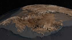
Operation IceBridge is a 2009–2016 NASA mission that aims to monitor changes in polar ice from a fixed-wing aircraft. It is a temporary replacement for the ICESat satellite until the ICESat-2 launch in 2017.
Equipment

Since 2003 NASA has used a satellite, ICESat (Ice, Cloud, and land Elevation Satellite), for observing polar ice. ICESat was retired in February 2010 due to a technical malfunction, leaving NASA without a satellite dedicated to ice observance. A new satellite is not expected to be launched until 2016.[1][2] NASA therefore introduced the IceBridge program which utilizes an aircraft to make similar measurements.
IceBridge flights began in October 2009[3] using a DC-8. Beginning in 2010, the DC-8 was joined by a P-3 Orion and other aircraft such as a King Air B-200, Gulfstream V and Guardian Falcon.[4]
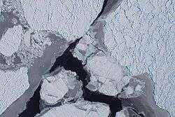
There are tradeoffs to using an aircraft instead of a satellite. One drawback is that a satellite can observe a far wider area. Also, satellites take measurements full-time, while IceBridge aircraft measurements are limited to annual campaigns that are several weeks long. Aircraft, however, have the advantages of being able to carry more instruments and target and focus on scientifically interesting areas instead of just flying a fixed path. Also, certain instruments such as ice-penetrating radar only work from the lower altitudes afforded by aircraft like the P-3 Orion and DC-8.[2][4]
Instruments

IceBridge aircraft carry a suite of specialized science instruments. Among these is the Airborne Topographic Mapper, a laser that measures the surface elevation of the ice. Also on board is a Gravimeter, an instrument capable of measuring the shape of cavities in the ice. There are numerous other pieces of equipment on board, including the Land, Vegetation and Ice Sensor, the Multichannel Coherent Radar Depth Sounder, a Snow Radar, a Ku-Band Radar Altimeter, a magnetometer and the Digital Mapping System.[4]
Laser Altimeters
Airborne Topographic Mapper (ATM) – The Airborne Topographic Mapper (ATM) is a laser altimeter that bounces laser light off ice surface and measures how long it takes for the light to return. By combining this timing data with information about the aircraft's position and attitude, researchers can calculate ice elevation. By flying over the same areas of ice year after year, they can build a time series of changes in elevation. This instrument works similarly to the lidar instrument used in ICESat and is helping maintain a record of elevation changes until ICESat-2 becomes operational.[5]
Land Vegetation and Ice Sensor (LVIS) - The Land, Vegetation and Ice Sensor (LVIS) is a laser altimeter optimized for operation at higher altitudes. LVIS was created by scientists at the Laser Remote Sensing Laboratory at NASA's Goddard Space Flight Center. LVIS has flown on a wide variety of aircraft such as NASA's P-3, DC-8, B-200 and HU-25C Guardian Falcon and NSF's Gulfstream G-V. By flying at a higher altitude, LVIS can survey larger areas and expands IceBridge's range.[6]
Radars
Operation IceBridge uses four different radar instruments operated by the operated by the Center for the Remote Sensing of Ice Sheets (CReSIS) at the University of Kansas. Indiana University provides data management services for CReSIS activities in Operation IceBridge.[7]
Multichannel Coherent Radar Depth Sounder (MCoRDS) - The Multichannel Coherent Radar Depth Sounder (MCoRDS) is used to measure ice thickness and map beneath the ice. This instrument uses multiple channels and a large range of radar frequencies to image internal ice layering and bedrock beneath ice sheets. Information on sub-ice terrain is useful for modeling ice sheets.[8]
Snow Radar - The CReSIS Snow Radar instrument is used to measure the thickness of snow layers on top of land and sea ice. Measuring snow thickness is crucial for estimating sea ice thickness.[9]
Ku-band Radar Altimeter - IceBridge also carries a Ku band radar altimeter, which can penetrate snow layers to measure sea and land ice surface elevation.[10]
Accumulation Radar - The accumulation radar instrument is used to gather high-resolution data on the top part of ice. Looking at the uppermost part of ice allows researchers to map past snow accumulation rates.[11]
Mapping Instruments
Digital Mapping System (DMS) - The Digital Mapping System (DMS), created by researchers at NASA's Ames Research Center, is an airborne digital imaging system that is used to detect openings in sea ice and build high-resolution maps of polar ice. The DMS instrument is a downward-facing digital camera that captures multiple individual frames that are combined into image mosaics using computer software.[12]
Gravimeter - Operation IceBridge also uses a gravity-measuring instrument known as a gravimeter. This instrument measures the strength of gravitational fields beneath the aircraft, which researchers can use to determine the shape of water cavities beneath floating ice shelves. Because water has a lower density than rock areas of floating ice show weaker gravitational fields than areas with rock underneath.[13]
Magnetometer - The NASA P-3 Orion carries a magnetometer that can be used to gather data on the properties of sub-ice rock. Density and magnetic properties can be used to infer bedrock type, which is helpful for determining sub-ice basal conditions.[14]
Research
The project, headed by Michael Studinger from NASA's Goddard Space Flight Center, uses a suite of airborne science instruments to get a three-dimensional view of Arctic and Antarctic ice.[15] The mission's goals are to monitor changes in polar ice, gather data for predictive models of ice and sea-level rise and bridge the gap in measurements between NASA's ICESat and ICESat-2 satellites. IceBridge achieves this by collecting data from specific glaciers. Pine Island Glacier is one such area of focus. There, Operation IceBridge has been observing the underside of the ice-sheet using an advanced radar, as well as closely monitoring an area of Pine Island Glacier, known as the ice tongue, that, were it to melt, would allow a large portion of the glacier to slide into the Amundsen Sea.[2]
In August 2013 the discovery of the longest canyon on the Earth under the ice sheet, was reported, based on the analysis of data from IceBridge.[16]
References
- ↑ "NASA's Successful Ice Cloud and Land Elevation Mission Comes to an End". NASA. 27 August 2010. Retrieved 31 August 2010.
- 1 2 3 Hamilton, John (30 October 2009). "NASA Launches Mission To Track Polar Ice By Plane". NPR. Retrieved 25 February 2011.
- ↑ "IceBridge Antarctica 2009". NASA. November 18, 2009. Retrieved 26 December 2012.
- 1 2 3 "IceBridge Aircraft & Instruments". NASA. Retrieved 26 December 2012.
- ↑ "Airborne Topographic Mapper (ATM)". NASA. Retrieved 26 December 2012.
- ↑ "Land, Vegetation and Ice Sensor (LVIS)". NASA. Retrieved 26 December 2012.
- ↑ Bertolucci, Jeff (13 May 2013). "NASA Polar Ice Flyover: One Bumpy Big Data Project". InformationWeek. Retrieved 22 May 2013.
- ↑ "Multichannel Coherent Radar Depth Sounder (MCoRDS)". NASA. Retrieved 28 December 2012.
- ↑ "Snow Radar". NASA. Retrieved 28 December 2012.
- ↑ "Ku-band Radar Altimeter". NASA. Retrieved 28 December 2012.
- ↑ "Accumulation Radar". NASA. Retrieved 28 December 2012.
- ↑ "Digital Mapping System (DMS)". NASA. Retrieved 28 December 2012.
- ↑ "Gravimeter". NASA. Retrieved 28 December 2012.
- ↑ "Magnetometer". NASA. Retrieved 28 December 2012.
- ↑ "Operation IceBridge home page". NASA. Retrieved 26 December 2012.
- ↑ Oskin, Becky (August 30, 2013). "Grand Canyon of Greenland Discovered under Ice". Livescience.
External links
- Operation Icebridge
- NASA's IceBridge Mission Contributes to New Map of Antarctica (2013)
- Antarctic Bedrock (Images & Video)