Opava (river)
| Opava | |
|---|---|
 The Opava near Háj ve Slezsku | |
| Country | Czech Republic, Poland |
| Basin | |
| Main source |
Hrubý Jeseník 520 meters (1,710 ft) 50°07′33″N 17°22′47″E / 50.1257°N 17.3796°E |
| River mouth |
Oder 49°50′01″N 18°13′16″E / 49.8336°N 18.2212°ECoordinates: 49°50′01″N 18°13′16″E / 49.8336°N 18.2212°E |
| Physical characteristics | |
| Length | 119 km (74 mi) |
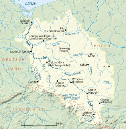
The Opava (Czech: Opava, Polish: Opawa, German: Oppa) is a river in the north-eastern Czech Republic, a left tributary of the Oder river. It originates at the confluence of Bílá (White), Střední (Middle) and Černá (Black) Opava in Vrbno pod Pradědem and runs over 119 km (74 mi) to the Oder at Ostrava, with some 25 km (16 mi) forming the border with Poland.
After the 1742 First Silesian War the Opava river in the Duchy of Troppau by the terms of the Treaty of Breslau became the border between Austrian and Prussian Silesia (the later Province of Silesia). After World War I the demarcation was confirmed by the 1919 Treaty of Saint-Germain-en-Laye as the border between Czechoslovakia (Czech Silesia) and the Second Polish Republic.
Towns
Tributaries of the Oder / Odra | ||
|---|---|---|
| Main tributaries of the left bank |
|  |
| Main tributaries of the right bank | ||
| Distributary | ||
| Cities | ||
This article is issued from Wikipedia - version of the 6/5/2016. The text is available under the Creative Commons Attribution/Share Alike but additional terms may apply for the media files.