Oosthuizen
For people with the surname, see Oosthuizen (surname).
| Oosthuizen | ||
|---|---|---|
| Village | ||
 | ||
| ||
 | ||
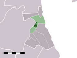 The village centre (darkgreen) and the statistical district (lightgreen) of Oosthuizen in the former municipality of Zeevang. | ||
| Coordinates: 52°34′15″N 4°59′45″E / 52.57083°N 4.99583°ECoordinates: 52°34′15″N 4°59′45″E / 52.57083°N 4.99583°E | ||
| Country | Netherlands | |
| Province | North Holland | |
| Municipality | Edam-Volendam | |
| Area | ||
| • Total | 6.76 km2 (2.61 sq mi) | |
| Population (2009)[1] | ||
| • Total | 3,224 | |
| • Density | 480/km2 (1,200/sq mi) | |
| Time zone | CET (UTC+1) | |
| • Summer (DST) | CEST (UTC+2) | |
| Postal code | 1474 | |
| Dialing code | 0299 | |

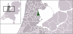
Oosthuizen (West Frisian: Oôsthúze) is a village in the Dutch province of North Holland. It is a part of the municipality of Edam-Volendam, and lies about 8 km north of Purmerend.
Oosthuizen was a separate municipality until 1979, when the new municipality of Zeevang was created.[2]
In 2001, the village of Oosthuizen had 2940 inhabitants. The built-up area of the village was 0.49 km², and contained 1153 residences.[3] The statistical district "Oosthuizen", which covers the village and the surrounding countryside including the hamlet of Etersheim, has a population of around 3220.[4]

Church in Oosthuizen
References
- ↑ Gemeente Zeevang (2009) "Gemeente in cijfers" Gemeentegids Amsterdam: De Telefoongids BV pp. 7.
- ↑ Ad van der Meer and Onno Boonstra, Repertorium van Nederlandse gemeenten, KNAW, 2006.
- ↑ Statistics Netherlands (CBS), Bevolkingskernen in Nederland 2001 . Statistics are for the continuous built-up area.
- ↑ Statistics Netherlands (CBS), Statline: Kerncijfers wijken en buurten 2003-2005 . As of 1 January 2005.
External links
| Wikimedia Commons has media related to Oosthuizen. |
- J. Kuyper, Gemeente Atlas van Nederland, 1865-1870, "Oosthuizen". Map of the former municipality, around 1868.
This article is issued from Wikipedia - version of the 8/1/2016. The text is available under the Creative Commons Attribution/Share Alike but additional terms may apply for the media files.