Omatako Dam
| Omatako Dam | |
|---|---|
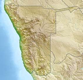 Location of Omatako Dam in Namibia | |
| Official name | Omatako Dam |
| Country | Namibia |
| Location | 100 km (62 mi) north of Okahandja, Otjozondjupa Region |
| Coordinates | 21°8′53.87″S 17°10′40.57″E / 21.1482972°S 17.1779361°ECoordinates: 21°8′53.87″S 17°10′40.57″E / 21.1482972°S 17.1779361°E |
| Construction began | 1978 |
| Opening date | 1981 |
| Dam and spillways | |
| Type of dam | Earth fill embankment |
| Impounds | Omatako River |
| Height | 16 m (52 ft) |
| Length | 3,460 m (11,350 ft) |
| Width (crest) | 5 m (16 ft) |
| Spillway type | Side chute |
| Spillway capacity | 2,000 cubic metres per second (71,000 cu ft/s) |
| Reservoir | |
| Total capacity | 43.49 million cubic metres (56,880,000 cu yd) |
| Surface area | 11.12 km2 (1,112 ha) |
Omatako Dam is an earth-fill embankment dam about 100 kilometres (62 mi) north of Okahandja in the Otjozondjupa Region of Namibia. It dams the ephemeral Omatako River[1] and has a capacity of 43.49 million cubic metres (56,880,000 cu yd).[2]
Completed in 1981, it was originally envisaged to become part of the Eastern National Water Carrier, a scheme to supply water to Namibia's capital Windhoek from the Okavango River, 1,000 kilometres (620 mi) to the north on the Angolan border.[3] The scheme was never completed, and Omatako Dam today only contains floods and supplies water to the Von Bach Dam. It is currently empty.[2][4]
References
- ↑ Omatako Dam at NamWater.com.na
- 1 2 Menges, Werner; Haidula, Tuyeimo (5 March 2015). "Water worries for Windhoek". The Namibian. p. 1.
- ↑ "Eastern National Water Carrier. Omatako Dam – S Van Bach Dam Component" (PDF). NamWater. 4 May 1984. p. 3.
- ↑ "The Omatako Dam – Sartorius Von Bach Dam Components of The Eastern National Water Carrier" (PDF). Nam Water. May 1984. Retrieved 6 March 2015.
This article is issued from Wikipedia - version of the 9/21/2015. The text is available under the Creative Commons Attribution/Share Alike but additional terms may apply for the media files.